Know what lies below with Leica’s DSX 3D utility detection system

April 11, 2025 Read time: 1 min
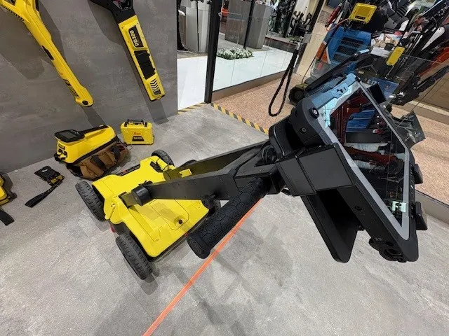
No ordinary lawnmower: utilities can’t hide from Leica Geosystem’s DSX detection solution

Emergency road repair work needn’t create yet another emergency by hitting unknow utility pipes and other systems.  

Leica Geosystems says its DSX utility detection solution can quickly be walked over the area where work is about to start and immediately show an excavator operator any dangers that lie below.

It locates, visualises and map utilities. Unlike any other ground penetrating radar system, the Leica DSX maximises productivity with cutting-edge software that automates data analysis and creates a 3D utility map of the field.

Leica DSX can be used together with Leica GPS/GNSS systems to generate highly accurate georeferenced maps.  

There is also a ‘quick scan’ mode for a quick utility, anomaly and ground condition check before a more detailed grid scan project gets underway.

Operators can add different background layers, such as Google Maps or DXF/DWG.

The solution can export, store, share and access data on major Cloud service providers. It can also maximise troubleshooting efficiency by sharing 
diagnostics data via the Cloud.

For more information on companies in this article

Related Content

  • Construction software boosts operating efficiency
    March 5, 2012
    Intelligent data handling and management technologies are helping boost operating efficiency - Mike Woof reports The construction software sector and GIS market are seeing a rapid development of new products and technologies that will help boost efficiency, with factors such as data management and platform integration being key focus areas.
  • Data collection key to software developments
    February 13, 2012
    The collection and handling of data are key technology drivers in the software sector. New methods of data collection and manipulation are driving significant developments in software at present. The latest technology allows designers and engineers to collect, store and manipulate ever larger amounts of data. Growing use of mobile field equipment for both data collection and field management is driving interactive systems. And in an interview this month Autodesk senior vice-president for the construction an
  • Cultivate better on-site safety awareness by leveraging technology with Leica Geosystems
    August 10, 2023
    When a vital fiber-optic cable was cut during construction work in Germany, the impact was huge. There were telecom disruptions affecting the greater Frankfurt area, all departures and landings at Frankfurt Airport were suspended, and Lufthansa’s global IT system crashed. Leica Geosystems says it is vital to put in place “strategies to protect people, equipment, and assets… and to emphasise the crucial role digital solutions play in ensuring safety.”
  • Data handling for efficient machine control
    October 16, 2012
    The rapid increase in information availability is transforming the construction sector. Conventional methods used for sourcing geographic data based on maps and localised sampling meant that there was often a lack of accurate information relating to ground conditions at specific areas where work was planned, often resulting in unwelcome surprises for construction companies along with additional costs for projects.