Versilis offers Safety Cloud alerts

Versilis has partnered with Haas Alert to offer motorists Safety Cloud, an infrastructure-to-vehicle (I2V) solution that sends notifications of road layout changes and lane closures
September 3, 2021 Read time: 2 mins
Versilis safety gates are now integrated with Haas Alert’s Safety Cloud, a cellular-V2X (C-V2X) solution that sends real-time digital alerts to drivers

Haas Alert’s Safety Cloud, a cellular-V2X (C-V2X) solution, sends real-time digital alerts to drivers and connected cars to aid drivers in making safer, smarter driving decisions. C-V2X uses 3GPP standardised 4G LTE or 5G mobile cellular connectivity to send and receive signals from a vehicle to other vehicles, pedestrians or to fixed objects such as traffic lights in its surroundings.

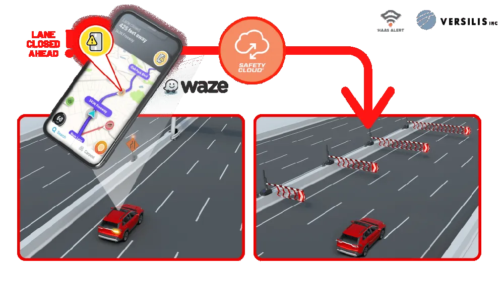
Safety Cloud can now be integrated with Versilis’ access control solutions to provide a real-time automotive collision prevention system improving workers’ and motorists’ safety. Safety Cloud delivers notifications to oncoming motorists that Versilis’ automated signs and gates are in a deployed position, indicating a road or lane closure ahead.

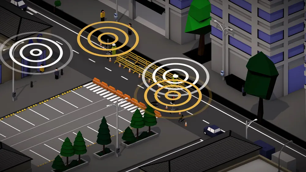
When police, firefighters, EMS crews, tow trucks, and other roadway workers are on-scene or en route to a call, nearby drivers receive real-time alerts through navigation apps and vehicle systems delivered via Safety Cloud.

These alerts are received by motorists, connected cars and autonomous vehicles via in-vehicle systems and navigation applications such as WAZE - a GPS navigation software app and a subsidiary of Google - giving drivers clear advance warning and more time to safely slow down and move over. Receiving an advance warning about the nearby roadway hazard reduces the risk of crashes by up to 90%, according to Haas.

WAZE works on smartphones and tablet computers that have GPS support. It provides turn-by-turn navigation information and user-submitted travel times and route details, while downloading location-dependent information over a mobile telephone network.

For more information on companies in this article

Related Content

  • Sorting out site comms
    August 9, 2021
    With the radio spectrum quickly filling up, signal congestion can hinder reliability and site communications. Darren Hudson, senior projects manager of Traffic Group Signals in the UK, explains
  • Topcon introduces sophisticated GIS technology
    November 20, 2014
    Topcon Positioning Group is broadening its range of GIS solutions with the introduction of the new FC-500 data controller and MAGNET Relay package. The FC-500 unit features a large, bright sunlight-readable display and is compatible with either the Topcon eGIS or MAGNET Field GIS software.
  • Specifying barriers correctly for optimum roadway safety
    April 29, 2015
    Mike Dreznes, executive vice president at the International Road Federation (IRF) discusses the proper utilisation of longitudinal barriers as a road safety priority Road authorities have a duty of care to ensure infrastructure not only meets safety requirements but provides protection for all road users. Crash barriers play an essential role in maximising safety, lowering the risk of sudden impact for road users and also allowing redirective capabilities.
  • Specifying barriers correctly for optimum roadway safety
    April 29, 2015
    Mike Dreznes, executive vice president at the International Road Federation (IRF) discusses the proper utilisation of longitudinal barriers as a road safety priority Road authorities have a duty of care to ensure infrastructure not only meets safety requirements but provides protection for all road users. Crash barriers play an essential role in maximising safety, lowering the risk of sudden impact for road users and also allowing redirective capabilities. If a road authority has a rigid hazard locate