Underground sight

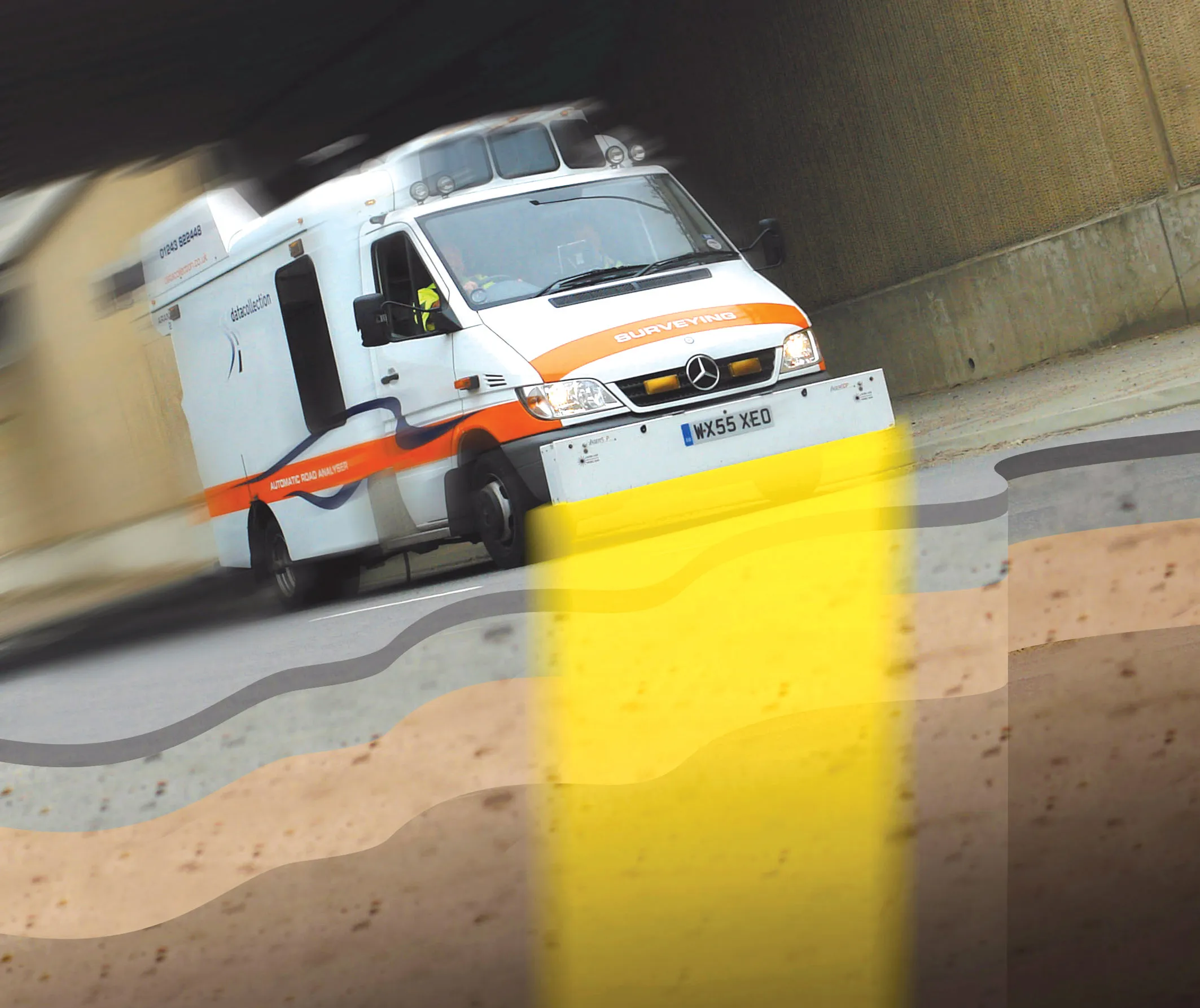
Innovative mobile radar technology that can detect subsurface problems is now being launched by surveying specialist Data Collection Limited. The system uses a specially designed vehicle to carry out surveys at normal traffic speeds. Ground-penetrating radar is used to generate a cross-sectional profile of the subsurface. This information can be used to assess road condition, helping with planning repairs and re-surfacing.
September 3, 2012 Read time: 2 mins
Travelling at highway speeds, this sophisticated survey package offers fast highway scanning

Innovative mobile radar technology that can detect subsurface problems is now being launched by surveying specialist Data Collection Limited. The system uses a specially designed vehicle to carry out surveys at normal traffic speeds. Ground-penetrating radar is used to generate a cross-sectional profile of the subsurface. This information can be used to assess road condition, helping with planning repairs and re-surfacing.

The ground penetrating radar (GPR) is fitted to a new electronic survey vehicle called ARAN2, which is also equipped with surface scanning systems and advanced technology to detect cracks down to 2mm in size. Unlike most conventional vehicles this allows surface and subsurface data to be collected at the same time.

The radar emits pulses of radio frequency energy into the road surface. With the transition of the pulses from one material to another, part of the energy echoes back to the surface and returning signals are processed to generate subsurface profiles. This equipment does away with the need for core sampling and means that survey data can be collected while travelling at normal traffic speeds. This GPR information maps layers to an accuracy of 5-10mm, and gives highway engineers a picture of road make-up and condition. On bridges, GPR is particularly useful for determining the location and thickness of concrete and asphalt layers, as well as reinforcing steel.

Related Content

  • Quieter roads
    July 20, 2012
    Sound absorption systems can cut traffic noise With traffic volumes increasing worldwide and highways having to be redesigned to minimise their impact on the environment, the industry has had to come up with new solutions that reduce the impact of roads. Highway noise is a major issue both in urban and non-urban locations so engineers have been busy developing innovative solutions that can help alleviate this problem. Durability and effective noise dampening properties are claimed for the new All Weather So
  • New testing equipment and services
    April 21, 2016
    This month’s round-up looks at new equipment from a number of manufacturers and a new bitumen testing service in the UK from global player Intertek - Kristina Smith reports CONTROLS GROUP has unveiled new machines from each of its specialist divisions, including a new triaxial tester from its soil mechanics arm Wykham Farrance; an E-modulus tester from its concrete testing division; and an asphalt binder analyser from PAVELAB SYSTEMS, its asphalt division. TRITECH is the result of 50 years of developm
  • Upgrading a busy A road link in the UK
    July 4, 2018
    The upgrade to the UK’s busy A14 route will address a significant traffic bottleneck - Mike Woof writes The UK is suffering badly from traffic congestion, a problem that is particularly severe in and around its major cities. Lack of investment in road construction over many years has resulted in a major backlog of work, while the country has seen growing vehicle numbers. To make matters worse, there have been few additions to the major road network since the late 1980s and early 1990s. And the combinatio
  • Know what lies below with Leica’s DSX 3D utility detection system
    April 11, 2025

    Emergency road repair work needn’t create yet another emergency by hitting unknow utility pipes and other systems.  

    Leica Geosystems says its DSX utility detection solution can quickly be walked over the area where work is about to start and immediately show an excavator operator any dangers that lie below.

    It locates, visualises and map utilities. Unlike any other ground penetrating radar system, the Leica DSX maximises productivity with cutting-edge software that automates data analysis and creates a 3D utility map of the field.