Topcon’s sophisticated drone offering

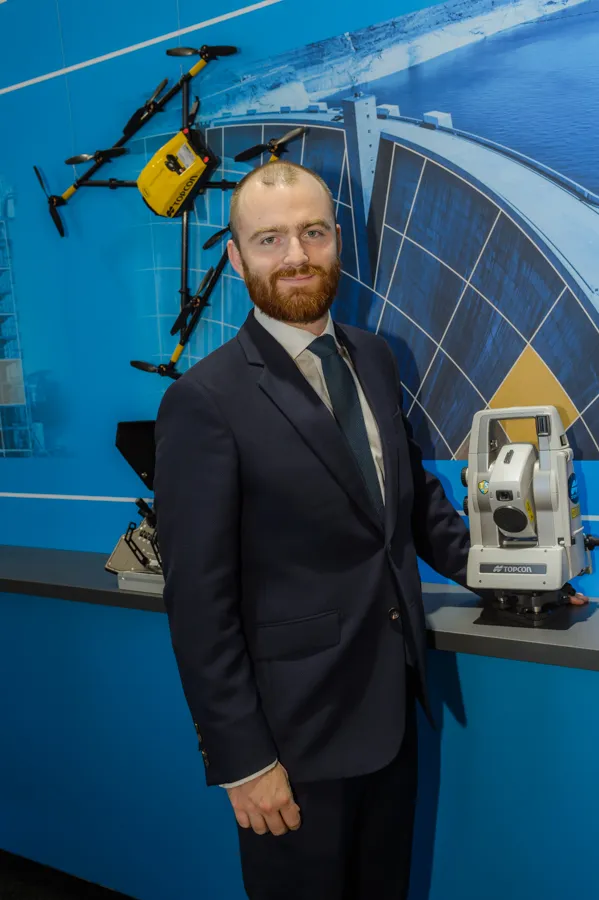
The sophisticated drone models offered by Topcon Positioning have been made available through the firm’s partnership with Intel. These highly-advanced units are available in fixed wing or rotary versions, with features including triple redundancy to ensure reliability and prevent failures. The units feature high resolution cameras, which offer accurate and comprehensive datasets for photogrammetry work. Chris Emery, Topcon’s business manager monitoring solutions, Europe said: “You get swathes of data for
April 26, 2018 Read time: 1 min
Topcon’s drone range offers accurate data gathering

The sophisticated drone models offered by 342 Topcon Positioning have been made available through the firm’s partnership with Intel. These highly-advanced units are available in fixed wing or rotary versions, with features including triple redundancy to ensure reliability and prevent failures.

The units feature high resolution cameras, which offer accurate and comprehensive datasets for photogrammetry work. Chris Emery, Topcon’s business manager monitoring solutions, Europe said: “You get swathes of data for as-built or verification purposes.”

Combined with new analytical tools, this technology means that there is no longer a need to send personnel into high-risk working areas. Data can be quickly collected, analysed and used, for example, in the evaluation of real-time progress on construction operations or producing stockpile reports.

For more information on companies in this article

Related Content

  • Sophisticated plotting
    February 7, 2012
    Leica Geosystems is offering its improved SpiderWeb v4.0 package as part of the new reference station software update. This improved suite of solutions also includes the GNSS Spider v4.0 and SpiderQC v4.0 packages.
  • Intelligent bulldozers provide productivity boost
    September 27, 2013
    New smart dozers provide faster working and greater efficiency - Mike Woof reports Both Caterpillar and Komatsu are making key moves in offering intelligent bulldozing capabilities on their latest machines. In the medium-sized bulldozer market, both companies have sophisticated new models that will increase both productivity and finish quality, while lowering running costs for the user.
  • VIDEO: Telstra drone LIDAR maps Melbourne’s EastLink Mullum Tunnel
    April 13, 2018
    One of the applications for LIDAR is to make high resolution 3-D maps. Self-driving cars are pre-loaded with a LIDAR map of the trials area in which they are permitted to fully self-drive themselves. The cars also have their own LIDAR scanner which captures a real-time LIDAR view of the vehicle’s surroundings. The fully autonomous driving system within these prototype cars compares the real-time LIDAR view against the pre-loaded LIDAR map to significantly increase the accuracy of their self-positioning
  • Topcon expanding through acquisition
    April 30, 2018
    Topcon Positioning Group is expanding its portfolio with the acquisition of Viasys VDC, a Finnish infrastructure construction software development company. The purchase is intended to strengthen Topcon’s software development expertise. This will support delivery of advanced Topcon virtual design and construction solutions with BIM interoperability. Topcon has now acquired all the outstanding shares of Viasys VDC after having bought a significant percentage of its holdings in early 2016. Jason Hallett, VP of