Remote surveying and scanning

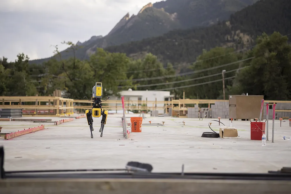
Remote surveying and scanning can be achieved using the autonomous robotic system available from Trimble. The package combines the Spot robot autonomous rover unit with the Trimble X7 3D laser scanner and Trimble FieldLink software.
January 18, 2022 Read time: 2 mins
Autonomous surveying and scanning is possible using the new package from Trimble

This solution has been jointly developed between Trimble and Boston Dynamics and allows autonomous operation on construction sites. The system takes advantage of the robot's ability to navigate challenging, dynamic and potentially unsafe environments. Trimble's 3D data capture technology can deliver a continuous flow of information between the field and the office for documentation of jobsite progress.

The innovative package allows users to make important decisions, rather than waiting for the information to be relayed to project staff. The integration is focused on the automated capture of field construction data through the use of Trimble 3D capture technology and the Spot robot. The autonomous workflow for the X7 laser scanner uses fully integrated Spot robot controls in FieldLink software to create a predefined path of waypoints for Spot to follow and collect laser scans.

Laser scans collected using the X7 scanner and the Spot robot can be tied to a jobsite project coordinate system, as well as individual scan stations. The data is collected, and then made into a composite point cloud in real-time on the Trimble tablet controller before leaving the site. While performing autonomous operations, Spot's docking station enables in-field charging of batteries on both the robot and the X7 3D laser scanner, and also provides the continuous transfer of data through a Gigabit Ethernet connection to the office.

For more information on companies in this article

Related Content

  • Trimble continues acquisitions with Linear Project deal
    March 5, 2015
    Trimble continues to develop its operations with the acquisition of German firm Linear project for an undisclosed sum. This privately owned firm is a leading provider of scheduling software for linear infrastructure projects. Linear project’s TILOS time and location planning software is used worldwide and is ideal for highways construction as well as other linear civil engineering projects. Linear construction projects present major challenges as work is not performed in a single location. But the TILOS sof
  • Ma-estro turns quarry operators into skilled Q-PILOTS
    July 3, 2023
    As the adoption of artificial intelligence-based technology sweeps across various industrial sectors, concerns have surfaced about the potential displacement of human labour and professional expertise. In response, Ma-estro is championing AI-driven innovation as a means of bucking the trend, placing people back at the core of the quarrying sector with tools designed to enhance and improve human labour rather than supplant it.
  • Bentley’s OpenBridge for Cebu-Cordova link
    February 7, 2024
    The OpenBridge software solution from Bentley Systems played a key role in the development of the Cebu-Cordova bridge project in the Philippines.
  • Trimble's ruggedised tablet for site use
    May 15, 2019
    Trimble is now offering its T7 Tablet, a rugged, lightweight and versatile device for construction surveying applications. The unit features the Trimble Siteworks Software for construction surveying, allowing it to provide real-time data to visualise cut/fill levels, calculate material volumes, check grade and communicate work orders. This can allow users to to improve productivity and decision-making. Scott Crozier, general manager for Trimble’s Civil Engineering and Construction Division said, “Surveyors