Remote surveying and scanning

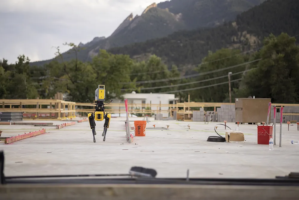
Remote surveying and scanning can be achieved using the autonomous robotic system available from Trimble. The package combines the Spot robot autonomous rover unit with the Trimble X7 3D laser scanner and Trimble FieldLink software.
January 18, 2022 Read time: 2 mins
Autonomous surveying and scanning is possible using the new package from Trimble

This solution has been jointly developed between Trimble and Boston Dynamics and allows autonomous operation on construction sites. The system takes advantage of the robot's ability to navigate challenging, dynamic and potentially unsafe environments. Trimble's 3D data capture technology can deliver a continuous flow of information between the field and the office for documentation of jobsite progress.

The innovative package allows users to make important decisions, rather than waiting for the information to be relayed to project staff. The integration is focused on the automated capture of field construction data through the use of Trimble 3D capture technology and the Spot robot. The autonomous workflow for the X7 laser scanner uses fully integrated Spot robot controls in FieldLink software to create a predefined path of waypoints for Spot to follow and collect laser scans.

Laser scans collected using the X7 scanner and the Spot robot can be tied to a jobsite project coordinate system, as well as individual scan stations. The data is collected, and then made into a composite point cloud in real-time on the Trimble tablet controller before leaving the site. While performing autonomous operations, Spot's docking station enables in-field charging of batteries on both the robot and the X7 3D laser scanner, and also provides the continuous transfer of data through a Gigabit Ethernet connection to the office.

For more information on companies in this article

Related Content

  • New industry developments push boundaries of machine control
    May 22, 2014
    A series of innovations in machine control or automation technologies are helping transform the construction industry - Mike Woof writes Equipment manufacturer have made huge advances in machine performance, delivering new models that offer increased capabilities and productivity, while using less fuel. Reliability and uptime too have been improved, with the development of equipment that can forestall unplanned downtime by telling the user when it will require service attention. Meanwhile new engines delive
  • Improved laser scanning capabilities
    February 23, 2012
    Leica Geosystems is broadening its software offering with its new Leica Cyclone v7.2 package, which is said to improve office processing capabilities. The package has been developed to address key market needs and trends in the processing and use of rich, as-built point cloud data from high definition laser scanning technology. According to the firm the package can help reduce laser scanning project costs, including office time, allowing projects to use more scans and higher scan densities.
  • Software advances from around the globe
    April 24, 2013
    A quick look at various software development in highways – Adrian Greeman. Software for BIM processes, internet cloud based computing to link site and office, and the use of laser scan point-cloud data continue to be the central themes for major software suppliers in the road design area. Developments go hand in hand with the recent strategic agreements that firms like Autodesk and Bentley Systems have made with major survey companies, Topcon and Trimble respectively. The tie-ups, along with acquisitions, m
  • New positioning tools streamline survey operations
    March 14, 2012
    Trimble has launched a range of new tools which it says will deliver faster and more accurate data to surveyors. The Trimble S6 Robotic Total Station with Trimble Vision Technology enables surveyors to remotely see and measure through a live video feed from the instrument on their data controller.