Remote surveying and scanning

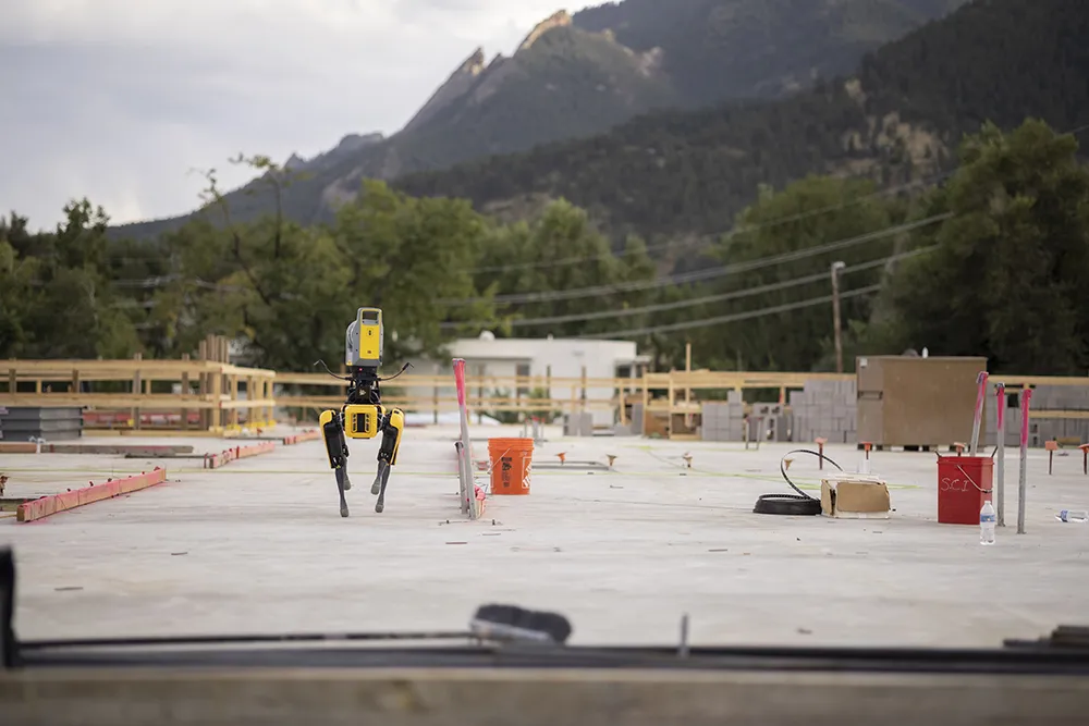
Remote surveying and scanning can be achieved using the autonomous robotic system available from Trimble. The package combines the Spot robot autonomous rover unit with the Trimble X7 3D laser scanner and Trimble FieldLink software.
January 18, 2022 Read time: 2 mins
Autonomous surveying and scanning is possible using the new package from Trimble

This solution has been jointly developed between Trimble and Boston Dynamics and allows autonomous operation on construction sites. The system takes advantage of the robot's ability to navigate challenging, dynamic and potentially unsafe environments. Trimble's 3D data capture technology can deliver a continuous flow of information between the field and the office for documentation of jobsite progress.

The innovative package allows users to make important decisions, rather than waiting for the information to be relayed to project staff. The integration is focused on the automated capture of field construction data through the use of Trimble 3D capture technology and the Spot robot. The autonomous workflow for the X7 laser scanner uses fully integrated Spot robot controls in FieldLink software to create a predefined path of waypoints for Spot to follow and collect laser scans.

Laser scans collected using the X7 scanner and the Spot robot can be tied to a jobsite project coordinate system, as well as individual scan stations. The data is collected, and then made into a composite point cloud in real-time on the Trimble tablet controller before leaving the site. While performing autonomous operations, Spot's docking station enables in-field charging of batteries on both the robot and the X7 3D laser scanner, and also provides the continuous transfer of data through a Gigabit Ethernet connection to the office.

For more information on companies in this article

Related Content

  • Trimble’s versatile surveying tool
    September 24, 2018
    New surveying tool Trimble has developed its TSC7 Controller as a new field solution for civil construction surveyors. The TSC7 was designed based on customer feedback. It provides a tablet experience with a physical keyboard and a sunlight readable touchscreen. Front- and rear-facing cameras allow users to video conference their office from the field for on-the-job support, and capture videos and images. The TSC7 runs on Windows 10 Professional, driven by an Intel Pentium 64-bit quad-core processor. The
  • Semi-Autonomous Operations Remove Site Risk for Brazilian Contractor’s Crew, Without Missing a Beat on the Jobsite
    February 28, 2022
    Remote operation keeps machine operators out of harm’s way, enabling advanced action in any environment
  • GPS guidance delivers accurate machine control
    July 12, 2012
    GPS systems for machine control can make massive reductions in operating costs for contractors. Using GPS systems for machine control can make massive reductions in operating costs for contractors and the pace of technology improvements from manufacturers has been rapid. This market segment is dominated by Leica Geosystems, Trimble and Topcon, all of which introduced an array of new products earlier this year. Topcon's dozer control system first seen in public at the Intermat show in Paris, offers notable c
  • AssetWise Completes Bentley’s CONNECT Edition
    November 15, 2016
    Connected Data Environment Spans both Comprehensive Project Delivery and Comprehensive Asset Performance: TOTEX! LONDON – The Year in Infrastructure 2016 Conference – 1 November 2016 – Bentley Systems, Incorporated, a leading global provider of software solutions for advancing infrastructure, today announced AssetWise CONNECT Edition.