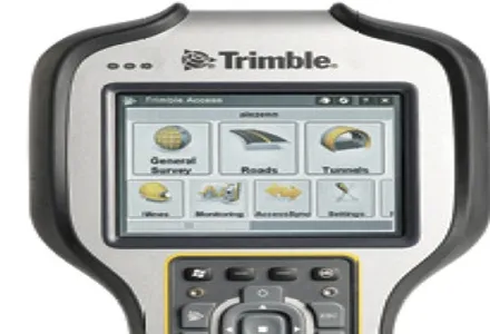
The TSC7 runs on Windows 10 Professional, driven by an Intel Pentium 64-bit quad-core processor. The processor and operating system are said to make it easy to process data in spreadsheets and run office software programs.
In addition to the TSC7 Controller, Trimble is also releasing two new rover systems for civil engineering and construction applications, for construction surveyors and for supervisors. Both systems feature new Trimble Siteworks Software tailored for construction workflows.
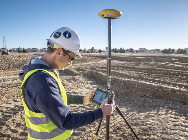
The Trimble Siteworks Positioning System for Construction Surveyors is comprised of the Trimble SPS986 GNSS Smart Antenna, the TSC7 Controller and Siteworks Software. It enables construction surveyors to work with complex 3D models, collect large data sets faster, and visualise complex 3D models more easily.
Trimble’s versatile surveying tool
New surveying tool
Trimble has developed its TSC7 Controller as a new field solution for civil construction surveyors. The TSC7 was designed based on customer feedback. It provides a tablet experience with a physical keyboard and a sunlight readable touchscreen. Front- and rear-facing cameras allow users to video conference their office from the field for on-the-job support, and capture videos and images.
The TSC7 runs on Windows 10 Professional, driven by an Intel Pentium 64-bit quad-core processor. The