Novel survey solution from Hexagon

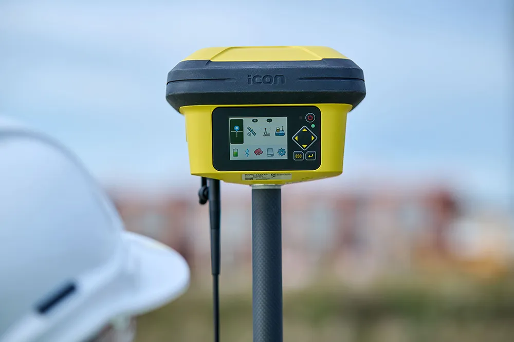
Leica Geosystems, part of Hexagon, says that its Leica iCON gps 160 package is a next-generation construction Smart Antenna with features that increase productivity for stakeout and measurement applications on the jobsite.
January 6, 2023 Read time: 2 mins
Leica iCON gps

The Leica iCON construction portfolio offers a broad range of Smart Antennas to suit all applications according to the firm. The Smart Antennas are said to be able to withstand challenging site conditions. The units integrate with all Leica iCON construction instruments and controllers as well as the iCON field software for precise, real-time verification.

The iCon gps 160 is a versatile solution for various applications. It can be used as a base station, a rover or for machine guidance. The Leica iCON gps 160 is an improved version of the successful Leica iCON gps 60. The result is a smaller, more compact GNSS antenna with additional features and a larger display for ease of use.

Leica Geosystems introduced its safety awareness solution portfolio, including Leica iCON PA10, iCON PA80 and iCON CAS, which addresses the need to immediately warn on- and off-machine field personnel of potential machine-to-people, machine-to-machine and machine-to-object and collisions. As the next step, the company integrates the field-generated safety data into the cloud-based collaboration platform Leica ConX, allowing decision-makers to review incidents and assess the entire operation over time and space. These insights support important safety initiatives by providing visualisation, analysis, monitoring, reporting and data management functions, and address communication and integration needs.

To expand its portfolio of Smart Antennas, Leica Geosystems has launched the iCON gps 160, a versatile solution for various applications. It can be utilised as a base station, a rover or for machine guidance. The Leica iCON gps 160 is a modernisation and enhancement of the successful Leica iCON gps 60, which has been well accepted in the market. The result is a smaller, more compact GNSS antenna with additional features and a larger display for ease of use.

For more information on companies in this article

Related Content

  • Real time site monitoring technology
    July 19, 2012
    Leica Geosystems is broadening its site monitoring technology with the introduction of the GeoMoS package. This can be linked to the firm's existing GNSS Spider software to offer an array of TPS and GNSS monitoring tools. Combined, these tools provide a web-based service for visualisation and analysis of monitoring. Authorised users can access a monitoring project using a web browser, pocket PC or mobile phone. Using the GeoMoS Web service, graphs and views can be customised and be tailored to the needs of
  • Data collection key to software developments
    February 13, 2012
    The collection and handling of data are key technology drivers in the software sector. New methods of data collection and manipulation are driving significant developments in software at present. The latest technology allows designers and engineers to collect, store and manipulate ever larger amounts of data. Growing use of mobile field equipment for both data collection and field management is driving interactive systems. And in an interview this month Autodesk senior vice-president for the construction an
  • Improved communications for construction from B2W
    October 2, 2023

    B2W Software has added extensive new alerts and notifications capabilities in the current release of its B2W Platform. The new features let contractors communicate automatically and in real time across the office, field and shop for further efficiency in resource scheduling, field performance tracking, and equipment maintenance workflows.

  • Sophisticated asphalt paving control technology
    July 27, 2020
    Advances in asphalt paving control systems are helping contractors deliver higher efficiency