New NetRover range from Leica

Leica Geosystems is expanding its Viva GNSS range with the addition of the new NetRover package. This comprises the GS08 receiver, a sophisticated RTK network rover and the new Leica Viva CS10 3.5G field controller. The field controller has a fully integrated high-speed 3.5G modem to connect to RTK reference networks and allow mobile broadband internet connectivity for field-to-office data transfer. In addition to 3.5G, the new field controller can also include Bluetooth, WiFi and TPS radio for further conn
February 7, 2012 Read time: 2 mins
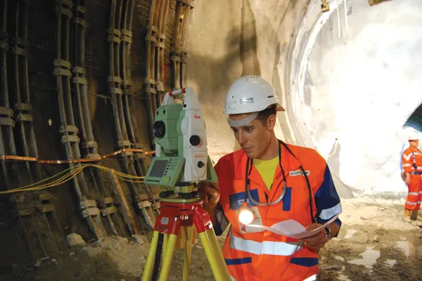
The latest GIS tools from Leica Geosystems allow accurate scanning of complex construction projects
265 Leica Geosystems is expanding its Viva GNSS range with the addition of the new NetRover package. This comprises the GS08 receiver, a sophisticated RTK network rover and the new Leica Viva CS10 3.5G field controller.

The field controller has a fully integrated high-speed 3.5G modem to connect to RTK reference networks and allow mobile broadband internet connectivity for field-to-office data transfer.

In addition to 3.5G, the new field controller can also include Bluetooth, WiFi and TPS radio for further connectivity. Said to provide an all-in-one GNSS Network Solution, the NetRover is optimised for RTK network use and also integrates the latest technology from Leica Geosystems, providing a lightweight and cable-free network rover. The system can automatically connect to any reference station network and features the RTCM 3.1 transformation message, so there is no need to measure control points for the determination of a local transformation, saving time and reducing errors.

In addition, the firm is offering the Viva GS12 receiver for combined GNSS/TPS one-person surveying. The Leica Viva GS12 is a lightweight receiver that ergonomically combines GNSS and TPS for a Viva SmartPole setup, an integrated system for productive one-person surveying. The Viva SmartPole combines the GS12 GNSS receiver and a 360º prism and provides good ergonomics with low weight. According to the firm, users increase productivity by using GNSS to orientate TPS and can switch between GNSS and TPS to measure any point with total flexibility. Starting the survey and conducting setup on-the-fly while completing measurements allows users to save time in survey planning and execution.

Meanwhile image assisted surveying is also possible with the TS15 Total Station and Leica Viva SmartWorx v3.00. Combining the SmartPole setup with the new Leica TS15 Robotic Imaging Total Station and Leica Viva SmartWorx v3.00 is said to deliver state-of-the-art technology. This allows the user to deliver exact photo documentation of what is seen and measured on site.

For more information on companies in this article

Related Content

  • Information integration
    February 17, 2012
    The sophisticated Leica MobileMatriX 4.1 package provides a key tool for integrating the new Leica Viva Total Stations with other technologies. Highly sophisticated, the Leica MobileMatriX package is said to be the most advanced solution available for mobile GIS applications. The system can be used in combination with GNSS, Total Stations, Level, Digital Cameras, and Laser Range Finders (LRF). Using the imaging support of the new TS15 and TS11, users of the Leica MobileMatriX package can take an image with
  • GPS technology developments
    June 13, 2012
    The use of GPS-inclusive technology is proving invaluable to contractors responsible for major transport-related construction projects across the globe. Guy Woodford looked at some of the latest and imminent site solutions featuring GPS Staff at Trimble Heavy Construction based in Sunnyvale, California recently finished developing three new solutions for connecting the construction site. The Trimble Connected Office, the Trimble Connected Controller and the Trimble Connected Machine, are all now available t
  • Straight to the point for measurement
    February 6, 2018
    Leica Geosystems says it is introducing a major advance in site surveying. This offers a novel tilt compensation system, so that users are no longer required to hold the pole vertical. The new Leica GS18 T is claimed to be the world’s fastest GNSS RTK rover, while the firm is also offering the latest versions of Leica Captivate field software and Leica Infinity office software. With the addition of calibration-free GNSS and various upgrades to the Captivate field software and Infinity office software, use
  • Topcon introduces sophisticated GIS technology
    November 20, 2014
    Topcon Positioning Group is broadening its range of GIS solutions with the introduction of the new FC-500 data controller and MAGNET Relay package. The FC-500 unit features a large, bright sunlight-readable display and is compatible with either the Topcon eGIS or MAGNET Field GIS software.