New NetRover range from Leica

Leica Geosystems is expanding its Viva GNSS range with the addition of the new NetRover package. This comprises the GS08 receiver, a sophisticated RTK network rover and the new Leica Viva CS10 3.5G field controller. The field controller has a fully integrated high-speed 3.5G modem to connect to RTK reference networks and allow mobile broadband internet connectivity for field-to-office data transfer. In addition to 3.5G, the new field controller can also include Bluetooth, WiFi and TPS radio for further conn
February 7, 2012 Read time: 2 mins
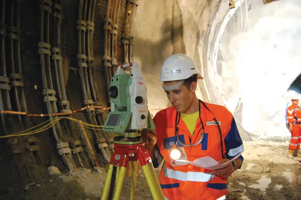
The latest GIS tools from Leica Geosystems allow accurate scanning of complex construction projects
265 Leica Geosystems is expanding its Viva GNSS range with the addition of the new NetRover package. This comprises the GS08 receiver, a sophisticated RTK network rover and the new Leica Viva CS10 3.5G field controller.

The field controller has a fully integrated high-speed 3.5G modem to connect to RTK reference networks and allow mobile broadband internet connectivity for field-to-office data transfer.

In addition to 3.5G, the new field controller can also include Bluetooth, WiFi and TPS radio for further connectivity. Said to provide an all-in-one GNSS Network Solution, the NetRover is optimised for RTK network use and also integrates the latest technology from Leica Geosystems, providing a lightweight and cable-free network rover. The system can automatically connect to any reference station network and features the RTCM 3.1 transformation message, so there is no need to measure control points for the determination of a local transformation, saving time and reducing errors.

In addition, the firm is offering the Viva GS12 receiver for combined GNSS/TPS one-person surveying. The Leica Viva GS12 is a lightweight receiver that ergonomically combines GNSS and TPS for a Viva SmartPole setup, an integrated system for productive one-person surveying. The Viva SmartPole combines the GS12 GNSS receiver and a 360º prism and provides good ergonomics with low weight. According to the firm, users increase productivity by using GNSS to orientate TPS and can switch between GNSS and TPS to measure any point with total flexibility. Starting the survey and conducting setup on-the-fly while completing measurements allows users to save time in survey planning and execution.

Meanwhile image assisted surveying is also possible with the TS15 Total Station and Leica Viva SmartWorx v3.00. Combining the SmartPole setup with the new Leica TS15 Robotic Imaging Total Station and Leica Viva SmartWorx v3.00 is said to deliver state-of-the-art technology. This allows the user to deliver exact photo documentation of what is seen and measured on site.

For more information on companies in this article

Related Content

  • Leica Vivo portfolio expansion
    February 18, 2013
    Leica Geosystems has expanded its Leica Viva portfolio with the Leica Viva GS14, said to be an exceptional and deployment versatile GNSS receiver. The Viva GS14 has a compact design with integrated communication devices. Along with the dependable GNSS RTK, the Viva GS14 is said to deliver complete confidence and knowledge in results. Useable as a robust yet lightweight rover and as a base station, Leica’s new GNSS receiver allows users to gain speed and efficiency by reducing the number of setups and contro
  • Precision pinpointing
    March 1, 2012
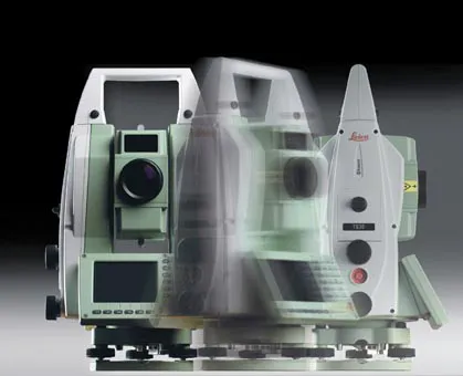
    Leica Geosystems says that its TS30 package is a new high precision Total Station that meets highest standards in all surveying applications. Distances can now be measured with Leica Geosystems' proven PinPoint EDM Technology with an unprecedented precision of 0.6mm + 1ppm on prisms. On natural surfaces a high accuracy of 2mm + 2ppm up to 1,000m can be achieved.
  • Topcon unveils Hybrid Robotic System
    January 21, 2014
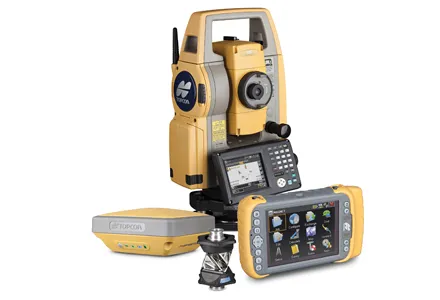
    Topcon Positioning Group has unveiled its Hybrid Robotic System, featuring the new DS series robotic total station and the recently announced MAGNET v2.0 software suite, a Topcon enterprise solution for the geomatics industry. Other Topcon components in the cutting-edge HRS include the economical HiPer SR GNSS receiver and Tesla large-screen tablet controller. The new system combines GNSS positioning and robotic measurements with an automated data workflow to provide added versatility and efficiency for
  • Latest GIS and software tools improve operations
    February 24, 2012
    Innovative GIS and software solutions are coming to market from the three key market players - Mike Woof reports Competition is strong in the field for GIS and surveying systems as well as the associated software. The three major players in the sector, Leica Geosystems, Topcon and Trimble, all invest heavily in research and development and continue to roll out new solutions for construction customers that will boost the efficiency of surveying as well as overall project implementation.