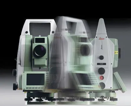
Leica offers technology warranty

Leica Geosystems, the leading Swiss manufacturer of surveying instruments and measurement tools, has launched a new warranty and service package for its range of construction-related products. Protect by Leica Geosystems offers a lifetime manufacturer’s warranty, no cost for product repairs and maintenance associated with normal conditions of use, and certified quality. Makers of products to tackle onsite positioning, measuring, levelling, aligning and plumbing tasks, Leica Geosystems’ Protect package is sa
November 27, 2012 Read time: 2 mins

Leica Geosystems, the leading Swiss manufacturer of surveying instruments and measurement tools, has launched a new warranty and service package for its range of construction-related products.

Protect by 265 Leica Geosystems offers a lifetime manufacturer’s warranty, no cost for product repairs and maintenance associated with normal conditions of use, and certified quality. Makers of products to tackle onsite positioning, measuring, levelling, aligning and plumbing tasks, Leica Geosystems’ Protect package is said by the firm to be the best among its peers.

The free repair service includes the repair or replacement of all defective parts; product adjustment and calibration; a thorough functional test and safety check; maintenance, cleaning of product and carrying case.

Leica Geosystems runs calibration laboratories (No. SCS079), and a test laboratory (No. STS549).  All are fully accredited by the SAS (Swiss Accreditation Service). The calibration and test certificates issued by Leica Geosystems are officially and internationally recognized for horizon, angle, distance, frequency, and laser classification. This confirmation of precision is said by the company to guarantee the highest possible reliability for its products. All laboratories are regularly controlled by an independent national institution according to ISO 17025.

For more information on companies in this article

Related Content

  • Real time site monitoring technology
    July 19, 2012
    Leica Geosystems is broadening its site monitoring technology with the introduction of the GeoMoS package. This can be linked to the firm's existing GNSS Spider software to offer an array of TPS and GNSS monitoring tools. Combined, these tools provide a web-based service for visualisation and analysis of monitoring. Authorised users can access a monitoring project using a web browser, pocket PC or mobile phone. Using the GeoMoS Web service, graphs and views can be customised and be tailored to the needs of
  • Precision pinpointing
    March 1, 2012
    Leica Geosystems says that its TS30 package is a new high precision Total Station that meets highest standards in all surveying applications. Distances can now be measured with Leica Geosystems' proven PinPoint EDM Technology with an unprecedented precision of 0.6mm + 1ppm on prisms. On natural surfaces a high accuracy of 2mm + 2ppm up to 1,000m can be achieved.
  • The UK Highways Agency engages Fugro for Doppler laser surveying
    January 6, 2015
    The United Kingdom’s Highways Agency has awarded its first commercial contract to survey thousands of road lanes using sophisticated Doppler laser equipment. Fugro is driving the project forward, reports David Arminas The Highways Agency Traffic Speed Defelectometer vehicle looks like an ordinary flatbed truck delivering a similarly ordinary steel shipping container. But looks are deceiving. Inside the container is a sophisticated Doppler laser measuring system collecting pavement condition data of the U