It’s a level playing field with Leica’s iCON gps 70 Series

Efficiency is the name of the game from the iCON gps 70 Series, a GNSS rover from Leica Geosystems. With the iCON gps 70 T you can measure and stakeout points faster and without the need to keep the pole vertical and level the bubble. The combination of the latest GNSS technology and inertial measurement unit (IMU) equips the iCON gps 70 T with permanent tilt compensation and makes it resistant to any magnetic interference. Because the iCON gps 70 T is calibration-free, it can be ready instantly and any
April 27, 2018 Read time: 2 mins
Leica’s iCON gps 70: no need to keep the pole vertical and level the bubble

Efficiency is the name of the game from the iCON gps 70 Series, a GNSS rover from Leica Geosystems.

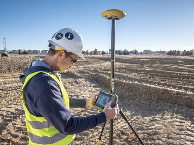
With the iCON gps 70 T you can measure and stakeout points faster and without the need to keep the pole vertical and level the bubble.

The combination of the latest GNSS technology and inertial measurement unit (IMU) equips the iCON gps 70 T with permanent tilt compensation and makes it resistant to any magnetic interference.

Because the iCON gps 70 T is calibration-free, it can be ready instantly and anywhere that it is needed.

The on-site operator can collect as-built field data and stake out designs faster while increasing accuracy and reduced errors. This also allows the operative to focus more on his or her safety in a hazardous environment.

The iCON gps 70 series is seamlessly integrated into the Leica iCON field software. By keeping the core central interface, following the unrivalled Leica iCON concept, the onsite operative can benefit from the simple-to-use workflows which require less training and avoid costly downtime.

The GNNSS technology allows 555 channels for more signals, faster acquisition
and improved sensitivity.

To ensure accuracy and continued use, the unit is IP66 / IP68 protected. It is also built for extreme temperatures of -40°C to +65°C.

Related Content

  • Topcon unveils FC-336 date controller
    March 27, 2014
    Topcon has unveiled its new FC-336 data controller designed specifically for the construction industry. In addition to providing field crews with access to MAGNET Enterprise to send and receive data files, the new controller operates with Topcon MAGNET Field, Site and Layout software, as well as Topcon Pocket 3D. A compact and lightweight handheld controller, the FC-336 works with all Topcon GNSS receivers and total stations.
  • Topcon’s LN-100 3D positioning system
    May 13, 2014
    Topcon Positioning Group says its new BIM solution - the LN-100 – is the world’s first 3D positioning system designed specifically for construction layout. Said to offer seamless integration and flow of project data from the design to the field, the LN-100 is simple to operate, removing “the intimidation factor and reducing the learning curve in performing construction layout tasks,” according to Eduardo Falcon, Topcon Positioning Group executive vice president and general manager for the GeoPositioning
  • Trimble's ruggedised tablet for site use
    May 15, 2019
    Trimble is now offering its T7 Tablet, a rugged, lightweight and versatile device for construction surveying applications. The unit features the Trimble Siteworks Software for construction surveying, allowing it to provide real-time data to visualise cut/fill levels, calculate material volumes, check grade and communicate work orders. This can allow users to to improve productivity and decision-making. Scott Crozier, general manager for Trimble’s Civil Engineering and Construction Division said, “Surveyors
  • New Leica Geosystems grade control works in more applications
    January 6, 2017
    Leica Geosystems has introduced a dual-control system for graders that works in more applications, including crab walking and slope work.The Leica iCON grade iGG4 means designs and applications previously thought to be beyond control technology now can be handled