High performance from Topcon’s HiPer XR

April 11, 2025 Read time: 1 min
The lightweight HiPer XR, from Topcon Positioning Systems, Dynamic TILT Compensation technology for effortless measurements, even in difficult conditions

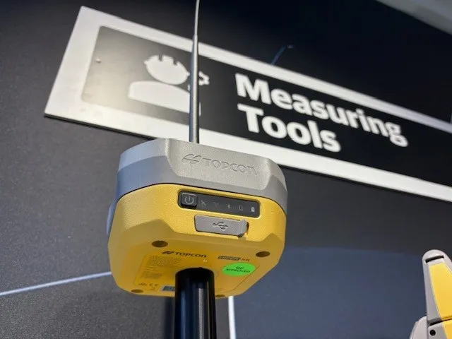
The HiPer XR, from Topcon Positioning Systems, is a robust high-precision GNSS receiver for surveying, construction and geospatial work. It delivers precision and efficiency, tackling all challenges with RTK accuracy and Dynamic TILT Compensation technology for effortless measurements, even in difficult conditions.

Its anti-jamming capabilities ensure reliable performance, while the lightweight, rugged design withstands harsh environments. The HiPer XR is about versatile connectivity with long battery life at an affordable price.

Its multi-constellation support delivers improved accuracy by tracking multiple satellite systems simultaneously, ensuring reliable data even in challenging conditions. With fast charging that reaches 50% in just 30 minutes, downtime is minimised.

TILT technology enables accurate pole-tip measurements without the need for calibration and is also resistant to magnetic interference. Its advanced anti-jamming capabilities ensure reliable signal performance, even in demanding environments.  

Designed to be both durable and lightweight – just under 1kg - it can endure tough conditions while remaining easy to handle.

With support for multiple constellations, flexible connectivity options, and a cost-effective design, the HiPer XR is a practical and adaptable solution for modern surveying needs. 

For more information on companies in this article

Related Content

  • Mobile mapping innovation
    June 1, 2022
    There are millions of kilometres of roads and features that need to be mapped in today’s world. We see a strong vision and application for the future, therefore Leica Geosystems, part of Hexagon, recently announced the introduction of the reality capture mobile mapping system Leica Pegasus TRK, introducing artificial intelligence, autonomous workflows and intuitive interfaces. This technology goes beyond the capabilities of what’s already been done, making it the perfect companion for today’s mobile mapping requirements.
  • Sophisticated plotting
    February 7, 2012
    Leica Geosystems is offering its improved SpiderWeb v4.0 package as part of the new reference station software update. This improved suite of solutions also includes the GNSS Spider v4.0 and SpiderQC v4.0 packages.
  • A winter wonderland for Vaisala’s MD30 sensor
    November 18, 2019
    Accurately measuring road network conditions in real time requires rugged and durable mobile sensor technology, writes Rose Parisi* Monitoring road conditions is critical to performing efficient and effective maintenance that reduces risks posed by hazardous driving conditions. This is most critical during winter. Road weather information systems (RWIS) help support road maintenance decision-making through the measurement of atmosphere and pavement conditions. However, due to the static location and
  • Topcon’s advanced software for construction
    December 12, 2018
    Topcon Positioning is introducing the latest version of its MAGNET 5 software. This new version includes upgrades to the MAGNET Field, Office and Enterprise applications designed for advanced performance, third-party integration, and construction planning and oversight capability. The package offers new flexible display options and additional customisable data labels. Additionally, operators can view GNSS status when the controller is connected to a total station in Hybrid mode, and show offsets as a visua