Handheld imaging from Leica Geosystems

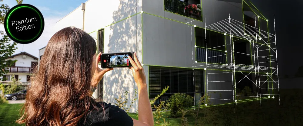
Leica Geosystems is offering an updated imaging tool in the shape of its latest BLK3D model.
May 21, 2021 Read time: 1 min

The firm says that its new handheld imager now offers twice the operating range of the previous variant. In-picture measurement accuracy has also been improved for indoor and outdoor applications.

Users benefit from new guidance and accuracy indication features that allow them to optimise the capturing process to achieve high measurement accuracy. This is achieved by significantly enhancing BLK3D image processing algorithms alongside workflow adaptation which allows for capturing multi-shots with up to four shots. The BLK3D Update is rolled out with the new BLK3D Mobile and Desktop software version 3.0. BLK3D with Publisher license enables collaboration amongst teams, providing accessibility to 3D images using the cloud. Measurements can be created and shared on mobile devices such as smartphones and tablets across project teams.

The firm says that it designed BLK3D mobile and desktop 3.0 for users starting their journey into digitalisation and digital experts that have already been working in the area for some time. The unit provides increased accuracy, longer range and added functionality, allowing users to make their work more efficient, effective and productive according to the company.

For more information on companies in this article

Related Content

  • Rapid adoption of GPS machine control
    February 10, 2012
    The high sophistication of GPS machine control systems has resulted in a fast pace of technological advancement. The three major players in the machine control sector, Leica Geosystems, Topcon and Trimble have all made major gains in recent years. The sophistication of the latest systems can combine satellite position data from the GPS and GLONASS networks with information from total stations to provide precise, high speed machine operation. Further more the firms have also prepared themselves for the intro
  • Road construction software innovations
    February 13, 2012
    A range of key software innovations are now available for road construction applications from various suppliers - Adrian Greeman writes. Two significant and highly economic alternatives are now available to the major CAD providers both from Belgium and both offering interesting features. First is Pythagoras, which describes itself as a modern CAD program specially designed for topographical applications which include land surveying, road design and city planning.
  • Cultivate better on-site safety awareness by leveraging technology with Leica Geosystems
    August 10, 2023
    When a vital fiber-optic cable was cut during construction work in Germany, the impact was huge. There were telecom disruptions affecting the greater Frankfurt area, all departures and landings at Frankfurt Airport were suspended, and Lufthansa’s global IT system crashed. Leica Geosystems says it is vital to put in place “strategies to protect people, equipment, and assets… and to emphasise the crucial role digital solutions play in ensuring safety.”
  • Free modeling: Improving efficiency in construction- site management
    July 24, 2025
    Liebherr’s innovative Free Modeling technology enables road-construction operators to create and modify simple 3D site models directly from their machinery, enhancing real-time decision-making.