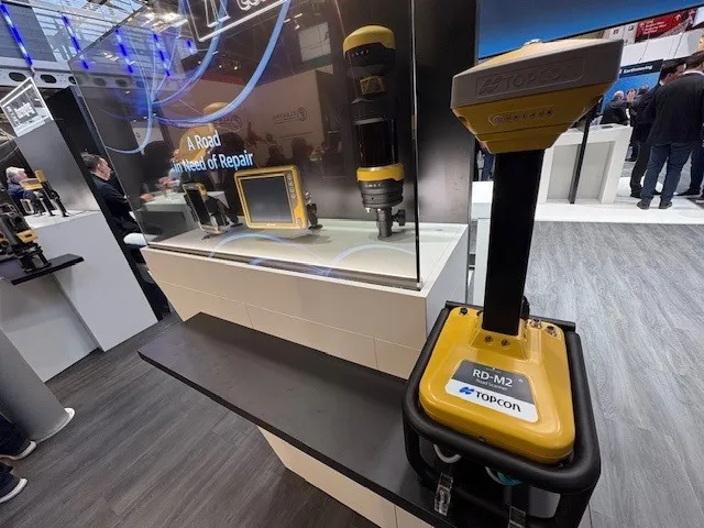
Get highly detailed 3D point road surface data from Topcon’s new RD-M2 scanner

April 11, 2025 Read time: 1 min
The vehicle-mounted downward-facing RD-M2 from Topcon Positioning Systems delivers precise surface conditions over long and complex roads

Topcon Positioning System’s new RD-M2 laser scanner has been purpose-built for road resurfacing applications.

The vehicle-mounted downward-facing RD-M2 delivers precise surface conditions over long and complex roads, which means no road closures are needed.  

Millions of points are collected by the vehicle operator from safety of his or her cab.

The 3D point data from the RD-M2 scanner serves as the basis for detailed road surface designs using the Topcon Office Suite.  

These ground-truth surfaces are a part of the company’s SmoothRide system workflow.

Users can take advantage of Topcon’s intuitive workflow to create their own custom design from the scan or they can integrate a predefined template.  

Users can also align the scan to the local coordinate system with millimetre-level precision, providing complete flexibility for road resurfacing projects.  

For more information on companies in this article

Related Content

  • Komatsu introduces 3D machine guidance and payload functions for crawler and wheeled excavators
    April 5, 2024
    Drawing on a decade of experience and a deep understanding of the intelligent Machine Control system, Komatsu now offers Smart Construction 3D Machine Guidance kit as a simple and flexible technological enhancement for a broad range of standard Komatsu machines and mixed fleets.
  • Topcon’s advanced software for construction
    December 12, 2018
    Topcon Positioning is introducing the latest version of its MAGNET 5 software. This new version includes upgrades to the MAGNET Field, Office and Enterprise applications designed for advanced performance, third-party integration, and construction planning and oversight capability. The package offers new flexible display options and additional customisable data labels. Additionally, operators can view GNSS status when the controller is connected to a total station in Hybrid mode, and show offsets as a visua
  • Germany builds its first major PPI autobahn project
    July 7, 2015
    Rebuilding of one of the oldest motorways in Germany is testing out the possibilities for public-private project road construction reports Adrian Greeman A freshly renovated section of the A8 Autobahn in southern Germany will be watched with some interest this summer as traffic begins driving along its rebuilt carriageway and additional third lanes. That is not because of any special road features, other than a distinctive reddish colour to its concrete surface, but because it is a first fullscale public
  • Data allowing safety on UK motorways
    February 17, 2025
    Accurate data is allowing safer roads for UK motorways