Get highly detailed 3D point road surface data from Topcon’s new RD-M2 scanner

April 11, 2025 Read time: 1 min
The vehicle-mounted downward-facing RD-M2 from Topcon Positioning Systems delivers precise surface conditions over long and complex roads

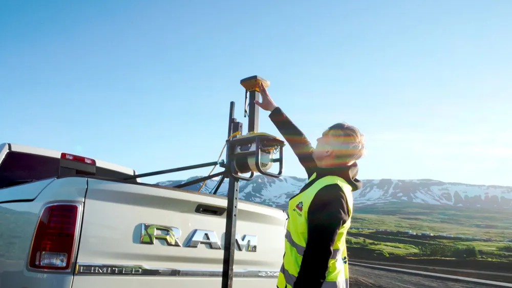
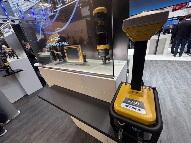
Topcon Positioning System’s new RD-M2 laser scanner has been purpose-built for road resurfacing applications.

The vehicle-mounted downward-facing RD-M2 delivers precise surface conditions over long and complex roads, which means no road closures are needed.  

Millions of points are collected by the vehicle operator from safety of his or her cab.

The 3D point data from the RD-M2 scanner serves as the basis for detailed road surface designs using the Topcon Office Suite.  

These ground-truth surfaces are a part of the company’s SmoothRide system workflow.

Users can take advantage of Topcon’s intuitive workflow to create their own custom design from the scan or they can integrate a predefined template.  

Users can also align the scan to the local coordinate system with millimetre-level precision, providing complete flexibility for road resurfacing projects.  

For more information on companies in this article

Related Content

  • Topcon’s LN-100 3D positioning system
    May 13, 2014
    Topcon Positioning Group says its new BIM solution - the LN-100 – is the world’s first 3D positioning system designed specifically for construction layout. Said to offer seamless integration and flow of project data from the design to the field, the LN-100 is simple to operate, removing “the intimidation factor and reducing the learning curve in performing construction layout tasks,” according to Eduardo Falcon, Topcon Positioning Group executive vice president and general manager for the GeoPositioning
  • Technology from Topcon plays key role in resurfacing race track
    May 13, 2021
    Located in northern Iceland, Akureyri is the fourth largest town in the country, with a modest population of 19,000. The town is home to one of Iceland’s oldest car racing clubs, the Akureyri Car Club, which runs regular drag racing events. However, its popularity resulted in heavy wear and tear, which meant the quarter-of-a-mile drag race strip was in urgent need of an upgrade.
  • Topcon announces increased 3D scanning integration with Autodesk
    August 17, 2015
    Topcon Positioning Group says it has improved workflow compatibility for the GLS-2000 3D laser scanner and ScanMaster software with Autodesk solutions. With the latest version of Autodesk ReCap, the GLS-2000 pairs with Topcon ScanMaster software to collect, process, edit and deliver 3D point cloud data from a laser scanner. ReCap allows users to perform tasks such as scan conversion, editing and viewing point cloud data. It also provides integration with Autodesk’s portfolio of design software. Aut
  • Laser scanning focuses on asset management
    January 9, 2015
    Laser scanners and improved data collection and analysis software are making light of asset management surveying. David Arminas reports The age of the laser scanner is upon us, taking over from traditional manual methods of surveying, data collection and processing. These new technical developments are making it much easier to process and use the data captured and are providing highways engineers with powerful tools to record, map and visualise their assets. This is good news for highways authorities