Generate real-world ROI with reality modeling!

Understanding existing site conditions is essential to efficiently design, build, and operate road networks around the world. But how can the real-world be captured quickly and cost-effectively?
September 8, 2022 Read time: 1 min
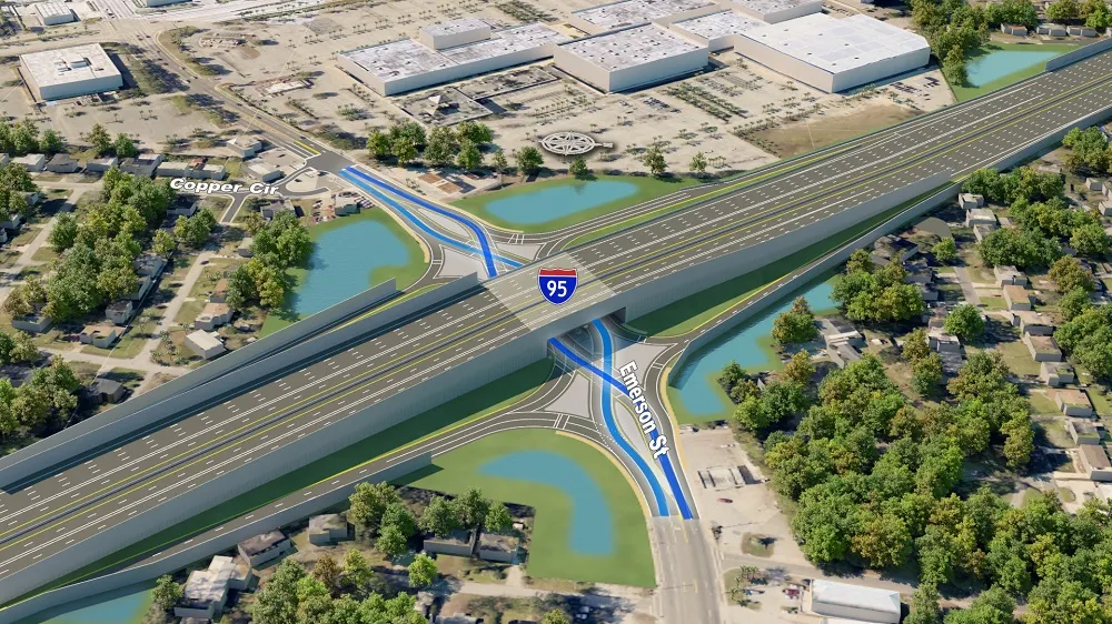
Courtesy of RS&H

Reality modeling is going mainstream in the transportation industry as it provides real-world digital context for infrastructure projects, enabling organisations to improve worker safety, start projects faster, iterate designs more efficiently, and share information more effectively.

Bentley’s reality modeling software solutions automatically generate high-fidelity 3D reality models from simple photographs and/or point clouds. These reality data can be captured from a variety of devices and techniques, including aerial LiDAR, drone photography, hand-held cameras, terrestrial laser scanners, mobile mapping systems, and even smartphones. The process brings new opportunities to optimize workflows to win projects.

Courtesy of Alabama DOT

You can manage an unlimited number of high resolution photographs, dense point clouds, and panoramic images to gather the information needed to create high-fidelity georeferenced 3D models, reducing health and safety risks for works at dangerous sites. These 3D reality models are quickly generated and available in many formats for users to incorporate into their design, construction, analysis and operation workflows.

Download our e-book and learn how transportation agencies are leveraging reality modeling throughout the asset lifecycle to accelerate the decision-making process and improve team collaboration.

Click here to download our e-book

Content produced in association with Bentley Systems.

For more information on companies in this article

Related Content

  • Leica Cyclone teams up with NCTech’s iSTAR camera database
    January 19, 2016
    Users of Leica Cyclone, a 3D point cloud processing software, can now automatically import and align high-dynamic range (HDR) data from NCTech’s iSTAR camera database. The result is enhanced images delivered faster and easier, according to both companies. “It is also the accuracy to which these images fit the 3D point cloud data that is paramount. NCTech’s iSTAR camera produces high-quality HDR imaging at the accuracy everyone expects,” said Faheem Khan, vice president, business development for Leica Geosys
  • Improved excavator models available
    September 7, 2021
    Improved excavator models are now being made available for customers wanting higher performance
  • Think smart with RM XSMART
    July 13, 2022
    The launch of XSMART, by Rubble Master, is the next step towards the future digital construction site, explains Gerald Hanisch*, the company’s chief executive, and Markus Gaggl, the chief technical officer
  • Cultivate better on-site safety awareness by leveraging technology with Leica Geosystems
    August 10, 2023
    When a vital fiber-optic cable was cut during construction work in Germany, the impact was huge. There were telecom disruptions affecting the greater Frankfurt area, all departures and landings at Frankfurt Airport were suspended, and Lufthansa’s global IT system crashed. Leica Geosystems says it is vital to put in place “strategies to protect people, equipment, and assets… and to emphasise the crucial role digital solutions play in ensuring safety.”