Faster surveying with Leica Geosystems

Leica Geosystems says that the new LS15 tool can be used to complete all the key stages for levelling. The system has a high accuracy of 0.2mm, which can be achieved by aiming at the target via the colour touch display and pressing the measuring button. Key working features include an electronic bubble and tilt checks prior to each measurement and autofocus. These are said to help to reduce fatigue over a shift and help minimise the risk of working errors, ensuring consistently high accuracy of measureme
June 16, 2016 Read time: 2 mins
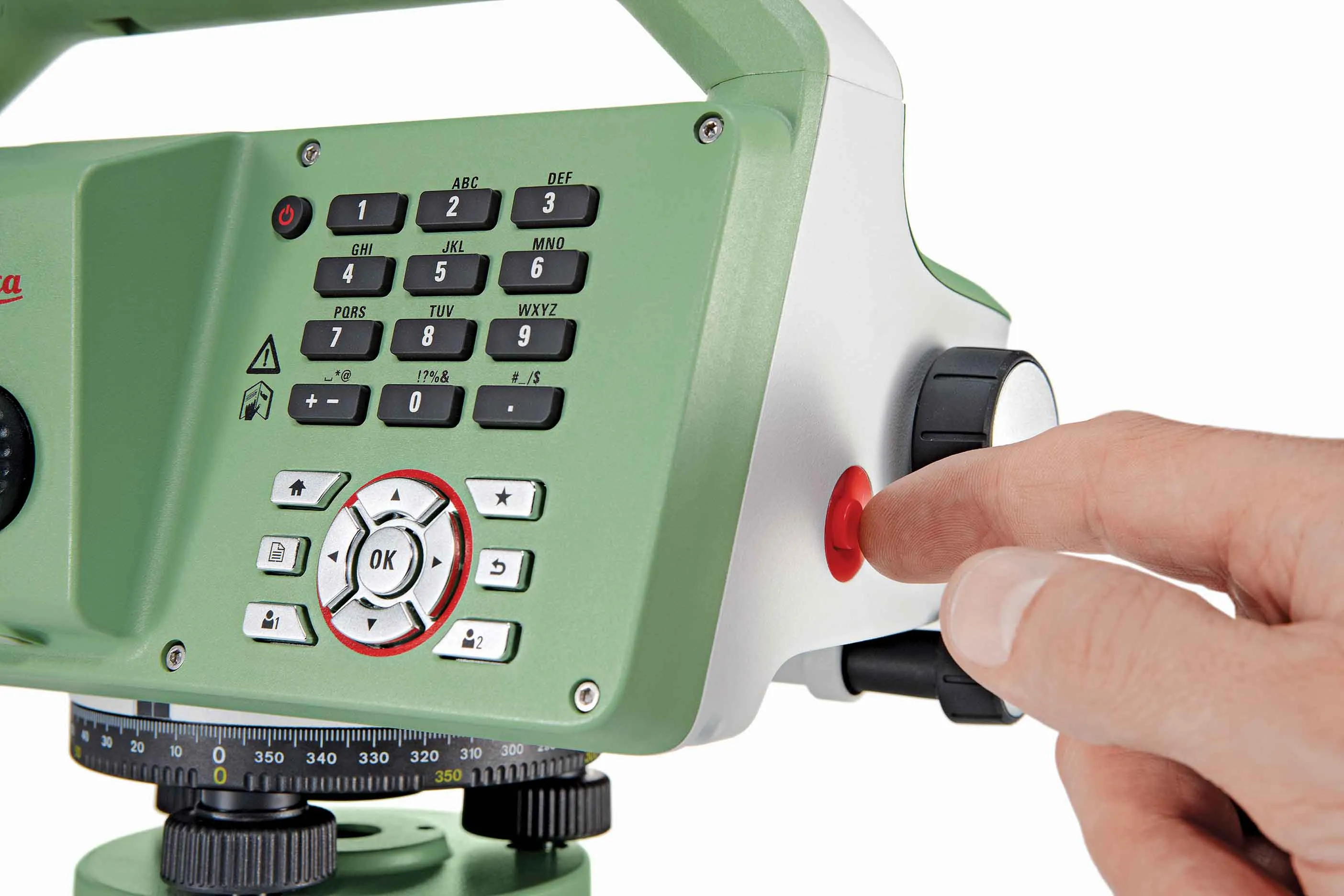
The new tool from Leica Geosystems helps boost surveying efficiency
265 Leica Geosystems says that the new LS15 tool can be used to complete all the key stages for levelling. The system has a high accuracy of 0.2mm, which can be achieved by aiming at the target via the colour touch display and pressing the measuring button.

Key working features include an electronic bubble and tilt checks prior to each measurement and autofocus. These are said to help to reduce fatigue over a shift and help minimise the risk of working errors, ensuring consistently high accuracy of measurement.

The firm says that the LS15 is the only level on the market equipped with a camera and this allows target staffs to be sighted faster. Users locate the staff on the camera touch display and then press the measuring button to record the staff reading and measurement values.

The unit’s USB and Bluetooth interface allow enable fast data transfer, while the Leica Infinity software package can process complex levelling data in the office. Users can combine tables with graphics or cross check key project information in one program window, providing access to all data, results and deliverables.

For more information on companies in this article

Related Content

  • Mobile mapping innovation
    June 1, 2022
    There are millions of kilometres of roads and features that need to be mapped in today’s world. We see a strong vision and application for the future, therefore Leica Geosystems, part of Hexagon, recently announced the introduction of the reality capture mobile mapping system Leica Pegasus TRK, introducing artificial intelligence, autonomous workflows and intuitive interfaces. This technology goes beyond the capabilities of what’s already been done, making it the perfect companion for today’s mobile mapping requirements.
  • Intercomp adds Bluetooth to wireless indicators
    September 30, 2020
    Intercomp has added Bluetooth to its HH60 RFX Wireless Indicators to communication weight data to Apple mobile devices using the free apps iVehicleWeigh or iExactWeigh.
  • Effective demarcation boosts traffic safety
    July 29, 2015
    Effective demarcation can play a crucial role in boosting safety for road users. Good demarcation is vital on a road network to help ensure that drivers stay in the correct lanes and are warned of changes that lie in their path, for example. Road markings are hugely important and for those involved in maintenance, ensuring that these are visible at night and in poor weather can help maximise safety. New technology is on the market now that can help road authorities ensure that road markings meet requirement
  • French fine milling achieved
    January 10, 2025
    Contractor 2AGE-MCS achieved precision and speed in milling the Route Centre-Europe Atlantique in France with the use of 3D technology