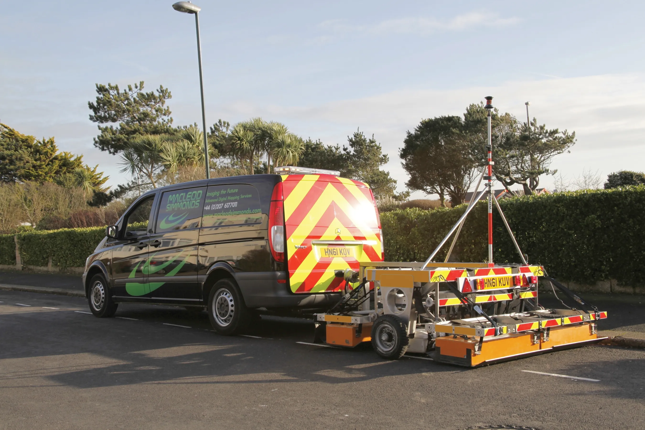
A sophisticated package for evaluating road condition is now available called e-Spott, from Pipe Hawk. This system is said to be a fast and reliable method of measuring the total bound layer thickness of asphalt laid in a highway reinstatement.

RSSA sophisticated package for evaluating road condition is now available called e-Spott, from 5770 Pipe Hawk. This system is said to be a fast and reliable method of measuring the total bound layer thickness of asphalt laid in a highway reinstatement. It uses proven ground probing radar (GPR) technology that is used in a different format in utility detection and mapping works or in geophysical investigations. But unlike conventional coring methods e-Spott minimises disruption to road traffic as well as eliminating immediate damage to newly laid surfaces.
The tests are non-intrusive and can be carried out in just seconds whether they are between parked vehicles, around other obstacles or in gaps in the traffic flow. Tests are undertaken on a one-man, single button push basis, without damage to the road surface.
The most recent version has been upgraded with the addition of facilities to use an on-board memory card and in-built GPS positioning system which pinpoints the reading location. All data is stored immediately to file for easy transfer and client access after the survey.
The system is a complementary technology that can improve the effectiveness of traditional coring programmes. Survey data of large re-instatements can pinpoint potential hot-spots where layer thickness may fall short of standard. This allows core sampling to be targeted to where it is likely to be most effective in ensuring that the works meet required standards.
On the smaller scale, the system can survey individual repairs and highlight those that may be substandard with a single quick and inexpensive test. The system allows both the client and the contractor to ensure that the works are up to the required standard before they are handed over.