Accurate utilities detection

By MJ Woof November 26, 2024 Read time: 1 min
Utility works can be carried out more efficiently using new capabilities offered jointly by Trimble and Radiodetection

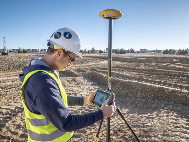
Trimble and Radiodetection are collaborating to improve the technology used in the utility measurement and mapping process. Integrating the Trimble Catalyst DA2 GNSS system and Radiodetection’s RD MapTM+ application and precision locator products helps to streamline utility-locating workflows to provide accurate measurement capabilities and generate underground utilities maps in a single field operation.

When using conventional technology, field technicians mark their measurements onsite or rely on data entries to provide to office staff for map creation after a site visit. However, data collected with the Trimble Catalyst DA2 GNSS system can now be simultaneously synchronised with Radiodetection RD Map+ and precision locators that find and mark buried utilities. By streamlining this connection, workers can digitise utility-line locations and reduce reporting errors. 

“Accurate geolocation is critical to the operation and maintenance of underground utilities and public infrastructure,” said Stephanie Michaud, strategic marketing manager, Trimble Surveying & Mapping Field Solutions. “By adding survey-grade capabilities to existing utility workflows, this collaboration creates a connected solution that provides confidence and reliability during the data capture process.”

The combined technologies provide accurate data for construction firms to work from, assisting with the establishment of dependable digital twins.




For more information on companies in this article

Related Content

  • Software innovations benefit construction planning
    February 9, 2012
    Bentley Systems remains bullish with a healthy financial performance and continued investment in research and development, reports Mike Woof. The State Geological Institute of Dionyz Stur in Slovakia won an award in the Bentley Systems Be Inspired event's geotechnical category for an innovative project to log and analyse an area of the country's geology. As a leading player in the construction software sector, Bentley Systems is benefiting from growth in infrastructure investment worldwide. And despite the
  • Improved laser scanning capabilities
    February 23, 2012
    Leica Geosystems is broadening its software offering with its new Leica Cyclone v7.2 package, which is said to improve office processing capabilities. The package has been developed to address key market needs and trends in the processing and use of rich, as-built point cloud data from high definition laser scanning technology. According to the firm the package can help reduce laser scanning project costs, including office time, allowing projects to use more scans and higher scan densities.
  • AibotX6 Version 2 uses High Precision GNSS
    January 19, 2016
    Kassel-based company Aibotix has presented a solution for high-precision surveying with Version 2 of its tried and tested surveying hexacopter AibotX6: High Precision GNSS. Aibotix, based in Kassel, in the middle of Germany, develops and manufactures multi-copters for applications in the industrial sector. The company's name is a combination of Ai for artificial intelligence and botix for robotics.
  • Trimble's ruggedised tablet for site use
    May 15, 2019
    Trimble is now offering its T7 Tablet, a rugged, lightweight and versatile device for construction surveying applications. The unit features the Trimble Siteworks Software for construction surveying, allowing it to provide real-time data to visualise cut/fill levels, calculate material volumes, check grade and communicate work orders. This can allow users to to improve productivity and decision-making. Scott Crozier, general manager for Trimble’s Civil Engineering and Construction Division said, “Surveyors