Accurate utilities detection

By MJ Woof November 26, 2024 Read time: 1 min
Utility works can be carried out more efficiently using new capabilities offered jointly by Trimble and Radiodetection

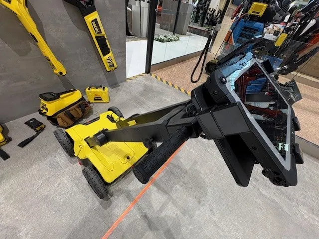
Trimble and Radiodetection are collaborating to improve the technology used in the utility measurement and mapping process. Integrating the Trimble Catalyst DA2 GNSS system and Radiodetection’s RD MapTM+ application and precision locator products helps to streamline utility-locating workflows to provide accurate measurement capabilities and generate underground utilities maps in a single field operation.

When using conventional technology, field technicians mark their measurements onsite or rely on data entries to provide to office staff for map creation after a site visit. However, data collected with the Trimble Catalyst DA2 GNSS system can now be simultaneously synchronised with Radiodetection RD Map+ and precision locators that find and mark buried utilities. By streamlining this connection, workers can digitise utility-line locations and reduce reporting errors. 

“Accurate geolocation is critical to the operation and maintenance of underground utilities and public infrastructure,” said Stephanie Michaud, strategic marketing manager, Trimble Surveying & Mapping Field Solutions. “By adding survey-grade capabilities to existing utility workflows, this collaboration creates a connected solution that provides confidence and reliability during the data capture process.”

The combined technologies provide accurate data for construction firms to work from, assisting with the establishment of dependable digital twins.




For more information on companies in this article

Related Content

  • Trimble continues to develop connected community portfolio
    April 9, 2013
    Trimble is demonstrating its sophisticated Connected Site portfolio for heavy civil contractors, which connects assets, information, people, machines and sites. This package can meet a vast array of workflow needs of different stakeholders within the contractor’s organisation and meets demand for greater efficiency, shorter completion times and higher quality. Trimble is demonstrating how its Connected Site solutions leverage real-time wireless data flow between the office and job site. This technology allo
  • Information technology and transport development
    April 12, 2012
    A team of eminent Russian specialists* introduce exciting new information technologies, such as the Internet of Things, and foresee their promising applications in the field of transport infrastructure development. Global economic growth, combined with explosive digital technology proliferation, brings new challenges to the field of transport infrastructure. Technical advances such as Intelligent Transportation Systems (ITS), vehicle to infrastructure interfaces, global positioning, electronic toll collecti
  • Information technology and transport development
    February 16, 2012
    A team of eminent Russian specialists* introduce exciting new information technologies, such as the Internet of Things, and foresee their promising applications in the field of transport infrastructure development
  • Know what lies below with Leica’s DSX 3D utility detection system
    April 11, 2025

    Emergency road repair work needn’t create yet another emergency by hitting unknow utility pipes and other systems.  

    Leica Geosystems says its DSX utility detection solution can quickly be walked over the area where work is about to start and immediately show an excavator operator any dangers that lie below.

    It locates, visualises and map utilities. Unlike any other ground penetrating radar system, the Leica DSX maximises productivity with cutting-edge software that automates data analysis and creates a 3D utility map of the field.