Total tunnel management with Yunex Yutraffic Varia

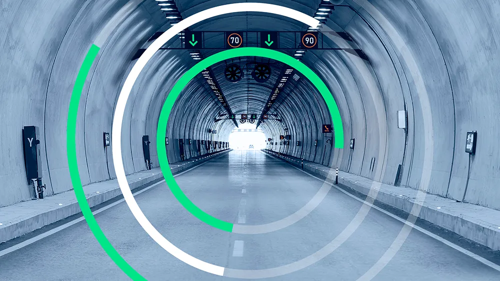
Yunex Traffic says its new Yutraffic Varia software enables integrated, automated and scalable management of all key tunnel management processes in an intuitive application.
August 29, 2023 Read time: 2 mins
With Yutraffic Varia, one single integrated application controls all tunnel processes including traffic management activities

YuTraffic Varia is, the company says, one of the first controllers on the market that has already achieved SIL-2 certification in projects. It was shown recently at the World Tunnel Congress 2023 in Athens.

Currently, functions - from ventilation to lighting to traffic flow - are managed typically by a number of applications, leaving the operator with the major challenge of deriving necessary information and coordinating actions across them. With Yutraffic Varia, one single integrated application controls all tunnel processes including traffic management activities.

They can now be monitored and managed in an integrated manner, which both simplifies control and increases safety, explains Holger Erhardt, Yunex Traffic’s senior vice president interurban and tolling. Being modular and scalable, Yutraffic Varia can be flexibly adapted to the needs and requirements of the user. Yet, despite this capability, it remains intuitive and easy to use, he says. Automatic response plans and strategies enable an immediate reaction to unpredictable traffic situations and incidents, such as a blocked lane, a stationary vehicle or even a fire in a tunnel. In this way, the software contributes to greater safety in tunnels.

Also at the World Tunnel Congress in Athens, Yunex Traffic showcased developments of the digital twin – a visualisation of tunnels in virtual reality. It is the result of a combination of building information modelling (BIM), traffic and asset management system, traffic simulation and asset management. It represents a virtual image of the real infrastructure, systems and processes of tunnels.

The digital twin can replace real systems in many process steps and enables testing and simulation that would not be possible in the real world. This can increase project quality, accelerate implementation, reduce project costs and optimise operations. 

For more information on companies in this article

Related Content

  • Protecting bridge assets over time
    September 1, 2021
    One of the challenges facing transportation agencies today is how to conduct accurate, timely, and safe bridge inspections. Maintaining bridges is important to ensure public safety, and bridge owners and engineers need to perform regular inspections to determine the structural integrity of bridges so that they can plan for maintenance, rehabilitation, and replacement of those bridges.
  • John Deere ploughs significant resources into electric future 
    October 28, 2022
    John Deere Power Systems is investing significant resources in advanced battery technologies for off-highway vehicles.
  • Visualisation technology from Bentley Systems
    May 15, 2019
    Bentley Systems has introduced its SYNCHRO XR, its app for immersively visualising 4D construction digital twins with the new Microsoft HoloLens 2. The SYNCHRO XR for HoloLens 2 system allows users to interact collaboratively with digital construction models using intuitive gestures to plan, visualise, and experience construction sequencing. Project digital twin data is visualised with the HoloLens 2 through Bentley’s connected data environment, powered by Microsoft Azure. With the mixed reality solutio
  • VIDEO: Telstra drone LIDAR maps Melbourne’s EastLink Mullum Tunnel
    April 13, 2018
    One of the applications for LIDAR is to make high resolution 3-D maps. Self-driving cars are pre-loaded with a LIDAR map of the trials area in which they are permitted to fully self-drive themselves. The cars also have their own LIDAR scanner which captures a real-time LIDAR view of the vehicle’s surroundings. The fully autonomous driving system within these prototype cars compares the real-time LIDAR view against the pre-loaded LIDAR map to significantly increase the accuracy of their self-positioning