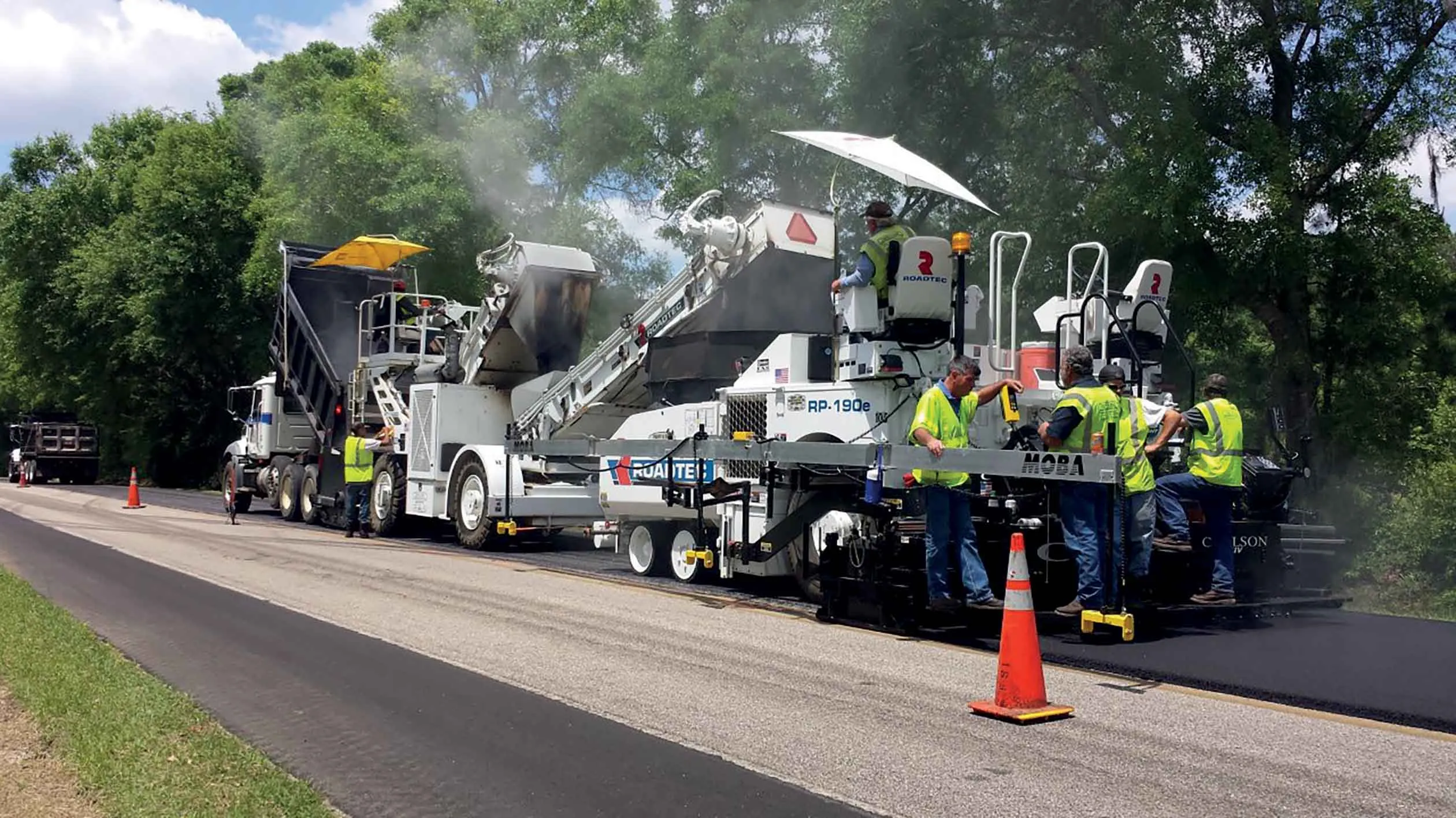
Asphalt road construction has improved over the decades, with better compaction being a key factor. The state-of-the-art machines offer automatic compaction to a desired final stiffness. This enables users to select a task such as gravel base or wearing course, and the roller self-adjusts to optimise compaction effect. Fully automated self-driving rollers have already been presented in research studies and prototypes, although they are some way away from being available commercially.
While considerable effort has been spent to ensure the fast and efficient compaction of the asphalt mix to the desired density, surface quality is another important factor to be considered. Bumps and undulations place unnecessary and damaging stress on the asphalt and on road users. However, the degree of smoothness is currently only assessed once compaction work has been completed, making any correction of errors costly. Without prompt feedback, it is almost impossible to improve road smoothness beyond the minimum specifications.
An ideal addition to the quality control tools currently used in road construction would be a mobile scanner able to measure the smoothness of the road during compaction to provide additional quality control. Scanning the road surface while it is being built can avoid the need for costly reworking.
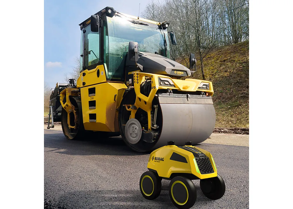
Compaction rollers themselves are not best suited for carrying such high-precision measuring equipment. The suggestion by BOMAG is for a fully autonomous, compact measuring rover that travels with the other machines during road construction. The rover could be a compact unit as it would only need to carry a number of electronic sensors to evaluate road surface quality. The surface smoothness level measured could then then be transmitted from the unit to display devices. In addition to waves and irregularities, the mobile measuring rover could also assess road surface roughness.
The small-scale roughness of a road surface depends on the amount and timing of gritting. If it takes place too early, the grit can become deeply embedded, making it inefficient and leaving a dangerous road with a low initial skid resistance. Gritting too late can prevent the particles from bonding properly, wasting a lot of material and reducing road grip.
An exact final road surface plays an important role as any reduction in waves and unevenness pays off. Smooth roads are more durable, improve driving comfort, reduce traffic noise, and offer increased safety. Sophisticated gyroscopic and acceleration sensors can allow precise measurement of waves in the centimetre to metre range. Laser-based sensors such as Lidar can measure well below one millimetre resolution. When this sensor data is combined with the GPS localisation of a self-driving rover, a map of the road profile can be generated as it is built.
Compaction is an important task in road construction so incorporating an autonomous road surface scanner into quality control will allow contractors to build higher quality roads in the future.