XenomatiX launches XenoTrack Dual Lane

XenoTrack Dual Lane surveys two neighbouring lanes in a single pass while the survey vehicle drives in one lane.
By David Arminas March 6, 2023 Read time: 2 mins
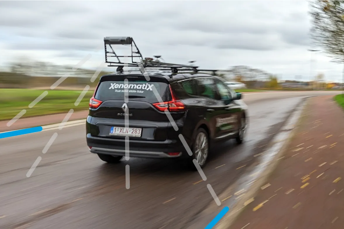
Two lanes better than one: the XenoTrack Dual Lane system is set up in no time and the measurement vehicle can drive faster than 70kph

The latest version of XenomatiX’s road lidar XenoTrack inspection system covers two lanes in one pass.

XenoTrack Dual Lane was officially launched this month at GeoWeek, a major event for the geospatial and 3D sector that took place in the US city of Denver.
 
XenomatiX, a solid state lidar company specialising in road asset management and digital twins of roads, launched the XenoTrack Single Lane system last year. Now, the company says that with the Dual Lane system, it “took a step-in easing 3D pavement measurement”.

Traditional road assessment systems are limited to measuring the width of one or part of a road lane on each pass. But XenoTrack Dual Lane surveys two neighbouring lanes in a single pass. While the vehicle drives in one lane, the system simultaneously measures the road surface condition of that lane and the neighbouring lane.

All XenoTrack products including the Dual Lane system, use a highly accurate lidar as main component, offering 3D and intensity maps of the road surface.

Additionally, 2D RGB camera images can complement the 6D Road Survey concept. The RGB colour model is an additive colour model in which the red, green and blue primary colours of light are combined to reproduce a broad array of colours. The name of the model comes from the initials of the three additive primary colours - red, green and blue.

Both the Single Lane and the Dual Lane systems fit on any standard vehicle, saving the customer having to invest in expensive and dedicated survey vehicles. The XenoTrack system is set up in no time and the measurement vehicle can drive faster than 70kph, further increasing the efficiency of the surveys.

XenomatiX’s solid state lidars are based on a multi-beam lasers concept and mature, scalable semiconductor technology. The company’s main product lines consist of XenoTrack and XenoLidar. XenoTrack collects and processes a wide range of data to enable applications like digitising the road, IRI (International Roughness Index), rutting analysis and more.

The company is based in Leuven, Belgium, and employs about 50 employees in Belgium, Germany, US and China with a distribution network around the world.

For more information on companies in this article

Related Content

  • Made to Measure laser mapping
    June 15, 2012
    Dutch surveying company Geomaat says it is taking millimetre accurate measurements in record time to aid a range of highway design, construction and maintenance projects. Using the mobile laser mapping system StreetMapper, and specially developed point cloud software, Geomaat says it can calculate highly accurate cutting, milling and asphalt figures, create as built models and undertake change detection.
  • Made to Measure laser mapping
    June 26, 2012
    Dutch surveying company Geomaat says it is taking millimetre accurate measurements in record time to aid a range of highway design, construction and maintenance projects. Using the mobile laser mapping system StreetMapper, and specially developed point cloud software, Geomaat says it can calculate highly accurate cutting, milling and asphalt figures, create as built models and undertake change detection.
  • Bentley Systems launches OpenRoads Designer CONNECT Edition
    April 13, 2017
    The beginning of this year saw Bentley Systems launch a major advanced comprehensive global tool for today’s increasingly widespread BIM environment. Christmas 2016 came early for Bentley's global clients. In fact, they had a hint of what was going to be under their tree come the celebrations in December. On November 1, at Bentley’s annual global client gathering and awards event Year in Infrastructure Conference in London, the solutions provider announced that OpenRoads Designer CONNECT Edition would be a
  • Technology helps earth moving and paving
    August 18, 2014
    Located in Meeker, Colorado and serving the area for air transportation is Meeker Airport, a C-II general aviation airport. The FAA designation of C-II means the airport can accommodate aircraft with wingspan of less than 24m. Runway 3-21 at the Rio Blanco county-owned Meeker Airport had reached a point of wear and deterioration that required full reconstruction and upgrades to remain compliant with the FAA’s C-II requirements.