XenomatiX launches XenoTrack Dual Lane

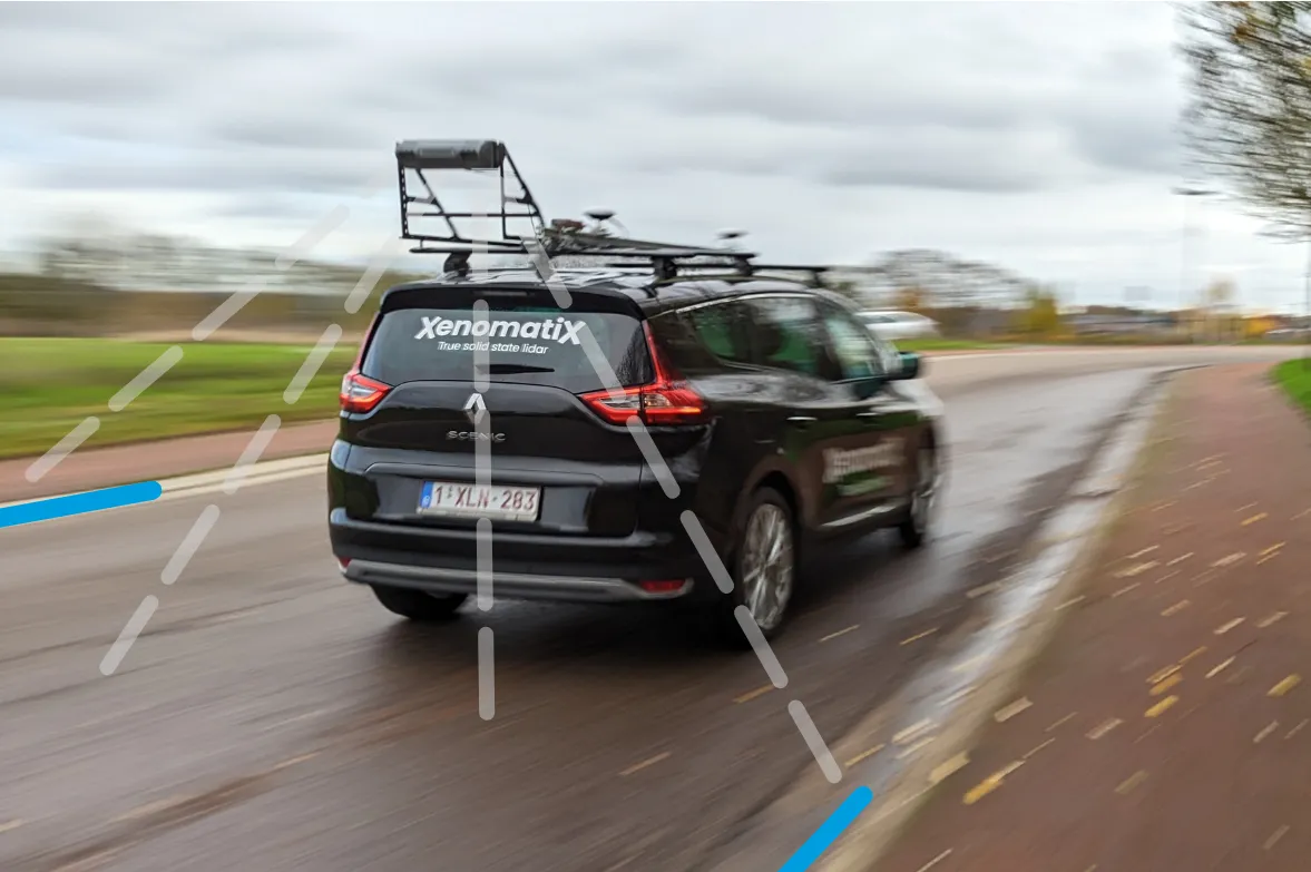
XenoTrack Dual Lane surveys two neighbouring lanes in a single pass while the survey vehicle drives in one lane.
By David Arminas March 6, 2023 Read time: 2 mins
Two lanes better than one: the XenoTrack Dual Lane system is set up in no time and the measurement vehicle can drive faster than 70kph

The latest version of XenomatiX’s road lidar XenoTrack inspection system covers two lanes in one pass.

XenoTrack Dual Lane was officially launched this month at GeoWeek, a major event for the geospatial and 3D sector that took place in the US city of Denver.
 
XenomatiX, a solid state lidar company specialising in road asset management and digital twins of roads, launched the XenoTrack Single Lane system last year. Now, the company says that with the Dual Lane system, it “took a step-in easing 3D pavement measurement”.

Traditional road assessment systems are limited to measuring the width of one or part of a road lane on each pass. But XenoTrack Dual Lane surveys two neighbouring lanes in a single pass. While the vehicle drives in one lane, the system simultaneously measures the road surface condition of that lane and the neighbouring lane.

All XenoTrack products including the Dual Lane system, use a highly accurate lidar as main component, offering 3D and intensity maps of the road surface.

Additionally, 2D RGB camera images can complement the 6D Road Survey concept. The RGB colour model is an additive colour model in which the red, green and blue primary colours of light are combined to reproduce a broad array of colours. The name of the model comes from the initials of the three additive primary colours - red, green and blue.

Both the Single Lane and the Dual Lane systems fit on any standard vehicle, saving the customer having to invest in expensive and dedicated survey vehicles. The XenoTrack system is set up in no time and the measurement vehicle can drive faster than 70kph, further increasing the efficiency of the surveys.

XenomatiX’s solid state lidars are based on a multi-beam lasers concept and mature, scalable semiconductor technology. The company’s main product lines consist of XenoTrack and XenoLidar. XenoTrack collects and processes a wide range of data to enable applications like digitising the road, IRI (International Roughness Index), rutting analysis and more.

The company is based in Leuven, Belgium, and employs about 50 employees in Belgium, Germany, US and China with a distribution network around the world.

For more information on companies in this article

Related Content

  • New equipment for materials testing
    January 13, 2014
    Leading formwork manufacturers have secured some impressive contracts in Africa, as the continent’s transport infrastructure continues to improve at a rapid pace. Meanwhile, other bridgework equipment companies are also seeing their products in demand in Africa, as well as North America and Australia. Guy Woodford reports
  • Weighty matters for developing countries
    November 6, 2012
    One leading Weigh in Motion technology manufacturer is helping governments in developing countries reduce excessive road damage, while several others have seen their latest WIM systems recently used on the highways of Eastern Europe. Guy Woodford reports Recent Central Weighing WIM installations in Bangladesh are helping its national government reduce the financial burden of excessive road damage, while also protecting many bridges that are vital to transport and trade. The need for such installations was e
  • Accurate weigh-in-motion technology
    June 21, 2016
    Weigh-in-motion technology is ensuring increasingly accurate, and flexible, weighing stations. Weigh-in-motion specialist manufacturer Axtec says that its space-saving dynamic weighbridge is accurate to within ±0.5% and is the most precise system in the world. From its Runcorn, UK manufacturing facility, Axtec undertakes research and development of new technologies, as well as software testing, fabrication, construction and installation of WIM products. Axtec’s axle weighing platform design is intended f
  • Wider range of survey software functionality
    February 9, 2012
    Leica Geosystems is offering a broad spread of new packages and hardware that will deliver improved performance to users. The firmware 2.0 product is said to add powerful new capabilities to the Leica ScanStation C10, the industry's most popular 3D laser scanner for as-built and topographic surveys. This further increases the productivity and versatility of the fully integrated, cable-less ScanStation C10. A new Setup facility lets users take advantage of known survey points and backsighting, while remote,