XenomatiX launches XenoTrack Dual Lane

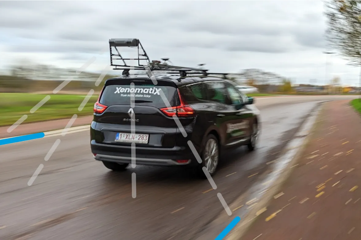
XenoTrack Dual Lane surveys two neighbouring lanes in a single pass while the survey vehicle drives in one lane.
By David Arminas March 6, 2023 Read time: 2 mins
Two lanes better than one: the XenoTrack Dual Lane system is set up in no time and the measurement vehicle can drive faster than 70kph

The latest version of XenomatiX’s road lidar XenoTrack inspection system covers two lanes in one pass.

XenoTrack Dual Lane was officially launched this month at GeoWeek, a major event for the geospatial and 3D sector that took place in the US city of Denver.
 
XenomatiX, a solid state lidar company specialising in road asset management and digital twins of roads, launched the XenoTrack Single Lane system last year. Now, the company says that with the Dual Lane system, it “took a step-in easing 3D pavement measurement”.

Traditional road assessment systems are limited to measuring the width of one or part of a road lane on each pass. But XenoTrack Dual Lane surveys two neighbouring lanes in a single pass. While the vehicle drives in one lane, the system simultaneously measures the road surface condition of that lane and the neighbouring lane.

All XenoTrack products including the Dual Lane system, use a highly accurate lidar as main component, offering 3D and intensity maps of the road surface.

Additionally, 2D RGB camera images can complement the 6D Road Survey concept. The RGB colour model is an additive colour model in which the red, green and blue primary colours of light are combined to reproduce a broad array of colours. The name of the model comes from the initials of the three additive primary colours - red, green and blue.

Both the Single Lane and the Dual Lane systems fit on any standard vehicle, saving the customer having to invest in expensive and dedicated survey vehicles. The XenoTrack system is set up in no time and the measurement vehicle can drive faster than 70kph, further increasing the efficiency of the surveys.

XenomatiX’s solid state lidars are based on a multi-beam lasers concept and mature, scalable semiconductor technology. The company’s main product lines consist of XenoTrack and XenoLidar. XenoTrack collects and processes a wide range of data to enable applications like digitising the road, IRI (International Roughness Index), rutting analysis and more.

The company is based in Leuven, Belgium, and employs about 50 employees in Belgium, Germany, US and China with a distribution network around the world.

For more information on companies in this article

Related Content

  • Latest GIS and software tools improve operations
    February 24, 2012
    Innovative GIS and software solutions are coming to market from the three key market players - Mike Woof reports Competition is strong in the field for GIS and surveying systems as well as the associated software. The three major players in the sector, Leica Geosystems, Topcon and Trimble, all invest heavily in research and development and continue to roll out new solutions for construction customers that will boost the efficiency of surveying as well as overall project implementation.
  • New methods for non-destructive concrete testing
    August 29, 2017
    How best is it possible to assess the state of concrete in a road pavement, bridge deck or tunnel wall? One of the most reliable ways is to take a core of concrete from the structure to analyse and test in the laboratory. One downside to this method is that doing the test creates weak points in the structure that must then be repaired. Another is that the frequency of such cores cannot be too great – so it is possible that some problem areas will be missed. New technologies from the world of geospatial eng
  • Stone Arch Bridge Rehabilitation
    May 19, 2022


    Rehabilitating an Historic Landmark

  • Milling efficiently with machine control
    July 11, 2018
    A contractor in the Netherlands has found that using Topcon’s latest machine control technology can deliver higher quality work at higher productivity The firm, Van Gelder, was looking for a solution to survey, mill and resurface a 7km length of the N518 to the island of Marken more quickly, more safely and more accurately. Together with Infra-Techniek, the company opted to use the latest package developed by Topcon for automatic milling. The N518 from Monnickendam is the only connecting road to the form