XenomatiX boosts its road scanning solution

An additional 14 types of road distress can be measured, including cracks, bleeding and raveling.
By David Arminas September 29, 2023 Read time: 2 mins
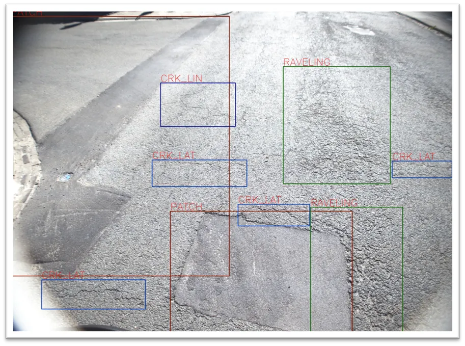
Seeing is believing: with one lidar system and camera installed on any vehicle, XenomatiX measures and collects data on the condition of the pavement (image courtesy of XenomatiX)

XenomatiX has added to its road scanning solution the capability to detect, with 95% accuracy, up to 14 types of road cracks. The company says this makes its road scanning services a full comprehensive solution for road inspection.

With one lidar system and camera installed on any vehicle, XenomatiX already measures and collects, in one go, data on the condition of the pavement. This includes evenness indexes such as IRI and rutting, road markings and potholes.

Now, an additional 14 types of road distress can be measured, including different types of cracks, bleeding and raveling. This facilitates an efficient road monitoring process allowing road owners to increase their productivity, by saving time in the field and in budget.

The company has developed two key solid-state lidar products to enhance safer roads, the XenoTrack, road lidar for cost-effective road management and XenoLidar for enabling autonomous vehicle. In the future of autonomous cars, XenomatiX inspires to achieve a fully digitised road system where every vehicle in the road is continuously collecting road condition data and feeding this back to city councils who can address the infrastructure needs and challenges for safer roads.

XenomatiX, based in the Belgian city of Leuven, designs solid state lidars based on a multi-beam laser concept and scalable semiconductor technology with different product lines to serve different industries and applications. The company’s products have been recognised by international competition programmes such as the IRF GRAA award and the CES Innovation Award.

XenomatiX employs around 50 people in Belgium, Germany, US and China and has a global distribution network. 

For more information on companies in this article

Related Content

  • Laser mapping speeds up survey measurement
    February 21, 2012
    British scanning company 3D Laser Mapping is hoping to benefit from a £3 million ($5 million) fund announced recently by the UK government for police forces to purchase laser scanning technology for accident recording and investigation.
  • Get the real picture with Image Logger
    July 31, 2020
    RoadBotics has placed time-stamped geo-spatial images on GIS-enabled maps.
  • Topcon announces increased integration with Autodesk scanning software
    June 2, 2016
    Topcon Positioning Group has announced increased integration in the Autodesk and Topcon reality data workflow that it says is designed to increase project efficiency. Raw scan data from the Topcon GLS-2000 laser scanner can now be taken directly into Autodesk ReCap 360 and ReCap 360 Pro with no intermediate software conversion steps necessary. Topcon said that this integration is designed to streamline point cloud analysis to quickly identify conflicts, measure variations and make adjustments at vari
  • Seal of approval
    August 2, 2012
    Timely maintenance using proven cost-effective methods can extend the life of a highway by many years as Patrick smith reports Highways are expensive assets to construct, and the wear and tear of modern traffic means that regular maintenance will delay costly repairs or in extreme cases reconstruction. There are a number of methods of carrying out such maintenance, and these include the use of slurry seals and micro-surfacing, which are cold mixed asphalt which is a mixture of graded aggregate, asphalt emul