
XenomatiX boosts its road scanning solution

An additional 14 types of road distress can be measured, including cracks, bleeding and raveling.
By David Arminas September 29, 2023 Read time: 2 mins
Seeing is believing: with one lidar system and camera installed on any vehicle, XenomatiX measures and collects data on the condition of the pavement (image courtesy of XenomatiX)

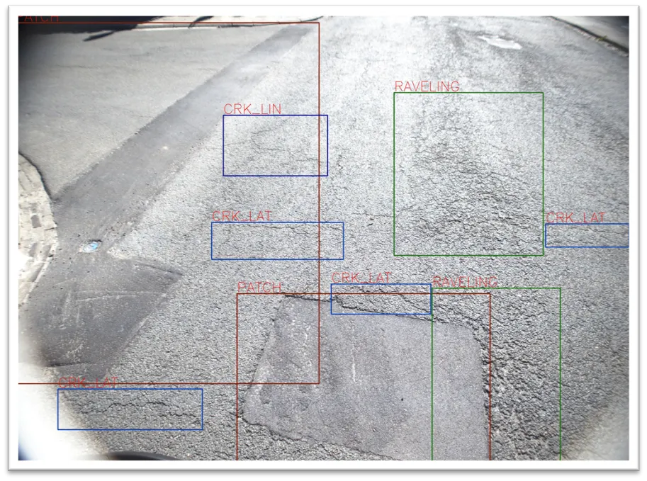
XenomatiX has added to its road scanning solution the capability to detect, with 95% accuracy, up to 14 types of road cracks. The company says this makes its road scanning services a full comprehensive solution for road inspection.

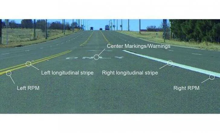
With one lidar system and camera installed on any vehicle, XenomatiX already measures and collects, in one go, data on the condition of the pavement. This includes evenness indexes such as IRI and rutting, road markings and potholes.

Now, an additional 14 types of road distress can be measured, including different types of cracks, bleeding and raveling. This facilitates an efficient road monitoring process allowing road owners to increase their productivity, by saving time in the field and in budget.

The company has developed two key solid-state lidar products to enhance safer roads, the XenoTrack, road lidar for cost-effective road management and XenoLidar for enabling autonomous vehicle. In the future of autonomous cars, XenomatiX inspires to achieve a fully digitised road system where every vehicle in the road is continuously collecting road condition data and feeding this back to city councils who can address the infrastructure needs and challenges for safer roads.

XenomatiX, based in the Belgian city of Leuven, designs solid state lidars based on a multi-beam laser concept and scalable semiconductor technology with different product lines to serve different industries and applications. The company’s products have been recognised by international competition programmes such as the IRF GRAA award and the CES Innovation Award.

XenomatiX employs around 50 people in Belgium, Germany, US and China and has a global distribution network. 

For more information on companies in this article

Related Content

  • Latest GIS and software tools improve operations
    February 24, 2012
    Innovative GIS and software solutions are coming to market from the three key market players - Mike Woof reports Competition is strong in the field for GIS and surveying systems as well as the associated software. The three major players in the sector, Leica Geosystems, Topcon and Trimble, all invest heavily in research and development and continue to roll out new solutions for construction customers that will boost the efficiency of surveying as well as overall project implementation.
  • RetroTek: standards are key
    December 12, 2022
    Accurate retroreflectivity measurements of line markings across the full lane width has become even more important after the US adoption of minimum levels of retroreflectivity.
  • IRF’s Marrakech regional event focuses on North Africa
    April 12, 2013
    A series of dynamic meetings in Marrakech signal the forward direction of IRF Geneva as it gears up for a bright new era as a global voice of the road sector. As these pages go to press, IRF Geneva is just emerging from a very rewarding regional conference focusing on North Africa and the Mediterranean that took place from 19-20 March, 2013. The success of this high-level gathering, organised in association with the Moroccan Road Association and Moroccan Motorways (Autoroutes du Maroc), reflects IRF Geneva’
  • Innovative testing boosts pavement quality
    February 16, 2012
    Innovative materials testing technology will allow the road sector to boost pavement quality, Mike Woof and Patrick Smith report. With billions being spent on highway construction worldwide, governments are looking to make sure their investments last as long as possible.