XenomatiX boosts its road scanning solution

An additional 14 types of road distress can be measured, including cracks, bleeding and raveling.
By David Arminas September 29, 2023 Read time: 2 mins
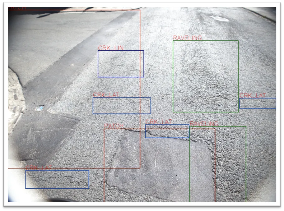
Seeing is believing: with one lidar system and camera installed on any vehicle, XenomatiX measures and collects data on the condition of the pavement (image courtesy of XenomatiX)

XenomatiX has added to its road scanning solution the capability to detect, with 95% accuracy, up to 14 types of road cracks. The company says this makes its road scanning services a full comprehensive solution for road inspection.

With one lidar system and camera installed on any vehicle, XenomatiX already measures and collects, in one go, data on the condition of the pavement. This includes evenness indexes such as IRI and rutting, road markings and potholes.

Now, an additional 14 types of road distress can be measured, including different types of cracks, bleeding and raveling. This facilitates an efficient road monitoring process allowing road owners to increase their productivity, by saving time in the field and in budget.

The company has developed two key solid-state lidar products to enhance safer roads, the XenoTrack, road lidar for cost-effective road management and XenoLidar for enabling autonomous vehicle. In the future of autonomous cars, XenomatiX inspires to achieve a fully digitised road system where every vehicle in the road is continuously collecting road condition data and feeding this back to city councils who can address the infrastructure needs and challenges for safer roads.

XenomatiX, based in the Belgian city of Leuven, designs solid state lidars based on a multi-beam laser concept and scalable semiconductor technology with different product lines to serve different industries and applications. The company’s products have been recognised by international competition programmes such as the IRF GRAA award and the CES Innovation Award.

XenomatiX employs around 50 people in Belgium, Germany, US and China and has a global distribution network. 

For more information on companies in this article

Related Content

  • Remote surveying and scanning
    January 18, 2022
    Remote surveying and scanning can be achieved using the autonomous robotic system available from Trimble. The package combines the Spot robot autonomous rover unit with the Trimble X7 3D laser scanner and Trimble FieldLink software.
  • Milano Serravalle and Iris agree monitoring deal
    June 21, 2024
    From the roads in southern Ontario, Canada, to the motorways around Milan in northern Italy, the relationship blossoms between Iris and Milano Serravalle for highway asset management.
  • Bentley boosts its OpenRoads CONNECT construction software
    November 1, 2016
    Construction software solutions provider Bentley Systems announced that its OpenRoads Designer CONNECT Edition will be available from December. OpenRoads CONNECT Edition is the successor to Bentley’s civil engineering brands InRoads, GEOPAK, MX, and PowerCivil. OpenRoads Designer is a multi-discipline 3D modeling application for roadway projects from conceptual design through construction stages. Bentley Systems said that it “blends traditional engineering workflows for plan, profile and cross-section
  • Intelligent paving and compaction holds the key
    October 16, 2024
    Intelligent paving and compaction holds the key to more efficient road construction according to BOMAG – Mike Woof writes