A novel system is now available that allows a smartphone to be used to measure road defects. Developed by Grimmer Software, the RoadBump Android application can be used to measure the roughness of a road.
This tool can provide estimates of International Roughness Index (IRI) in metric or standard units, without requiring high-cost laser profilers.
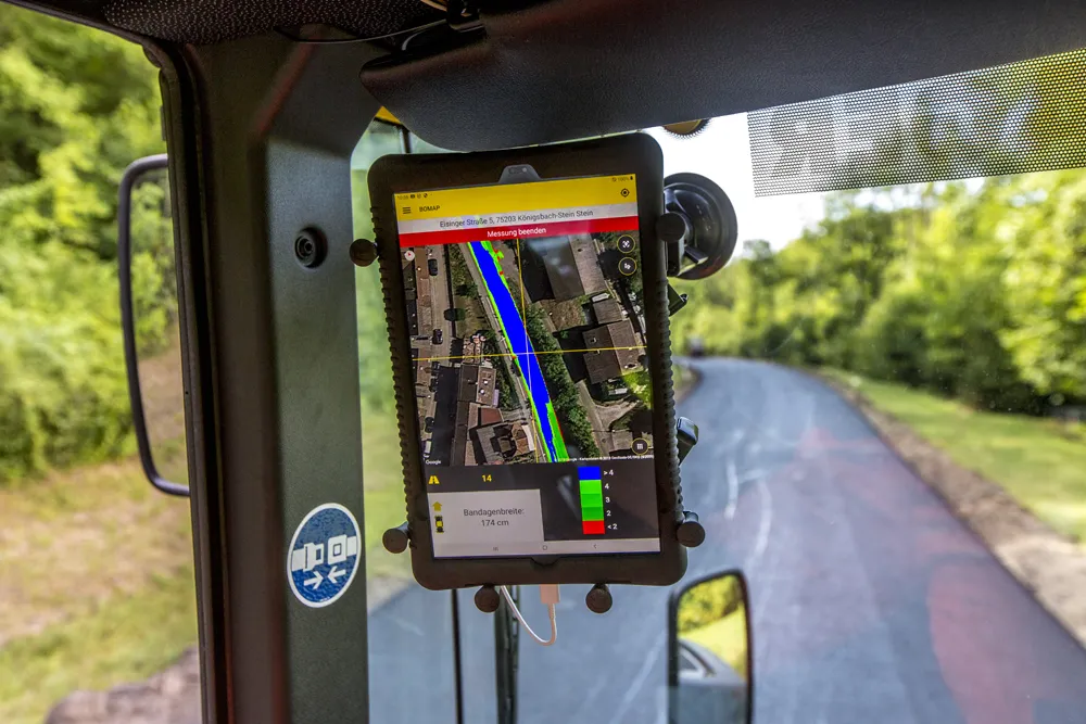
RoadBump uses an Android device's GPS and accelerometer to measure the roughness of a road. It displays a map of the road that was measured, and allows you to zoom in to measure any part of the travelled path. RoadBump produces estimated IRI and Present Serviceability Rating (PSR) graphs. An accelerometer graph shows individual bumps, dips and waves.
The firm said that this tool is easy to use. Activating the unit and driving along the road at normal speed is sufficient to gather road data. A network connection is not required. The unit can be used when travelling at speeds from 32 to 100km/h and is said to have been extensively tested to ensure its accuracy.
This tool can provide estimates of International Roughness Index (IRI) in metric or standard units, without requiring high-cost laser profilers.
RoadBump uses an Android device's GPS and accelerometer to measure the roughness of a road. It displays a map of the road that was measured, and allows you to zoom in to measure any part of the travelled path. RoadBump produces estimated IRI and Present Serviceability Rating (PSR) graphs. An accelerometer graph shows individual bumps, dips and waves.
The firm said that this tool is easy to use. Activating the unit and driving along the road at normal speed is sufficient to gather road data. A network connection is not required. The unit can be used when travelling at speeds from 32 to 100km/h and is said to have been extensively tested to ensure its accuracy.