Get the real picture with Image Logger

RoadBotics has placed time-stamped geo-spatial images on GIS-enabled maps.
By David Arminas July 31, 2020 Read time: 2 mins
Image Logger, the first product in the company’s cloud-based RoadWay Operating System online platform

RoadBotics is announcing the addition of Image Logger to its growing suite of products to help communities digitise assets such as roads, sidewalks and trails.

The company, based in Pittsburgh in the US state of Pennsylvania, said the technology places time-stamped geo-spatial image data on a GIS-enabled map. The result allows local authorities to view all public assets on one platform - from a desk or out in the field.

“The Image Logger is a great addition to our existing products and tools for road and infrastructure management,” said Matt Lucas, head of product at Roadbotics. “It helps our clients to better administer their assets while saving valuable resources.”

RoadBotics - known for automated pavement assessments using a smartphone for data collection –users can collect data on roads and adjacent assets such as signage and public right of ways including sidewalks, bike trails and walking paths. Whether collected monthly, seasonally or before and after maintenance projects, up-to-date data is invaluable for asset management.

The Image Logger  was released in early June as the first product for the company’s new RoadWay Operating System, a cloud-based online platform. RoadWay OS helps governments manage and administer their public infrastructure asset data in one central location. “Image Logger accomplishes that objective by the ease of use and breadth of data available,” said Benjamin Schmidt, president and co-founder of RoadBotics.

Roadway OS is also available to outside consultants and professionals who help governments maintain infrastructure, whether this is managing tactical day-to-day operations or enhancing strategic planning.

Related Content

  • CONEXPO-CON/AGG 2017 will help you imagine what’s next
    March 15, 2017
    What sort of key trends will be on show, and how will these new technologies shape the sector over the coming years? Alan Dron interviewed Al Cervero, the AEM senior vice-president for construction, utility and mining on how the show will reveal what is coming. The theme for this year’s event is “Imagine what’s next”, a particularly appropriate title in view of the changes in both technology and the environment in which that technology will be used.
  • US pedestrian deaths fall but remain high
    June 27, 2024
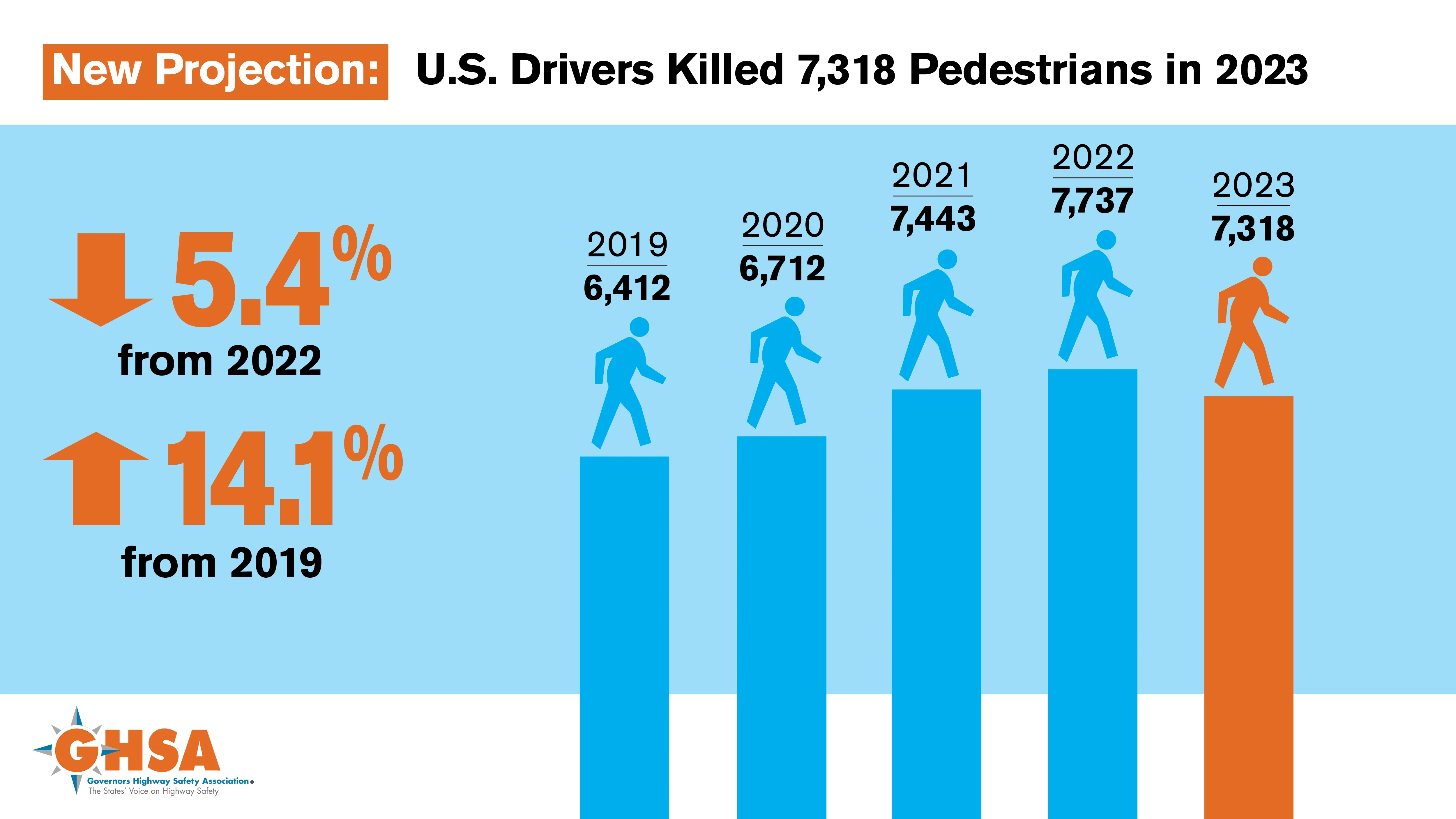
    According to analysis from the Governors Highway Safety Association - GHSA – annual US pedestrian traffic deaths fell for first time since the pandemic, but are still above the pre-pandemic level.
  • Key deals show strength of Tolling solutions sector
    September 26, 2013
    The world’s leading tolling solution providers have achieved significant deals in recent months emphasising the importance of their latest and proven technology. Guy Woodford reports Kapsch TrafficCom North America (Kapsch), part of Kapsch TrafficCom Group, has been awarded a five-year US$30 million contract by Canadian Tolling Company International (Cantoll). The contract will see the leading tolling technology manufacturer supply its next generation TDMA V6 Interior Transponder, also known as an onboar
  • The GRSF: breaking down barriers
    December 17, 2020
    Improving road safety can be expensive, especially for low- to middle-income countries. The Global Road Safety Facility has been working hard to alleviate the situation