
Hitachi’s new road scanning technology

Using advanced vehicle to vehicle communications, this data could be shared between cars and trucks using the same stretch of road. Multiple alerts over road surface issues could also be used to highlight the need for debris removal or road repairs to road authorities.
January 11, 2019 Read time: 2 mins

233 Hitachi Automotive Systems (Hitachi) has developed a new technology package that allows the detection of road surface problems, including holes and small debris. The system works while a vehicle is being driven and uses the firm’s in-vehicle stereo camera technology. This allows for accurate detection of small road surface issues.

The firm intends to link the package to vehicle suspension systems. This would allow vehicles to respond quickly to any surface irregularities, immediately prior to passing over them. The firm is working on a new development that would tune the vehicle’s stability in accordance to the condition of the road surface.

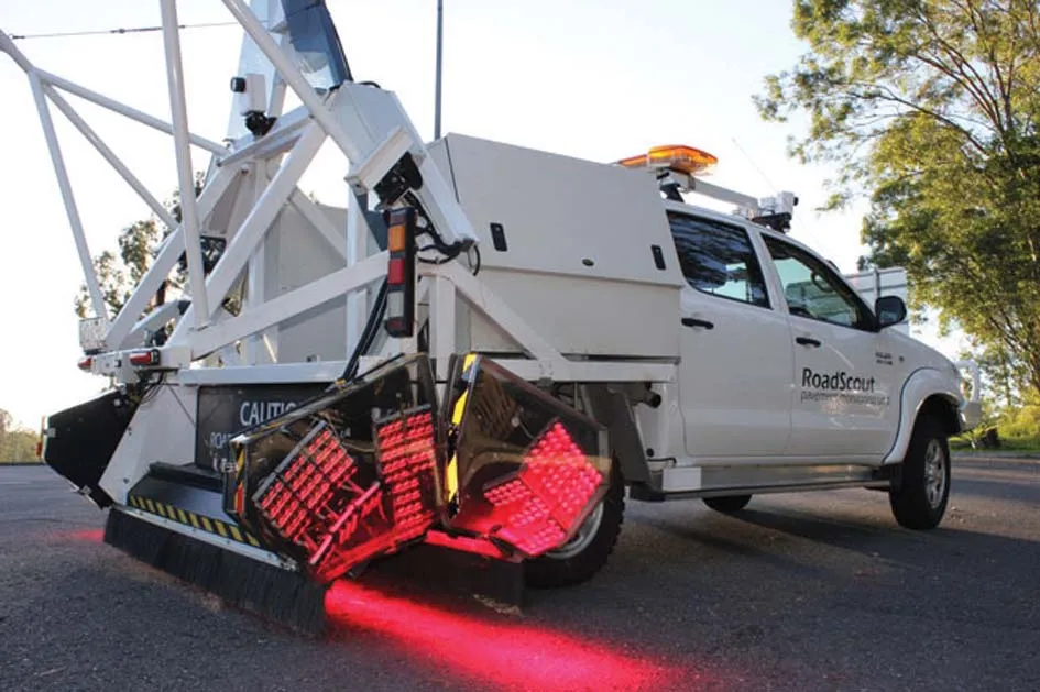
The firm says that its stereo cameras are also able to detect pedestrians as well as other objects and can determine distances accurately. The system is able to detect surface irregularities quickly accurately according to the firm and has been designed to ignore false readings caused by dirt or shadows in the roadway. The high performance readings made by the stereo cameras have been key to identifying shadows or dirt, aided by a sophisticated algorithm that can analyse the image information extremely rapidly, according to Hitachi.

Using advanced vehicle to vehicle communications, this data could be shared between cars and trucks using the same stretch of road. Multiple alerts over road surface issues could also be used to highlight the need for debris removal or road repairs to road authorities.

For more information on companies in this article

Related Content

  • Using radar to deliver a fine runway finish
    April 4, 2014
    Radar Portal Systems (RPS) has spent a lot of time developing its sophisticated pavement top-surface photometric imaging system so it can cater specifically for the aviation market. This has now been specially developed for use on aircraft runways and taxiways The system was recently used at Brisbane Airport to survey runway and runway shoulders, collecting photometric top-surface data at a 4m width at speeds of up to 100km/h. This dataset allows the firm to display meshing data of the runway surface showin
  • Efficient asset management to trim maintenance budgets
    January 22, 2014
    Transport infrastructure is taken for granted in many, if not most, developed countries. This has resulted in a shortage of investment in maintenance, posing potential long term cost issues. In many developing nations transport networks are expanding fast, but insufficient thought is also being given to how these will be maintained.
  • Accurate road scanning with WDM
    January 24, 2022
    UK firm WDM has developed an innovative road assessment vehicle (RAV), capable of carrying out accurate surveys quickly. The RAV is equipped with an array of sensors that allow it to measure the various parameters needed to meet the UK SCANNER specification.
  • New ice detection technology for motorists
    January 23, 2013
    A new technology developed by the VTT Technical Research Centre of Finland provides drivers with warnings of black ice on the roads. This automatic detection system will warn a driver in advance that a road is dangerous due to the presence of ice. According to VTT, this uses a novel, real-time method of obtaining information on road surface friction and employs data collected from the car’s in-built sensors. This compares the speeds of the drive shafts and axles in an array of driving conditions, with an al