Visualise today's concept of a major commercial traffic corridor in the western United States. A roadway responsible for delivering goods to Arizona, Nevada and Utah, that also connects Mexico to the United States to Canada through the North American Free Trade Agreement (NAFTA). What springs to mind? A multi-lane highway carrying thousands of vehicles a day past cities at speeds up to 113km/hour, while egress ramps make sure vehicles get safely to city streets and their final destination. This is not the c
July 18, 2012
Read time: 6 mins

Visualise today's concept of a major commercial traffic corridor in the western United States. A roadway responsible for delivering goods to Arizona, Nevada and Utah, that also connects Mexico to the United States to Canada through the North American Free Trade Agreement (NAFTA).
What springs to mind? A multi-lane highway carrying thousands of vehicles a day past cities at speeds up to 113km/hour, while egress ramps make sure vehicles get safely to city streets and their final destination.This is not the case with a vital stretch of U.S. Highway 93 connecting Arizona to Nevada.
It is a major commercial corridor with very little modern-day design, making it an adventure for the 14,000 vehicles/day travelling the narrow lane two-lane highway atop the Hoover Dam packed with thousands of sightseers. It is also potentially dangerous.
For many of these reasons, U.S. 93 was considered a high priority corridor for modernising by the National Highway System Designation Act of 1995. Funding for the $240 million bypass reflects the joint federal-state coalition and commitment to the project and includes: $100 million in federal funds from various programs; $20 million each from the States of Arizona and Nevada; and $100 million in bonded funds.
The attacks on the Twin Towers of 11 September, 2001, served to fast-track the need for a bypass, as commercial trucks were no longer permitted to use U.S. 93 to cross the dam.
"Only those trucks authorised through a local permit programme for local business are allowed to cross," explains Dave Zanetell, Project Manager for the
The current alternate route to cross from Nevada to Arizona for commercial truck traffic is through Laughlin, Nevada, which adds 27km to the trip.
Bypass underway
Following extensive environmental impact studies, careful consideration of the best location for the bypass, and significant public feed-back during the late 1990s and early 2000s, design for the Hoover Dam Bypass project began in 2001.
The
The PMT chose Sugar Loaf Mountain for the bypass alignment, determining this route had the least environmental impact and was the most economically feasible of the three alternatives considered.
The 5.6km bypass corridor for U.S. 93 starts in Clark County, Nevada, and ends in Mohave County, Arizona.
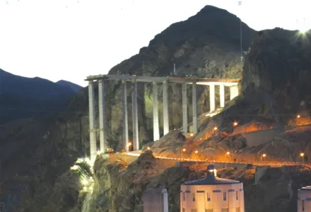
A focal point of the project, the bypass bridge crosses the Colorado River at Black Canyon some 488m south of the Hoover Dam. Matching the magnificence of the dam, a composite bridge design with a steel superstructure and concrete arches was selected by the PMT.
The chosen design enables on-site work to progress concurrently with precasting and steel fabrication activities, while offering the greatest flexibility to design and construct the most cost-effective elements for bridge components.
Construction of the 579m Colorado River Bridge began in early 2005 by a joint venture between
"On a project of this magnitude, a joint venture works best for bonding and to share the risk," says Terry Pawlowski, Project Engineer for Obayashi/PSM JV.
The best from all of the JV's employees is what will be required to construct the bridge. Just the sheer height above the river (approximately 274m) poses its own set of issues.
"Access to the work and getting equipment to the site are big challenges," says Pawlowski.
Excavation and blasting the steep Sugar Loaf slopes for pier footings was difficult, since the contractor had to ensure that excess material did not fall into the Colorado River.
Once on site, equipment and supplies must get to the workers on the bridge deck, piers and arches. To address this Obayashi/PSM constructed a high line that spans the canyon. This critical tool allows equipment and material to be delivered over the canyon to where it is needed.
Ambient conditions also play a factor in constructing the Colorado River Bridge. The weather can bring extreme temperature swings, rain and sometimes snow during the winter months, while the summer months can feature long stretches of temperatures well over 37°C.
When is comes to paving the bridge deck, Obayashi/PSM pays close attention to the wind speed, as the contractor does not want the surface to dry too quickly.
"We target paving when the wind is blowing 16km/hour or less," says Pawlowski. The company will not pave if the wind tops speeds of 24km/hour and has learned the best times to pave. "The wind regularly dies down at night, so we are paving during the night-time hours."
Built for the future
With the inherent risks associated with constructing the bypass, the PMT is having the contractors build the approaches and bridge to easily handle the current 14,000 vehicles/day load as well as future traffic demand. The bridge, which will feature a pedestrian walkway and shoulders, will have a total deck width of 26.8m.
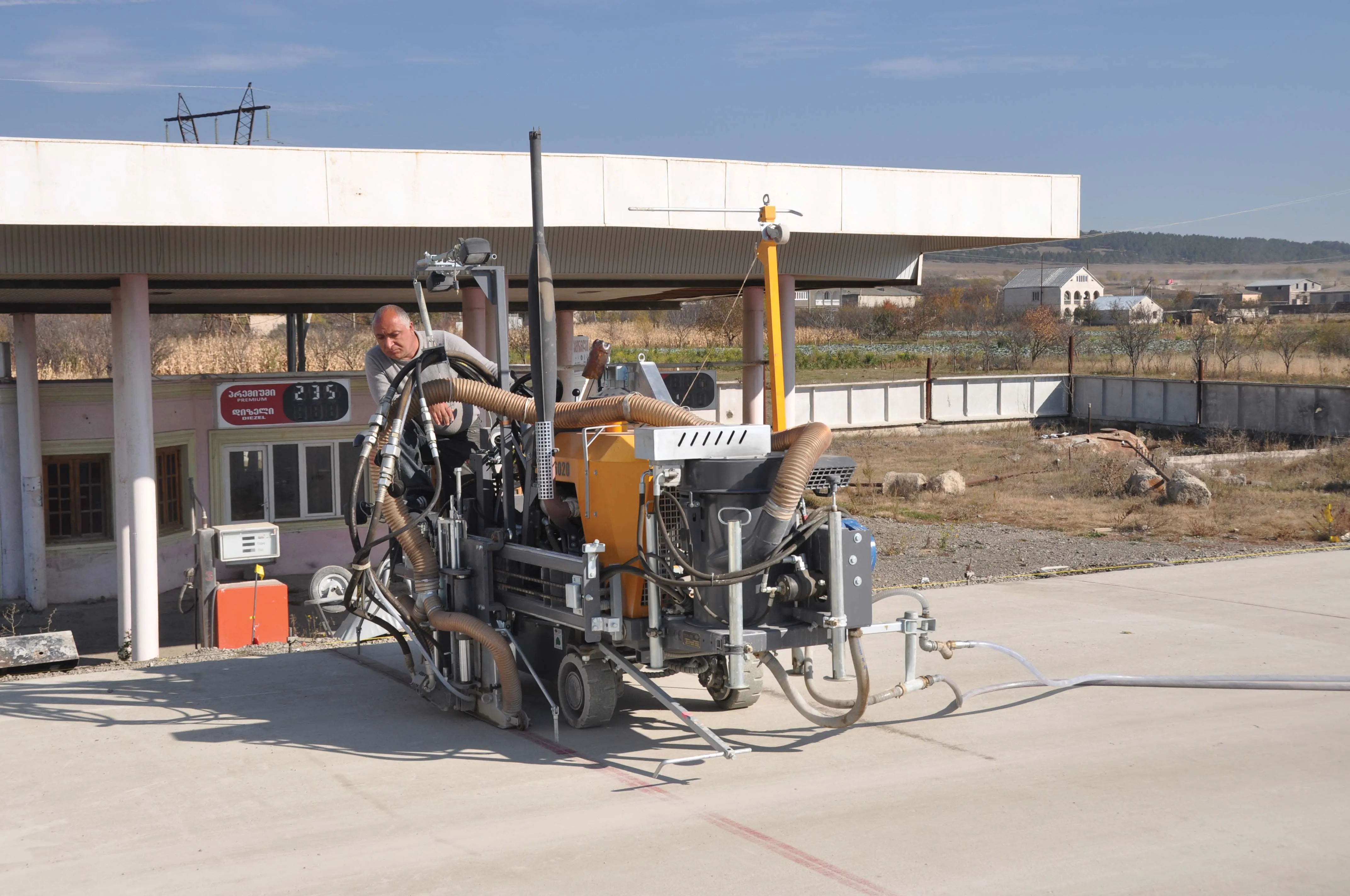
With the challenging paving conditions, Obayashi/PSM is paving the deck full width, using a Bid-Well 4800 bridge paver. With a 121.9cm truss depth to prevent deflection across the span, the 4800 was equipped with two Rota-Vibe carriages, one each to pave the northbound and southbound lanes up to a centre barrier.
Being delivered by a concrete pump truck at a 10-15cm slump, the deck's 4500 PSI concrete includes a fibre mesh to help control surface cracking. Aiding in concrete curing, the 4800 paver's finishing pans were equipped with an optional fogging system to immediately initiate the moist cure.
Obayashi/PSM decided to pour the pedestrian walkway at the same time as the traffic lanes, so the paver was equipped with an optional sidewalk roller.
"The sidewalk roller allows us to pour the full deck width at one time, rather than going back to pour and hand screed the sidewalk after finishing the traffic lanes," explains Pawlowski Working high above the Colorado River, the contractor is also extremely concerned about worker safety. There is not a lot of room for workers finishing the sides of the deck. The overhang jacks support a walkway enclosed by steel railing and a handrail marked with safety tape. All workers also attend a safety meeting prior to working on the job site.
Beginning on 10 April year, Obayashi/PSM paved the deck over the first five piers on the Nevada side of the bridge and piers 14 and 15 on the Arizona side. A total of seven pours were made, totalling nearly 1,758m3 of the nearly 4,205m3 necessary to complete bridge deck paving.
With these pours complete, the contractor has now stopped deck paving and is focused on completing the bridge's arches. It will take approximately 14 months to complete the 323m spans of the twin concrete arches, which will be the longest in the Western Hemisphere.
Once the arch work is complete, the contractor's attention will once again focus on the bridge deck. Obayashi/PSM will have to carefully pour the final bridge sections.
"We have to load the arch symmetrically from the centre out," says Pawlowski.
Even with these extreme challenges, the JV is confident it will be up to the task to complete work by the 2010 deadline.


