
Sophisticated slipformer control from Wirtgen

Wirtgen is now offering a new version of its concrete slipformer control package. This new tool offers additional capabilities and improved performance over the earlier version. The company claims that its upgraded Wirtgen AutoPilot 2.0 package can deliver a higher paving accuracy along with lower costs. Newly-developed, this package is said to produce a wide array of offset and inset profiles, while also delivering these more economically and precisely than with the previous version. The 3D system can eit
August 10, 2018 Read time: 4 mins
The system allows users to slipform complex layouts easily, according to the firm
Wirtgen is now offering a new version of its concrete slipformer control package. This new tool offers additional capabilities and improved performance over the earlier version.


The company claims that its upgraded 2395 Wirtgen AutoPilot 2.0 package can deliver a higher paving accuracy along with lower costs. Newly-developed, this package is said to produce a wide array of offset and inset profiles, while also delivering these more economically and precisely than with the previous version. The 3D system can either use an existing data model or can be used to generate a new, digital data model at the site.

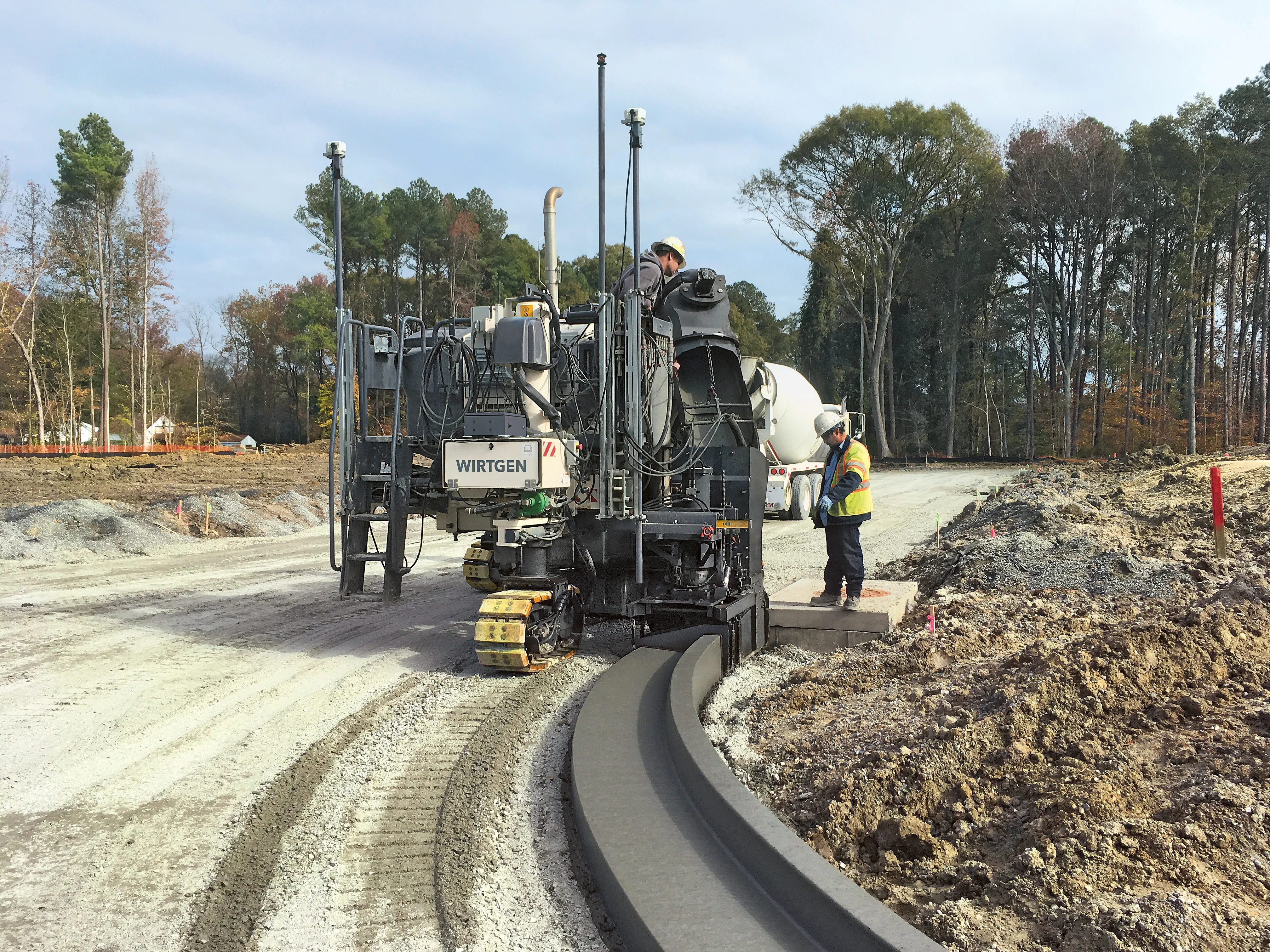
Wirtgen supplies the AutoPilot 2.0 for the models SP 15/SP 15i and SP 25/SP 25i, while the system can also be retrofitted to machines already in use by customers.

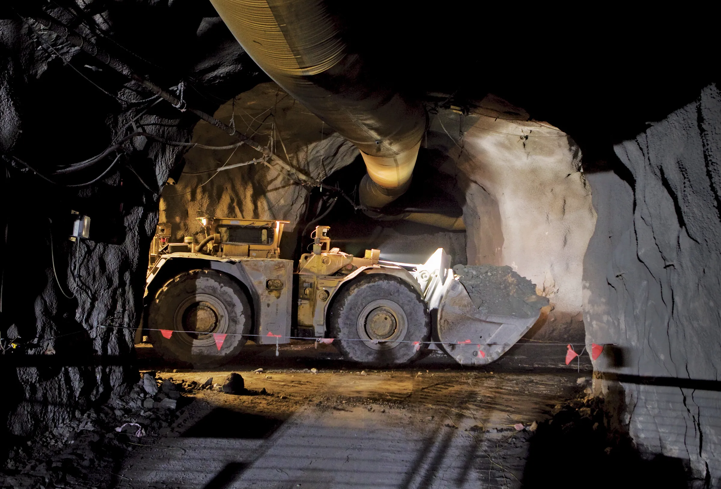
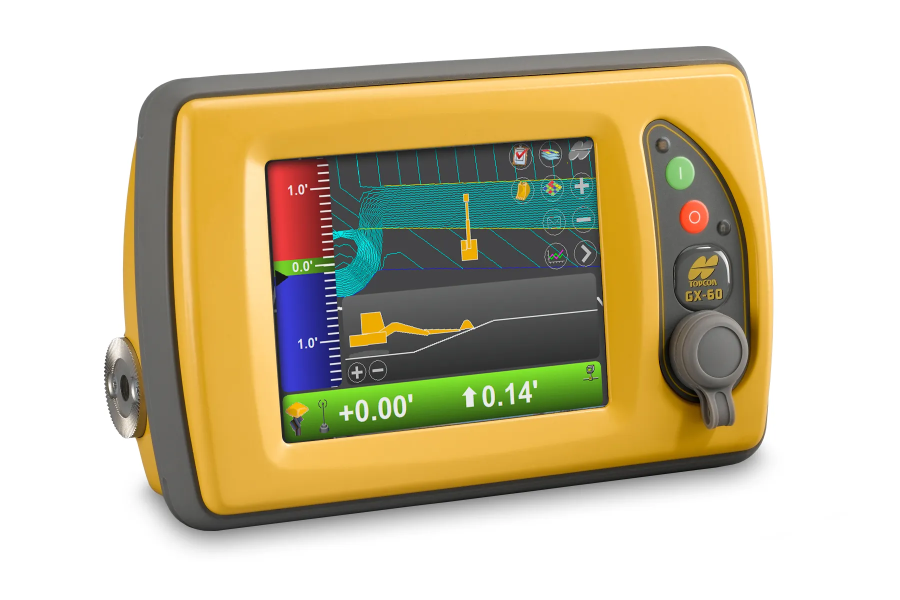
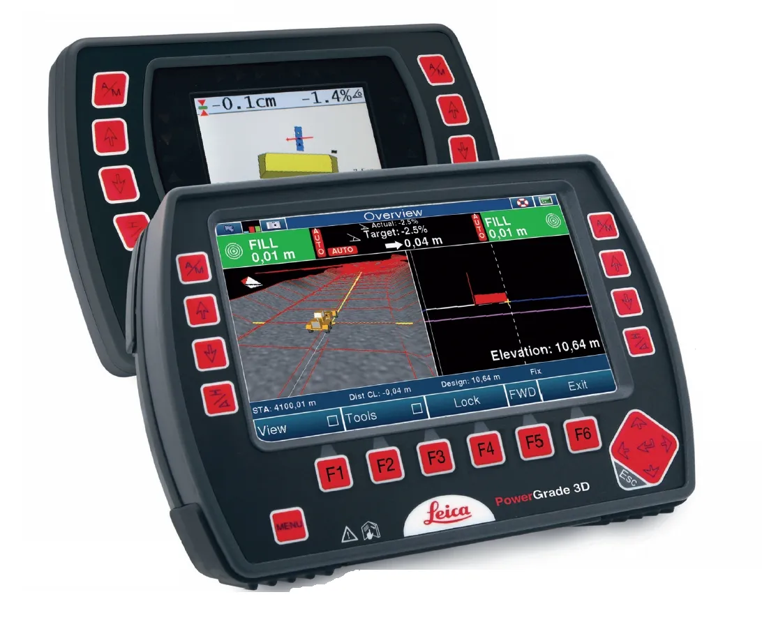
Typical applications for the AutoPilot 2.0 system are for making concrete safety barriers, kerbs, traffic islands or for road surfaces with a width of up to 3.5m. The 3D control package comprises a computer integrated into the machine and a tablet attached to the Field Rover survey pole. Two GPS receivers are mounted on the machine and these communicate with a GPS reference station at the job site. The satellite-based navigation system (GNSS) controls the steering and cross slope of the slipform paver fully automatically. All that is needed is the reception of a sufficient number of satellites and an operator trained to handle the system. A key benefit is with surveying time as there is no need to set up, dismantle or maintain string lines. In addition, paving crews no longer need to take care working around a string line, which can be easily damaged.

Removing the string lines also means that the concrete mixers have more space for manoeuvring, making it easier to supply the slipform paver with material. There is also no need to generate a geodetic data model in advance and overall, works can be carried out more quickly and efficiently according to the firm.

Users can use the system to generate a virtual string line themselves on the job site with the intuitive software on the tablet. The design of the system means that users have two different methods to choose from. One option is for the user to import data from an existing 3D model onto the tablet and the package is designed so that it allows compatibility with other software types. The second option allows the user to plot the stretch to be paved with the Wirtgen Field Rover survey pole. The user then uses these plots to define individual measuring points. An important feature of the system is that the generating computes the optimum course on the basis of the measuring points, creating a virtual string line. However existing objects such as water inlets, lighting or road signage can be taken into account and the virtual string line modified as required.


The software also features tools that can be used in a similar way as setting up a conventional string line. To achieve the best paving quality, the software automatically tests the imported or newly created data for kinks affecting steering and height control and displays these on the tablet. The user can then correct unwanted kinks in the model data by rounding them with a few simple steps on the touchscreen using graphic editors.

After quality testing, the tablet is connected to the machine control of the slipform paver and the design generated is put into the machine’s control system. The concrete paver then starts on its own at the specified starting point and progresses automatically along the predefined course.

The firm claims that the simplicity of the system means that users are able to create designs, check data and pave complex layouts in a short time, using the tablet. Existing objects on the job site can be included quickly and easily into the data. Meanwhile, users retain full control and can intervene in the autonomous paving process at any time.

For more information on companies in this article

Related Content

  • Ground control to mining truck offers efficiency gains
    June 19, 2015
    Autonomous and remote control machines are not about to take over the world, but they can provide efficiency gains and savings in some operations – Colin Sowman writes The thought of autonomous machines may conjure up visions of an Orwellian future where society works for the ‘common good’ defined by an all-powerful being and in which people are insignificant in terms of their needs, aspirations and physical wellbeing; of machines that relentlessly carry out their task regardless of anybody or anything that
  • Topcon’s multi-platform i33 3D indicate system
    January 6, 2017
    The i33 is Topcon’s cutting-edge economical and multi-platform 3D indicate grade system. The new system features GPS technology and a graphical display to provide a powerful indicate system at an economical price.
  • Efficient compaction
    January 17, 2023
    An innovative tool to help optimise surface quality after compaction is now being considered by BOMAG. There is a need for this technology to fill a gap in road construction work, according to the firm
  • Control versatility
    July 2, 2012
    Leica Geosystems says that its CI-14 CAT Interface Module cuts installation time when fitting its 2D & 3D machine control systems to Caterpillar off-highway machines. Using the CI-14 package is said to eliminate the cost and effort of installing add-on hydraulic valves when fitting control tools from Leica Geosystems to Caterpillar K and T Series dozers and M Series graders. The CI-14 system can be used in conjunction with laser, slope, ultrasonic or 3D GPS/GNSS as well as the Leica PowerTracker total stati