Catsurveys Group’s latest mobile ground penetrating radar (GPR) unit can cover up to 50km a day to identify underground utilities, buried manholes, chambers, culverts, tunnels and other objects. The mobile GPR uses a multitude of low- and intermediatefrequency antennas to boost the quality of data. Double polarised antennas cover longitudinal and transverse scans to create clear images. The surveys combine GPS and total station theodolite recording to give pinpoint geolocations of all features of interest.
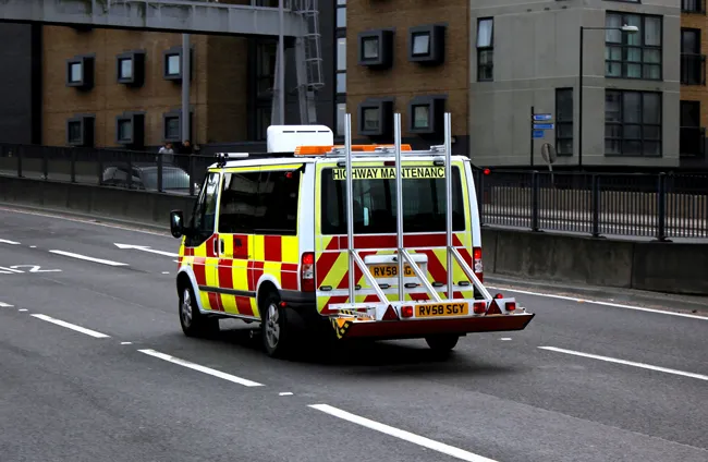
Catsurveys Group’s latest mobile ground penetrating radar (GPR) unit can cover up to 50km a day to identify underground utilities, buried manholes, chambers, culverts, tunnels and other objects.
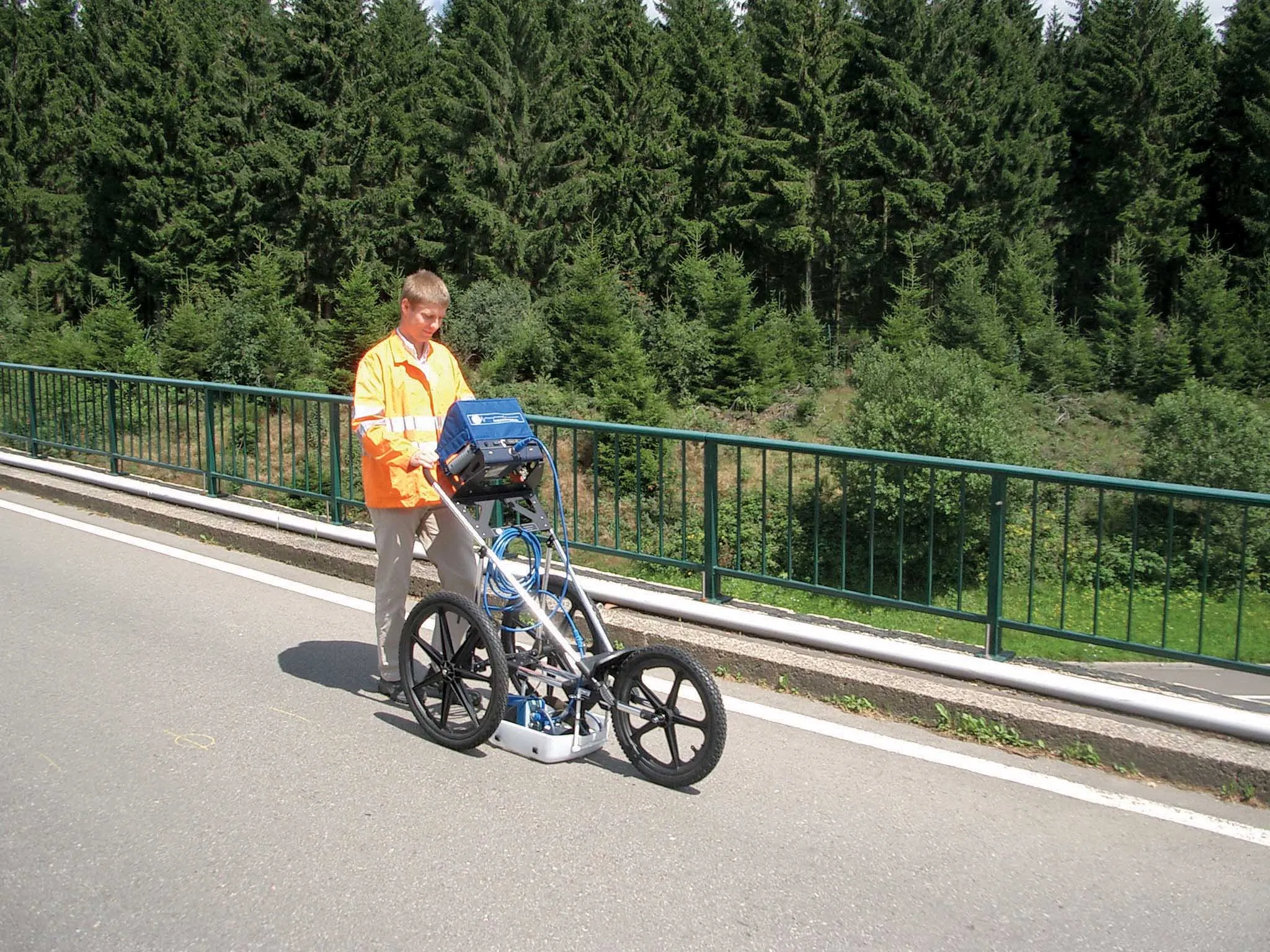
The mobile GPR uses a multitude of low- and intermediatefrequency antennas to boost the quality of data. Double polarised antennas cover longitudinal and transverse scans to create clear images. The surveys combine GPS and total station theodolite recording to give pinpoint geolocations of all features of interest. This allows design based on facts and assists with building information modelling integration and clash detection (allowing for the effective identification, inspection and reporting of interferences in a 3D project model).
1146 Balfour Beatty Construction Services UK had 8028 Catsurveys identify utilities and underground anomalies during the Dartford Freeflow Charging project, a large-scale traffic rerouting and management contract to reduce traffic congestion around the Queen Elizabeth II Bridge, near London. It was also used on the UK’s Manchester Smart Motorways scheme to locate and identify all services crossing the busy M62 motorway.
Catsurveys Group, based in Brentwood, near London, has three divisions: Geomatics, Site Investigation and Utilities.
The mobile GPR uses a multitude of low- and intermediatefrequency antennas to boost the quality of data. Double polarised antennas cover longitudinal and transverse scans to create clear images. The surveys combine GPS and total station theodolite recording to give pinpoint geolocations of all features of interest. This allows design based on facts and assists with building information modelling integration and clash detection (allowing for the effective identification, inspection and reporting of interferences in a 3D project model).
Catsurveys Group, based in Brentwood, near London, has three divisions: Geomatics, Site Investigation and Utilities.