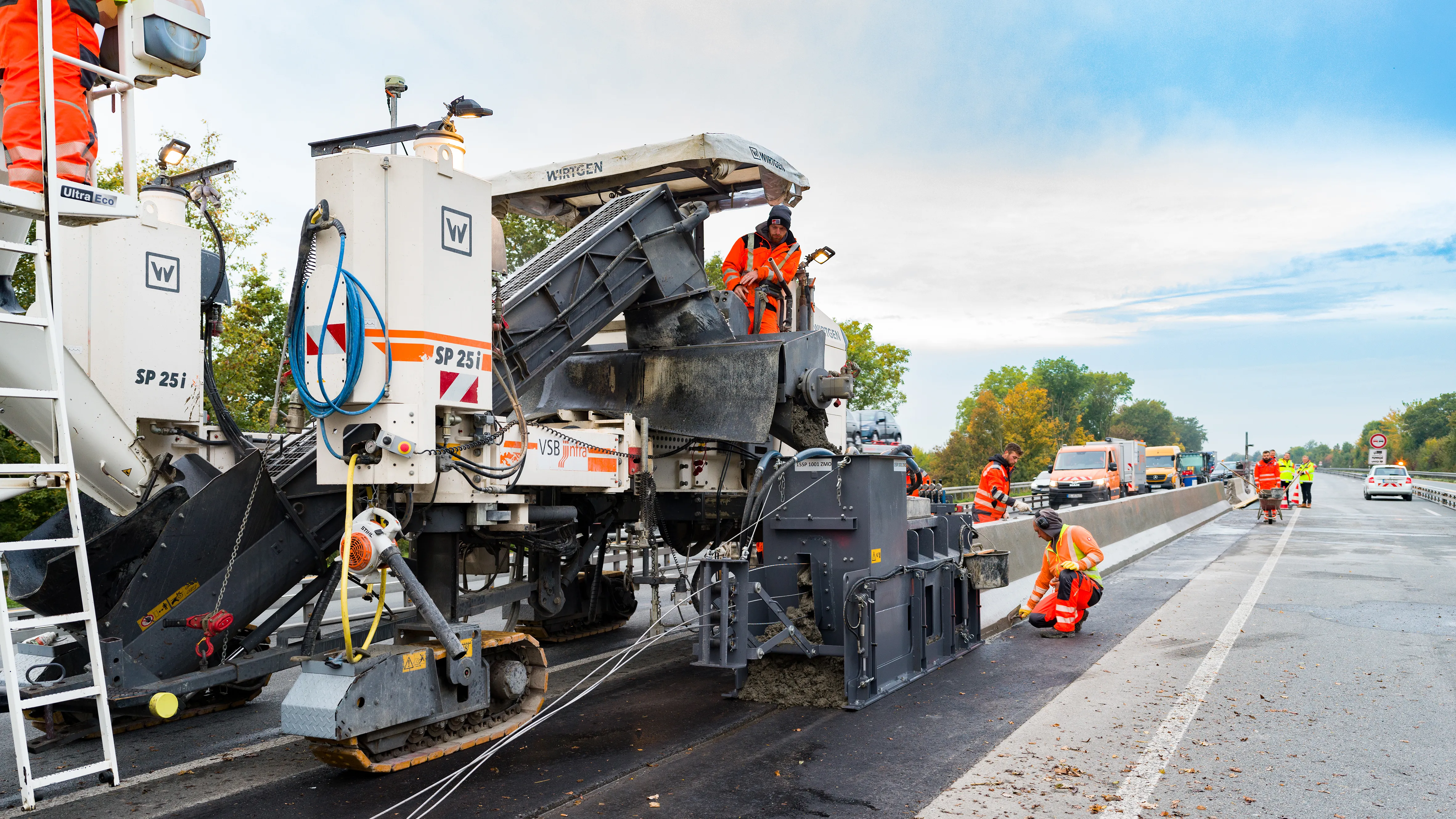
Wirtgen’s improved stringless concrete paving system is being used on the A43 highway near Münster in Germany.
The AutoPilot 2.0 is a 3D control system that helps increase efficiency and safety. The system is being used to deliver a new poured in-place concrete safety barrier that will separate the eastbound and westbound lanes of the A 43 Autobahn.
Reinforced concrete barriers offer effective vehicle restraint for road sections carrying heavy traffic and the barrier profile was paved by an SP 25i using slipform paving. The use of AutoPilot 2.0 eliminated the need for the paving crew from VSB infra to set up a stringline for controlling the machine.
The automatic 3D control system can optimise slipform paving, allowing accurate stringless control of slipform pavers. It consists of a control system integrated in the machine, a base station and a tablet computer that can be used together with the Field Rover survey pole and on the slipform paver. The system eliminates the need to set up and remove a stringline for conventional machine control, it also reduces project times and costs. The machine is guided by satellite-aided navigation, speeding the workflow and making the operation more efficient, while also allowing tight turns or more complex geometries to be slipformed.
‘This is another project on which we are using stringless paving. We have been using the AutoPilot system since it came onto the market. It saves us so much time that we use it on both of our machines whenever we can.’ said Kay Petersen, CEO of VSB infra.
The working area on this job offers little room for the paving crew and using a stringline would limit this space more. Having more space in front of the slipformer allows mixer trucks to manoeuvre right up to the paver to deliver each load. The absence of the vulnerable stringline also removes the risk of tripping and injuries as a result of falls.
The screen of the AutoPilot tablet displays the course of the virtual stringline and provides information to the operator as the machine moves along the predefined track. The AutoPilot 2.0 3D control system can be used to produce an array of offset and inset profiles. There is no longer a need for a surveyor to generate a geodetic data model in advance. If a 3D data model already exists, it can be uploaded from the tablet and integrated into the system.
The AutoPilot comes into play before the actual paving work begins. Relevant points on the project site are recorded with the Field Rover survey pole and are used for the digital data model that generates the virtual stringline on the tablet computer. This eliminates the need for an additional surveyor onsite.
The existing sub-base of the A 43 was sampled by an ultrasonic sensor and also used as a reference datum by the machine control system, delivering precise paving of the concrete profile.
Wirtgen
www.wirtgen.com