
3D GPR technology makes for speedy surveys

Traffic-speed surveys using 3D ground penetrating radar (GPR) are slashing the time required for surveying the UK’s motorways, and allowing a more thorough analysis of the pavement layers and condition.
August 21, 2019 Read time: 3 mins
New systems allow high speed scans of road surface quality

The UK’s Transport Research Laboratory (777 TRL) was the first organisation in the UK to use 3D GPR for this purpose in 2014, said Adam Cook, data manager, asset surveys at TRL who has been working with GOR for two decades. Since then the equipment and processing software have improved and TRL is now looking at new uses for the technology. 3D GPR is more commonly used for surveying underground utilities such as pipes and cables. In pavement surveys, it can be used to identify the thickness of the different paving layers, voids or areas of damage. Cook’s team first proposed the use of 3D GPP on a Smart Motorways project, which involves changing the configuration of the carriageways to incorporate more lanes.


“The specification called for a cross-carriageway cross-section every 250m. To do that using a traditional 2D GPR system would have required that we close the road and push the equipment across the carriageway every 250m,” said Cook. “For a large survey, involving several tens of kilometres, that’s a lot of lane closures.”

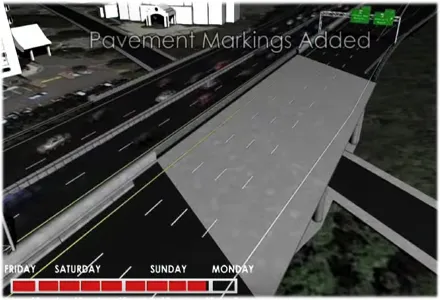
Using the 3D GPR, travelling at 88km/h, meant that TRL could survey a 25km stretch of motorway in both directions in two or three days, as opposed to two or three months using 2D radar. TRL uses a 3D GPR system called GeoScope from Norwegian company 3D-Radar. “I am very much a proponent of traffic-speed surveys,” says Cook. “This was the first time I had seen a system that would be capable of doing that.”

National roads authority 8100 Highways England liked TRL’s proposal, not only because it was faster but because it was safer: it did not require people to be working on the roads. The other big benefit, explained Cook, is that you can take a cross-section at whatever point you wish.

“You may not need a cross-section every 100m. You want to look at the road and see where the construction is changing and take more sections there,” said Cook. On the Smart Motorways programme, where lane positions are moved, the joint between old lanes can sometimes end up being the most heavily trafficked part of the pavement.

Since that first project for Highways England, TRL has carried out several more predesign surveys across the Smart Motorways programme. Over that time, there have been some improvements to the system. The antenna or bar that emits and receives the radar is now wider and the software to help process the data has improved.

“The analysis is still manual,” said Cook, “for instance identifying where the interface between materials is. But the software has improved so that there are more tools to help with that.”

Now 3D GRP is used for other related surveys such as bridge or tunnel decks. TRL is about to start a trial of the technology for investigating the filter drains that run down the sides of motorways. These often get full of silt, which only becomes apparent when they flood.

“We have done some work in the past using radar to investigate silting levels in filter drains, but sometimes it’s difficult to see what’s going on from one section down the middle of the drain,” said Cook. “We would like to use 3D to get a good picture of what is going on.”

Filter drain surveys could become a regular part of the inspection and maintenance regime to prevent flooding events, he added.

For more information on companies in this article

Related Content

  • Act FAST when it comes to bridge maintenance, argues Cliff Weston
    February 27, 2017
    Deck waterproofing remains critical to a bridge’s structural integrity for its design life, explains Cliff Weston, director of Stirling Lloyd To properly maintain deck waterproofing there must be a willingness to look at solutions based on whole-life costing rather than just short-term initial costs. There are lessons to be learned from examples of prematurely failed infrastructure due to a focus on initial short-term costs.
  • Bad roads make people poorer
    July 17, 2019
    India is said to be the fastest developing countries today only after China. Although India is doing excellently well in fields like education, industrialization, infrastructure, health, agriculture and fashion, there are still certain areas where the country is lagging behind. India's road network is gigantic and said to be only after the United States of America. But one of the striking underlying facts is the condition of the roads, around 30 percent of the country’s population lacked access to all-weath
  • Conference focuses on road design software
    February 23, 2012
    Trimble Dimensions 2009 takes a hard look at opportunities in a tough economy If attendance is the standard by which user conferences are measured, then Trimble Dimensions 2009 should be considered a success. The conference, which took place from 23-25 February at the Mirage Hotel in Las Vegas, USA, hosted more than 2,400 attendees, slightly exceeding last year. The strong attendance, in the face of global economic concerns, was seen by Trimble CEO Steven Berglund as a show of support for the company's tech
  • Auckland’s causeway project
    April 4, 2014
    When it is finished in early 2017, the causeway on Auckland’s North-western Motorway, State Highway 16, will have been raised 1.5m to stop flooding at extreme high tides. There will be four lanes city-bound and four/five lanes westbound with dedicated bus lanes in each direction, and the existing North-western cycleway that runs alongside it will be upgraded.