Upgrading Bolivia’s Uyuni – Condo K route will help boost the country’s economy - Mauro Nogarin writes. The area of influence along the new Uyuni - Huarancani - Condo K road in Bolivia is of major importance to the country’s economy as it has great agricultural potential for quinoa. The highway is located in south-western Potosi and it has a cultivated area of 55,000ha, with an annual output of 13,154tonnes of quinoa. South-western Potosi is also one of the areas with the highest population of camelid lives
Upgrading Bolivia’s Uyuni – Condo K route will help boost the country’s economy - Mauro Nogarin writes
The area of influence along the new Uyuni - Huarancani - Condo K road in Bolivia is of major importance to the country’s economy as it has great agricultural potential for quinoa. The highway is located in south-western Potosi and it has a cultivated area of 55,000ha, with an annual output of 13,154tonnes of quinoa. South-western Potosi is also one of the areas with the highest population of camelid livestock in the Altiplano and in addition has a large range of tourist sites, encompassing what is called the "third tourist circuit of Potosi" which includes the Uyuni Salt Flats and Laguna Colorada.
The area also includes a new plant for the production and industrialisation of lithium carbonate located in the Delta of the Rio Grande. The facility will produce 25,000tonnes/year of lithium carbonate and construction began in 2011. In addition to lithium, the plant will also produce boron, potassium and magnesium. According to data released by the Ministry of Mining, the output of the new production will flow by road to the port of Arica and on to international markets.
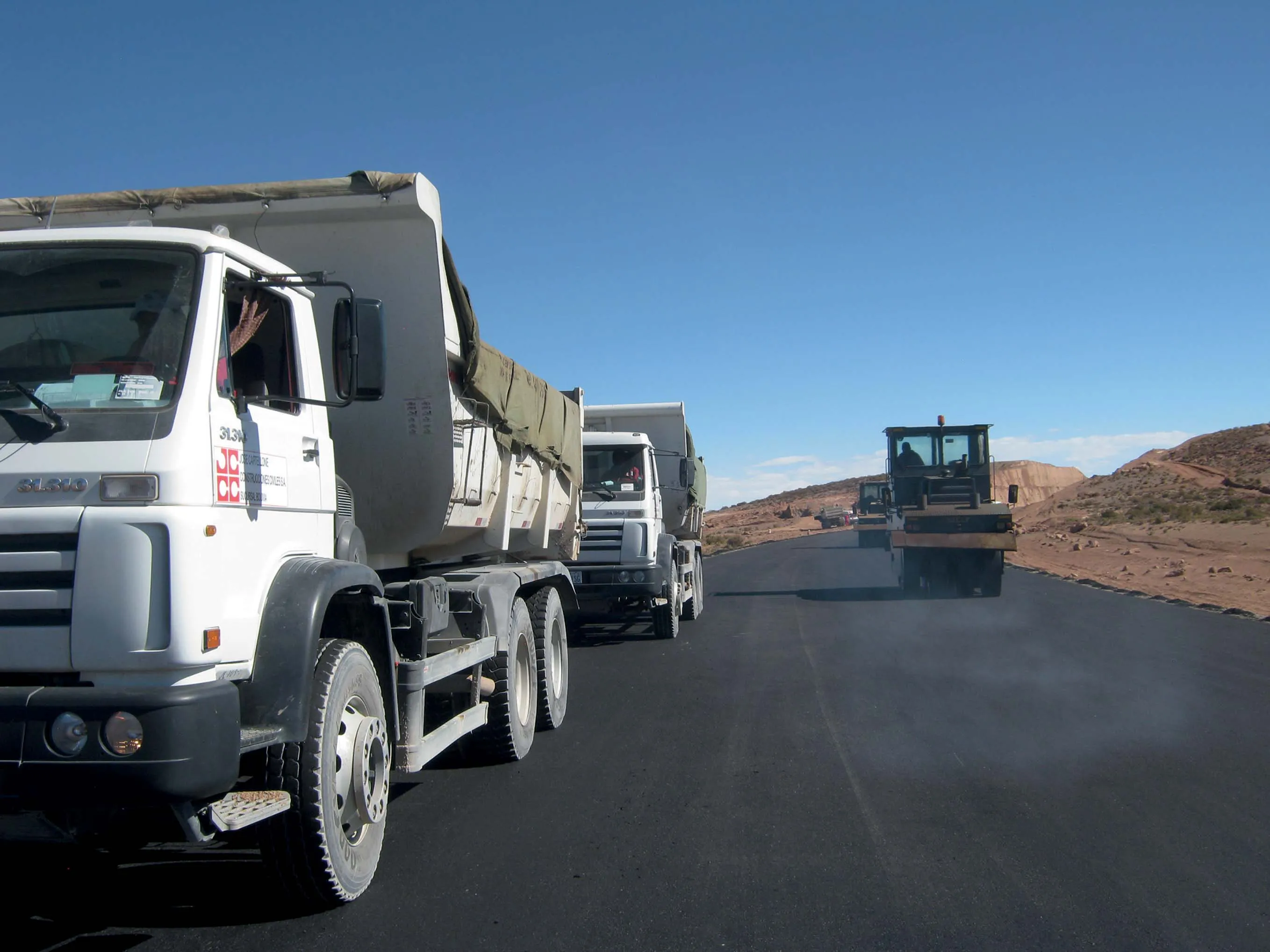
These are the reasons why the city of Uyuni, located at 3,670m above sea level in the south-western part of Bolivia is now benefiting from a new paved highway of 135km in length. This route links the region with the city of Oruro and the northern Amazon region of the country and was funded by the Andean Development Corporation (CAF), with a credit of US$104.3 million. The construction of this road is also linked with building other key infrastructure such as the bridges over the Coroma River (30m long), the Marquis River (also 30m ong) and the Mulatos River (25m long).
The project includes 15 additional bridges in the stretch between Uyuni - Huancarani that are very useful for local development, which the previous lack of basic road infrastructure had seriously hampered. The new road will allow the movement and transit of vehicles belonging to small and medium enterprises.
As a result of geophysical surveys and exploration of groundwater flow directions, the engineers were able to identify potential drill sites to determine potential aquifers for the construction phase. This highlighted areas susceptible to geological instability, such as the depth of the water table, the presence of identified bodies of water, the depth of the bed rock, the subsurface stratigraphy. The drilling also highlighted the depth and composition of different soil types throughout the course of the road.
From km 00 de Uyuni to the town of Chita located at km 42, the prevailing topographic relief is mostly flat alluvial Quaternary deposits mainly consisting of gravel sand and silt, fair to good quality and geotechnically stable.
Beginning at km 42 from the tertiary and cretaceous rocks predominate, made up mostly of banks and argillites and sandstone conglomerates, these rocks show adequate stability for slope cuts. From km 50 deposits are predominantly quaternary and tertiary deposits called the Quehua formation, on which horizontal to sub-horizontal friable sandstone arise, which from km 63 -68 are adequate for slope cuts. From km 100 to 134 the outline of the road occurs on volcanic rocks of Paleogeno-Neogene and Quaternary, lithologically composed of ignimbrites and tuffs, which in turn generate unconsolidated sandy residual soils.
The climate in the region and project area is cool, with average temperatures of -2.8 to 17°C; corresponding to the dry steppe climate of cold winters with frosts. Throughout the entire project area maximum rainfall occurs in the months of November to February, they are orographic and convective rain showers, in the order of 30-50mm of precipitation daily, with a maximum rainfall up to 190mm of rainfall annually.
The road was designed according to the standards currently in force provided by the state agency ABC (Bolivian Highway Administration), which regulates the road network in the country. To ensure the free movement of trucks and other heavy machinery, the width of the road and shoulder has been increased. Reducing descents and slopes to provide greater visibility and reduce fuel consumption; In addition making the curvature of the road uniform to avoid sharp bends in poor visibility.
Due to the importance of the road, the design taken into account the prevailing topographical features in the area, except for some critical sections. The standard speed has been set at 80km/h for flat to undulating sections of road as well as 80km/h in mountainous terrain topography. At critical stages the speed is reduced to 60km/h and for mountainous sections a speed of 40km/h is used. In the areas near or adjacent to population centres, where there is a greater population density, properties and intersecting streets, the speed may be reduced to between 20 and 30km/h.
The asphalt concrete binder was built in two stages: the initial stage of the pavement structure used a composed surface layer, this has been covered with a hot-mixed asphalt, offering an expected lifetime of 10 years. The second stage involves placing a reinforcement layer of asphalt expected to extend the useful life of the road to 20 years. The sub-base layer consists of selected material, which serves as a drainage layer to the pavement and which controls the capillary rise of water from the nearby water tables, or in the case of flooding in adjacent slopes of the area near the road, this layer will also protect the pavement from volume increase caused by the freezing of capillary water.
The area of influence along the new Uyuni - Huarancani - Condo K road in Bolivia is of major importance to the country’s economy as it has great agricultural potential for quinoa. The highway is located in south-western Potosi and it has a cultivated area of 55,000ha, with an annual output of 13,154tonnes of quinoa. South-western Potosi is also one of the areas with the highest population of camelid livestock in the Altiplano and in addition has a large range of tourist sites, encompassing what is called the "third tourist circuit of Potosi" which includes the Uyuni Salt Flats and Laguna Colorada.
The area also includes a new plant for the production and industrialisation of lithium carbonate located in the Delta of the Rio Grande. The facility will produce 25,000tonnes/year of lithium carbonate and construction began in 2011. In addition to lithium, the plant will also produce boron, potassium and magnesium. According to data released by the Ministry of Mining, the output of the new production will flow by road to the port of Arica and on to international markets.
These are the reasons why the city of Uyuni, located at 3,670m above sea level in the south-western part of Bolivia is now benefiting from a new paved highway of 135km in length. This route links the region with the city of Oruro and the northern Amazon region of the country and was funded by the Andean Development Corporation (CAF), with a credit of US$104.3 million. The construction of this road is also linked with building other key infrastructure such as the bridges over the Coroma River (30m long), the Marquis River (also 30m ong) and the Mulatos River (25m long).
The project includes 15 additional bridges in the stretch between Uyuni - Huancarani that are very useful for local development, which the previous lack of basic road infrastructure had seriously hampered. The new road will allow the movement and transit of vehicles belonging to small and medium enterprises.
As a result of geophysical surveys and exploration of groundwater flow directions, the engineers were able to identify potential drill sites to determine potential aquifers for the construction phase. This highlighted areas susceptible to geological instability, such as the depth of the water table, the presence of identified bodies of water, the depth of the bed rock, the subsurface stratigraphy. The drilling also highlighted the depth and composition of different soil types throughout the course of the road.
From km 00 de Uyuni to the town of Chita located at km 42, the prevailing topographic relief is mostly flat alluvial Quaternary deposits mainly consisting of gravel sand and silt, fair to good quality and geotechnically stable.
Beginning at km 42 from the tertiary and cretaceous rocks predominate, made up mostly of banks and argillites and sandstone conglomerates, these rocks show adequate stability for slope cuts. From km 50 deposits are predominantly quaternary and tertiary deposits called the Quehua formation, on which horizontal to sub-horizontal friable sandstone arise, which from km 63 -68 are adequate for slope cuts. From km 100 to 134 the outline of the road occurs on volcanic rocks of Paleogeno-Neogene and Quaternary, lithologically composed of ignimbrites and tuffs, which in turn generate unconsolidated sandy residual soils.
The climate in the region and project area is cool, with average temperatures of -2.8 to 17°C; corresponding to the dry steppe climate of cold winters with frosts. Throughout the entire project area maximum rainfall occurs in the months of November to February, they are orographic and convective rain showers, in the order of 30-50mm of precipitation daily, with a maximum rainfall up to 190mm of rainfall annually.
The road was designed according to the standards currently in force provided by the state agency ABC (Bolivian Highway Administration), which regulates the road network in the country. To ensure the free movement of trucks and other heavy machinery, the width of the road and shoulder has been increased. Reducing descents and slopes to provide greater visibility and reduce fuel consumption; In addition making the curvature of the road uniform to avoid sharp bends in poor visibility.
Due to the importance of the road, the design taken into account the prevailing topographical features in the area, except for some critical sections. The standard speed has been set at 80km/h for flat to undulating sections of road as well as 80km/h in mountainous terrain topography. At critical stages the speed is reduced to 60km/h and for mountainous sections a speed of 40km/h is used. In the areas near or adjacent to population centres, where there is a greater population density, properties and intersecting streets, the speed may be reduced to between 20 and 30km/h.
The asphalt concrete binder was built in two stages: the initial stage of the pavement structure used a composed surface layer, this has been covered with a hot-mixed asphalt, offering an expected lifetime of 10 years. The second stage involves placing a reinforcement layer of asphalt expected to extend the useful life of the road to 20 years. The sub-base layer consists of selected material, which serves as a drainage layer to the pavement and which controls the capillary rise of water from the nearby water tables, or in the case of flooding in adjacent slopes of the area near the road, this layer will also protect the pavement from volume increase caused by the freezing of capillary water.
| CONSIDERED LAYER | REQUIRED LAYERS | THICKNESS (cm) |
|---|---|---|
| Natural Terrain (MR= 11,210 psi) CBR = 15 % | Asphalt Layer | 5 |
| | Crushed base layer CBR 80% | 20 |
| Granular subbase layer CBR 30% | 26 |
Source: Prefectura de Potosí
| CONSIDERED LAYER | REQUIRED LAYERS | THICKNESS (cm) |
|---|---|---|
| Natural Terrain (MR= 11,210 psi) CBR = 15 % | Asphalt Layer | 5 |
| | Crushed base layer CBR 80%. | 20 |
| Granular subbase layer CBR 30% | 22 | |
| Natural Terrain (MR= 6,380 psi) CBR = 6 % | Asphalt Layer | 5 |
| | Crushed base layer CBR 80% | 20 |
| Granular subbase layer CBR 30% | 22 | |
| Improved sub grade layer CBR 15% | 20 |
Source: Prefectura de Potosí