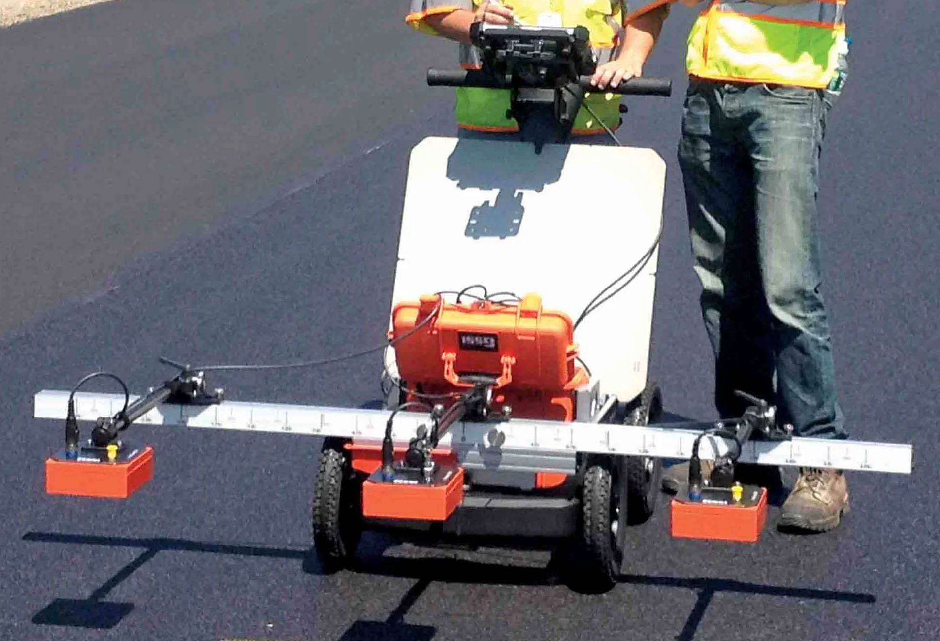
GSSI's new PaveScan unit can provide accurate real-time measurements and uncover problems that occur during the paving process, including poor uniformity and significant variations in density.
By avoiding these problems, PaveScan RDM helps avoid premature failures from road ravelling, cracking, and deterioration along joints. PaveScan automatically measures the dielectric value to identify anomalies in real-time. In addition, the dielectric values can be used to as a means to correlate voids and density in
GSSI's new PaveScan unit can provide accurate real-time measurements and uncover problems that occur during the paving process, including poor uniformity and significant variations in density.
By avoiding these problems, PaveScan RDM helps avoid premature failures from road ravelling, cracking, and deterioration along joints. PaveScan automatically measures the dielectric value to identify anomalies in real-time. In addition, the dielectric values can be used to as a means to correlate voids and density in new pavement. The technology enables users to obtain critical density data for QA/QC of new pavements. Unlike other options like nuclear density gauges or radioactive alternatives, PaveScan does not result in any site hazards or require closing off work areas however.
The unit can be integrated with GPS systems and features a versatile, modular design for easy and efficient operation and data collection. It is available as a small, portable single sensor cart-based system or a three-sensor configuration using an extended cart or vehicle configuration.