Easy does it with GSSI’s PaveScan RDM 2.0

GSSI says that its PaveScan RDM 2.0, a non-destructive asphalt density assessment tool, is characterised by being easy to use, no matter what technical level the operator has.
By David Arminas February 27, 2023 Read time: 2 mins
By uncovering inconsistencies that occur during the paving process, including poor uniformity and significant variations in density, PaveScan RDM 2.0 helps to avoid premature failures

GSSI, a manufacturer of ground penetrating radar (GPR) equipment, says that from technician to engineer, the PaveScan RDM 2.0 testing system is easy to operate.

The PaveScan RDM 2.0 is a second-generation asphalt density assessment tool ideal for non-destructive asphalt compaction testing, quality assurance/quality control of new pavements and determining pavement non-conformity.

By uncovering inconsistencies that occur during the paving process, including poor uniformity and significant variations in density, PaveScan RDM 2.0 helps to avoid premature failures like road raveling, cracking, and deterioration along joints.

Thanks to seamless GPS integration, real-time onscreen data output and export options, this system is ideal for government transportation agencies and paving contractors alike. The pavement density measurement technology used in PaveScan RDM 2.0 is an accepted American Association of State and Highway Transportation Officials (AASHTO) specification, PP 98-19.

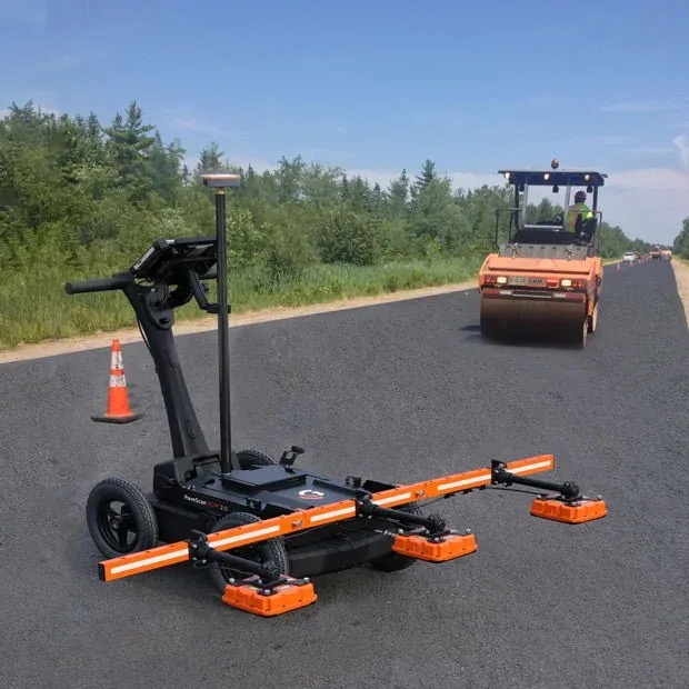
The complete PaveScan RDM 2.0 system includes a rugged deployment cart and an integrated concentrator box that accommodates up to three sensors. It includes housing for cable management and hot-swappable, dual batteries.

The new sensor design was built specifically for the extremes of the asphalt paving environment and features a green laser to aid location accuracy. Also available is a system upgrade kit to expand to three sensors for better pavement coverage.

Additional GPS options and mounting pole provide high precision location information and work seamlessly with the PaveScan interface.

For more information on companies in this article

Related Content

  • Latest GIS and software tools improve operations
    February 24, 2012
    Innovative GIS and software solutions are coming to market from the three key market players - Mike Woof reports Competition is strong in the field for GIS and surveying systems as well as the associated software. The three major players in the sector, Leica Geosystems, Topcon and Trimble, all invest heavily in research and development and continue to roll out new solutions for construction customers that will boost the efficiency of surveying as well as overall project implementation.
  • Advances in asphalt plant production
    November 27, 2012
    Leading asphalt plant manufacturers have recently unveiled their latest products aimed at customers looking for significant efficiency gains through the use of durable and lasting technology. Guy Woodford looks at some of the new batch Benninghoven showcased a wide variety of its new and innovative asphalt plants and individual plant components during its week-long Open Days event last month at the German firm’s HQ in Mülheim. Launched earlier this year, the MMX80 Continuous Asphalt Plant is capable of prod
  • Navtech Radar to showcase ClearWay radar-based safety and monitoring systems
    March 19, 2012
    Navtech Radar will be showcasing the safety and economic benefits of using longer-range radar systems for Automated Incident Detection (AID) and enforcement at Intertraffic 2012. The company’s ClearWay sensor technology is currently deployed in live tunnel and above-ground environments in Northern Europe and has been further developed to provide count and classification capabilities as well as an effective counter to illegal tailgating and unsafe lane-change manoeuvres.
  • Innovative traffic information technology used in Vancouver
    April 12, 2012
    As the world descended on Vancouver for the 2010 Winter Olympics, visitors were able to travel around the city with confidence and intelligence thanks to a landmark project by IRF Member, Delcan