Ecuador’s Buenavista – Zaruma Highway will provide a key route that will help boost economic activity – Mauro Nogarin writes
Ecuador hopes to boost economic activity with the construction of new highway links. Most economic activity in the Piñas canton currently relies on agriculture, forestry and fishing. These sectors employ over 50% of the economically active population of the region. Meanwhile, most of the working population of the Portovelo canton is dedicated to mining and quarrying, with this area
Ecuador’s Buenavista – Zaruma Highway will provide a key route that will help boost economic activity – Mauro Nogarin writes
Ecuador hopes to boost economic activity with the construction of new highway links. Most economic activity in the Piñas canton currently relies on agriculture, forestry and fishing. These sectors employ over 50% of the economically active population of the region. Meanwhile, most of the working population of the Portovelo canton is dedicated to mining and quarrying, with this area delivering 60% of Ecuador’s extraction industry.
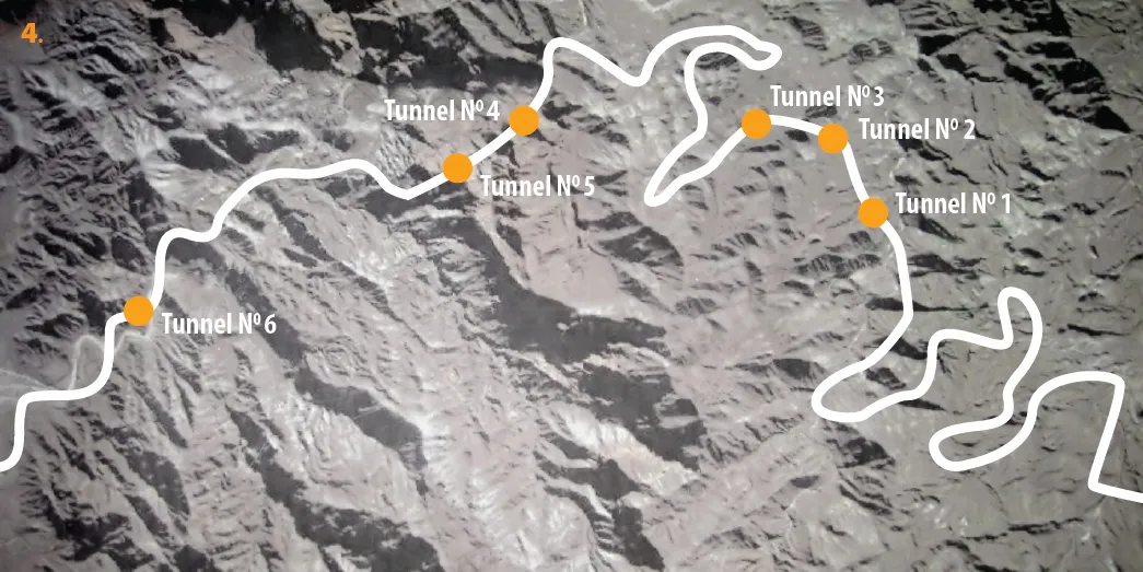
The new road construction project consists of work on three main links, according to the Ministry of Transport and Public Works (MTOP). Section 1 runs from Zaruma – Zaracay, a length of 42.45km, while Section 2 is the 7.8km stretch from Osorio – Portovelo and Section 3 is the 9.15km stretch from Chinchas – Rio Pindo.
Although the climate of the province is conditioned by both the Pacific Ocean and the Andes Mountains, temperatures are very stable throughout the year and there is no difference between the seasons. The annual rainfall is 997.39 mm/year, the average temperature is 24.35°C, and the average humidity is 85.7%. This reduces the number of challenges to the road construction operation.
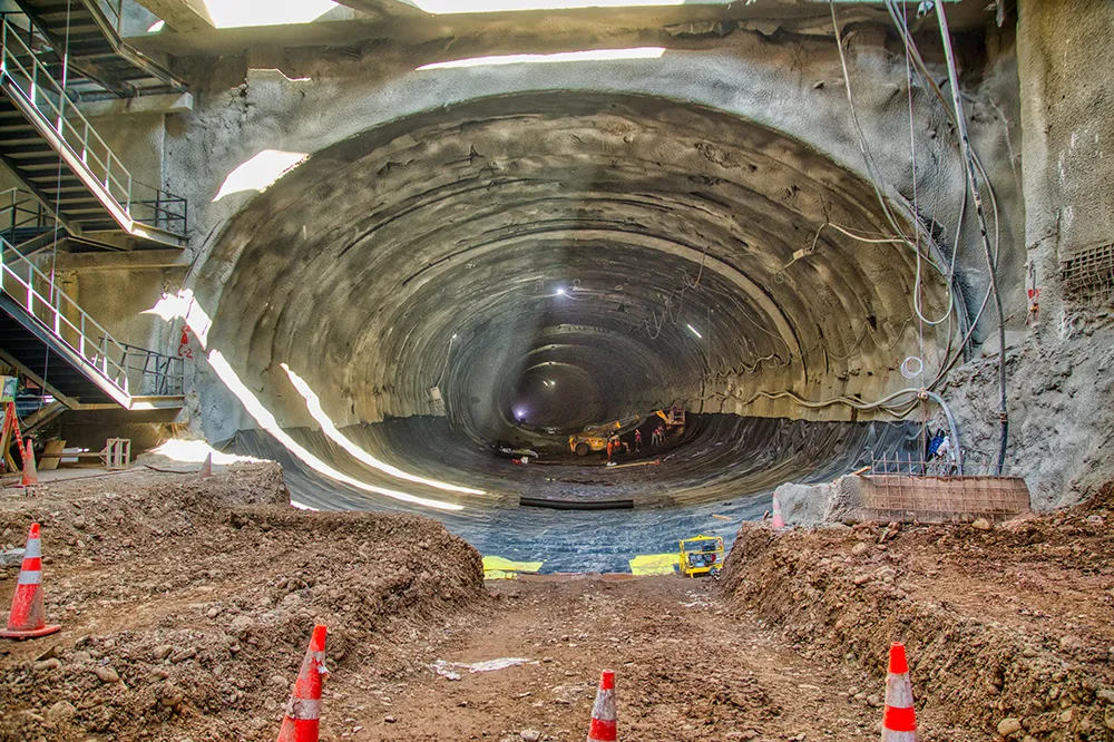
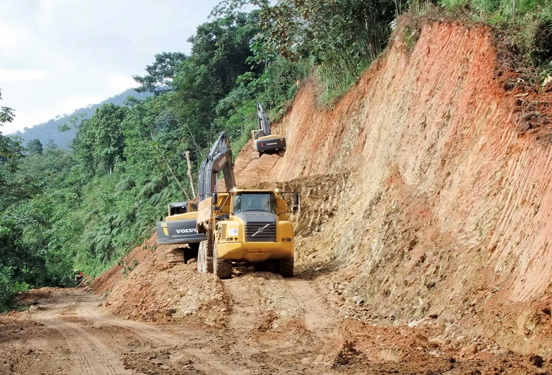
However the geology and topography faced by the engineers pose more challenges. The route of the road passes through different types of geotechnical areas: colluvial materials, weathered volcanic rock, volcanic rock that is weathered and fractured, alluvial terraces and serpentine rock (El Toro).
One of the geological features that has generated difficulties in designing the road comes from the risk of landslides. This problem is a feature of the entire length of the road, particularly in the area between the Buenaventura Reserve and Piñas; the area of the Monos River; the Moro-Moro area and the Prado area at the entrance to Piñas. In this area landslides are frequent and can cause significant damage to roads. As a result, the design of the road has taken particular consideration of the slopes, with a focus on solutions that can properly drain and stabilise the slopes.
The starting point of the road is located in the town of Zaruma, located at an altitude of 1,100m above sea level and runs to the town of Portovelo located at an elevation of 630m. This stretch of the route features a descent with gradients ranging between 7.5% and 10.7%. This stretch is mostly urban and there are houses on both sides of the current road. Along this stretch there are very small radius curves. Because of the density of the homes in this stretch, it was considered desirable to have an urban-type cross section, consisting of two lanes and sidewalk. The type of terrain in this section is residual and saprolitic rock and residual soil on volcanic rock.
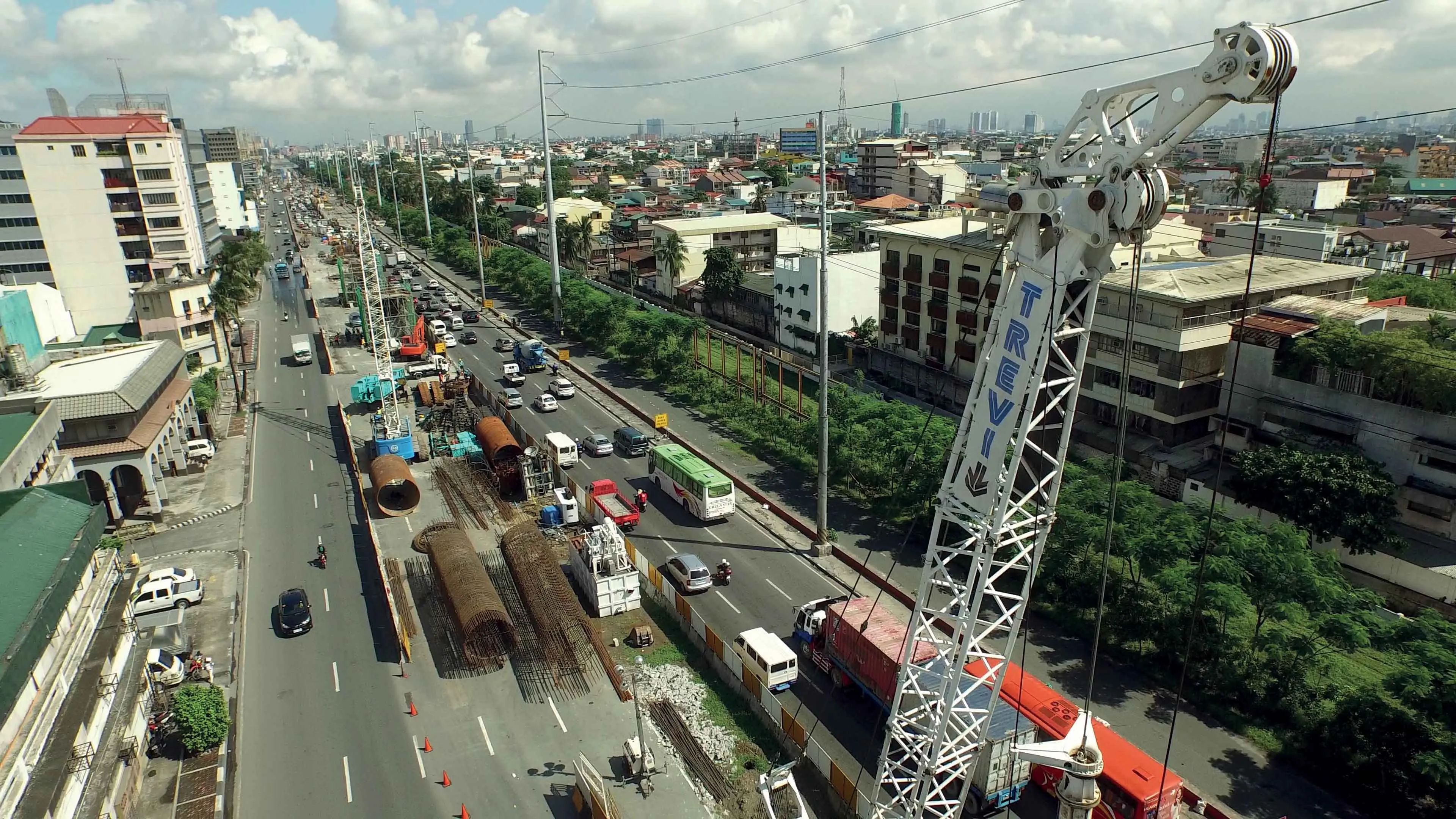
Section 2 from Osorio – Portovelo features a descent and includes a stretch with a gradient of 8.5%. This is an urban area with houses on both sides of the road and housing is most common during the first 2km where it enters the town of Portovelo. In this stretch, some small corrections of curves are being made, but this work is complex and the area is very densely populated and features a number of high buildings. This section features two lanes, two shoulders, side ditches and berms.
Section 3 runs from the bridge for the Union Portovelence and features problems with the road surface in some areas at present. The surface in this last stretch is deficient and this is an issue, particularly due to the high percentage of heavy vehicles serving the extraction industries (40%) located on the left bank of the Rio Amarillo. The typical layout for this section that has been adopted is two lanes, two shoulders, with side ditches and berms. At the end of the third section, there is a single lane bridge crossing the Pindo River.
The longest bridge on the route meanwhile is the 140m structure over the Moro Moro, which has a speed limit of 80km/h. The viaduct passes some 22m above the bottom of the riverbed and descends gradually with a gradient of 1.95%. It has a central height of 30m.
The deck is a post-tensioned concrete slab that measures 1.2m thick and has sloping side walls.
The piles are 3m wide and 1.5m deep, with the alignment of their axes perpendicular to the axis of the board. The head of the piles are widened in the form of a Y so as to better distribute forces from the deck.
The foundation of abutments and piles will be direct, through shoes, following the recommendations of the geotechnical study.
Ecuador hopes to boost economic activity with the construction of new highway links. Most economic activity in the Piñas canton currently relies on agriculture, forestry and fishing. These sectors employ over 50% of the economically active population of the region. Meanwhile, most of the working population of the Portovelo canton is dedicated to mining and quarrying, with this area delivering 60% of Ecuador’s extraction industry.
The new road construction project consists of work on three main links, according to the Ministry of Transport and Public Works (MTOP). Section 1 runs from Zaruma – Zaracay, a length of 42.45km, while Section 2 is the 7.8km stretch from Osorio – Portovelo and Section 3 is the 9.15km stretch from Chinchas – Rio Pindo.
Although the climate of the province is conditioned by both the Pacific Ocean and the Andes Mountains, temperatures are very stable throughout the year and there is no difference between the seasons. The annual rainfall is 997.39 mm/year, the average temperature is 24.35°C, and the average humidity is 85.7%. This reduces the number of challenges to the road construction operation.
However the geology and topography faced by the engineers pose more challenges. The route of the road passes through different types of geotechnical areas: colluvial materials, weathered volcanic rock, volcanic rock that is weathered and fractured, alluvial terraces and serpentine rock (El Toro).
One of the geological features that has generated difficulties in designing the road comes from the risk of landslides. This problem is a feature of the entire length of the road, particularly in the area between the Buenaventura Reserve and Piñas; the area of the Monos River; the Moro-Moro area and the Prado area at the entrance to Piñas. In this area landslides are frequent and can cause significant damage to roads. As a result, the design of the road has taken particular consideration of the slopes, with a focus on solutions that can properly drain and stabilise the slopes.
The starting point of the road is located in the town of Zaruma, located at an altitude of 1,100m above sea level and runs to the town of Portovelo located at an elevation of 630m. This stretch of the route features a descent with gradients ranging between 7.5% and 10.7%. This stretch is mostly urban and there are houses on both sides of the current road. Along this stretch there are very small radius curves. Because of the density of the homes in this stretch, it was considered desirable to have an urban-type cross section, consisting of two lanes and sidewalk. The type of terrain in this section is residual and saprolitic rock and residual soil on volcanic rock.
Section 2 from Osorio – Portovelo features a descent and includes a stretch with a gradient of 8.5%. This is an urban area with houses on both sides of the road and housing is most common during the first 2km where it enters the town of Portovelo. In this stretch, some small corrections of curves are being made, but this work is complex and the area is very densely populated and features a number of high buildings. This section features two lanes, two shoulders, side ditches and berms.
Section 3 runs from the bridge for the Union Portovelence and features problems with the road surface in some areas at present. The surface in this last stretch is deficient and this is an issue, particularly due to the high percentage of heavy vehicles serving the extraction industries (40%) located on the left bank of the Rio Amarillo. The typical layout for this section that has been adopted is two lanes, two shoulders, with side ditches and berms. At the end of the third section, there is a single lane bridge crossing the Pindo River.
The longest bridge on the route meanwhile is the 140m structure over the Moro Moro, which has a speed limit of 80km/h. The viaduct passes some 22m above the bottom of the riverbed and descends gradually with a gradient of 1.95%. It has a central height of 30m.
The deck is a post-tensioned concrete slab that measures 1.2m thick and has sloping side walls.
The piles are 3m wide and 1.5m deep, with the alignment of their axes perpendicular to the axis of the board. The head of the piles are widened in the form of a Y so as to better distribute forces from the deck.
The foundation of abutments and piles will be direct, through shoes, following the recommendations of the geotechnical study.
| Length | 66.42 km |
| Type of Road | Class III |
| Type of terrain | Mountainous |
| Width of Shoulders | Variable from 0.5-1.5m on each side |
| Berm | 0.8m on each side |
| Maximum incline | Maximum 11% |
| Surface | Asphalt |
| SECTION | NAME | HEIGHT | WIDTH | TYPE |
|---|---|---|---|---|
| 1 | Rio Calera | 152m | 11m | Metal beam |
| 2 | Monos River | 120m | 15m | Concrete |
| 3 | Moro Moro R | 140m | 12.5m | Concrete |
| 4 | Amarillo R | 25m | 11m | Precast concrete |
| 5 | Pindo River | 70.5m | 12.5m | Metallic arch |