
Control versatility

Leica Geosystems says that its CI-14 CAT Interface Module cuts installation time when fitting its 2D & 3D machine control systems to Caterpillar off-highway machines. Using the CI-14 package is said to eliminate the cost and effort of installing add-on hydraulic valves when fitting control tools from Leica Geosystems to Caterpillar K and T Series dozers and M Series graders. The CI-14 system can be used in conjunction with laser, slope, ultrasonic or 3D GPS/GNSS as well as the Leica PowerTracker total stati
July 2, 2012 Read time: 2 mins
Lecia Geosystems' new machine control technology offers high precision and performance
265 Leica Geosystems says that its CI-14 CAT Interface Module cuts installation time when fitting its 2D & 3D machine control systems to 178 Caterpillar off-highway machines. Using the CI-14 package is said to eliminate the cost and effort of installing add-on hydraulic valves when fitting control tools from Leica Geosystems to Caterpillar K and T Series dozers and M Series graders. The CI-14 system can be used in conjunction with laser, slope, ultrasonic or 3D GPS/GNSS as well as the Leica PowerTracker total station sensors, and adds plug and grade control capabilities.

The system is compatible with both ARO-prepared and non-ARO bulldozers and motorgraders with no CAT SEA licence activation fee to pay. According to the firm, the hardware is field-proven and the software is fully field-programmable to allow for future upgrades, while it is CAN-Bus based to ensure reliable operation and simple diagnostics.

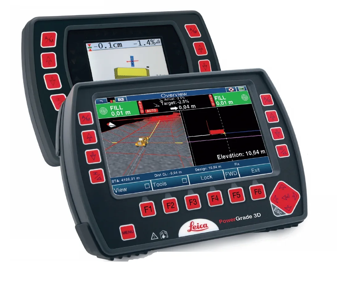
Meanwhile the firm's PowerGrade system features the PowerSnap concept, with a docking station that allows for quick exchange of panels and transfer between machines. The PowerSnap device allows the user to swap the tool from one machine to another and also allows the system to be reconfigured from 2D to 3D capabilities as required. The PowerGrade system can be upgraded and is scalable from the basic 2D package to full 3D capability using the same control panel.

For more information on companies in this article

Related Content

  • Positioning tools continue to improve
    July 16, 2012
    Topcon says that its new IP-S2 package combines GNNS positioning capabilities with inertial sensors, while the firm also has a solution for customers wanting to mix and match receiver components. The IP-S2 is a vehicle-mounted, mobile 3D tool that offers precision mapping and surveying capabilities. The package collects data using 3D laser scanners, LIDAR, and/or cameras, and this is then integrated, time-stamped and geo-referenced. The customer can use this assembled data to combine LIDAR point cloud and d
  • Versatile small construction equipment
    February 9, 2012
    Smaller construction equipment offers versatile options, particularly on highway repair and maintenance projects. Patrick Smith reports. Visitors to any highway construction site across the world will see a sizeable amount of utility equipment in action carrying out a variety of tasks. Indeed, because of its smaller, more compact size, such multi-task equipment is essential when repair and maintenance projects are being carried out, particularly in urban areas where space may be limited.
  • Sokkia is offering new field service solutions for GNSS
    January 31, 2017
    Sokkia is introducing new field and office software solutions for its total stations, robotics and GNSS rover systems. These are the GeoPro Field and GeoPro Office packages. GeoPro Field provides a graphical user interface designed to collect field measurements for land surveying and construction activities. Sokkia GeoPro Office is the office-processing complement to the field software and can clean, process, and analyse field data into an easy-to-use form. The office software can also be expanded wi
  • Leica Geosystems’ tools for site monitoring and handling GPR data
    October 11, 2017
    Leica Geosystems is offering new tools for construction firms for remote monitoring and for handling data from ground penetrating radar. With the GeoMoS Imaging package, users can stay up-to-date on remote monitoring; the live view allows observation and recording of areas of interest. A joystick provides remote access to the total station so that personnel can increase productivity and reduce time in the field.