
XenoTrack on track

XenoTrack Dual Lane was officially launched this month at GeoWeek, a major event for the geospatial and 3D sector that took place in the US city of Denver.
April 25, 2023 Read time: 1 min
The latest version of XenomatiX’s road lidar XenoTrack inspection system covers two lanes in one pass.

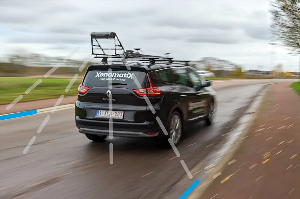
XenomatiX, a solid state lidar company specialising in road asset management and digital twins of roads, launched the XenoTrack Single Lane system last year. Now, the company says that with the Dual Lane system, it “took a step-in easing 3D pavement measurement”.

Traditional road assessment systems are limited to measuring the width of one or part of a road lane on each pass. But XenoTrack Dual Lane surveys two neighbouring lanes in a single pass. While the vehicle drives in one lane, the system simultaneously measures the road surface condition of that lane and the neighbouring lane.

All XenoTrack products including the Dual Lane system, use a highly accurate lidar as main component, offering 3D and intensity maps of the road surface.

For more information on companies in this article

Related Content

  • Weighty matters for developing countries
    November 6, 2012
    One leading Weigh in Motion technology manufacturer is helping governments in developing countries reduce excessive road damage, while several others have seen their latest WIM systems recently used on the highways of Eastern Europe. Guy Woodford reports Recent Central Weighing WIM installations in Bangladesh are helping its national government reduce the financial burden of excessive road damage, while also protecting many bridges that are vital to transport and trade. The need for such installations was e
  • Topcon to smoothen roads with SmoothRide system
    February 28, 2018
    Topcon Positioning has developed a sophisticated package that can help deliver better road surface quality. The firm’s latest SmoothRide data collection package is said to make the mapping of road conditions easier and more efficient. The new RD-M1 Collect 2.0 package has an improved interface and a new graphical interface status bar that indicates the optimum speed for collecting road information based on the project requirements.
  • Concrete paving a smoother surface using machine control technology
    May 17, 2017
    Innovative technology has been used to deliver a smooth concrete road surface on a busy stretch of highway in Nebraska. Much-needed work on a busy section of Interstate 80 has been carried out in Nebraska to improve the road surface. This is one of the most important highways in the US, providing a link that stretches right across the country between the east and west coasts. This busy highway carries a high percentage of heavy truck traffic as it is a vital transport route. However this constant flow of la
  • Accurate utilities detection
    November 26, 2024

    Trimble and Radiodetection are collaborating to improve the technology used in the utility measurement and mapping process. Integrating the Trimble Catalyst DA2 GNSS system and Radiodetection’s RD MapTM+ application and precision locator products helps to streamline utility-locating workflows to provide accurate measurement capabilities and generate underground utilities maps in a single field operation.