Smarter transport solutions from TomTom

TomTom is introducing two novel products that help deliver smart traffic solutions, RoadDNA and its HAD map. The Road DNA will help make automated driving a reality, according to the firm. Designed with vehicle data storage and processing limitations in mind, RoadDNA delivers highly accurate location information that can easily be integrated into the onboard system of a vehicle. This allows a vehicle to continuously know exactly where it is located on the road. It offers highly accurate vehicle localisa
January 4, 2016 Read time: 2 mins
The TomTom technology provides a stepping stone for autonomous vehicle mdevelopment
3972 TomTom is introducing two novel products that help deliver smart traffic solutions, RoadDNA and its HAD map. The Road DNA will help make automated driving a reality, according to the firm. Designed with vehicle data storage and processing limitations in mind, RoadDNA delivers highly accurate location information that can easily be integrated into the onboard system of a vehicle.

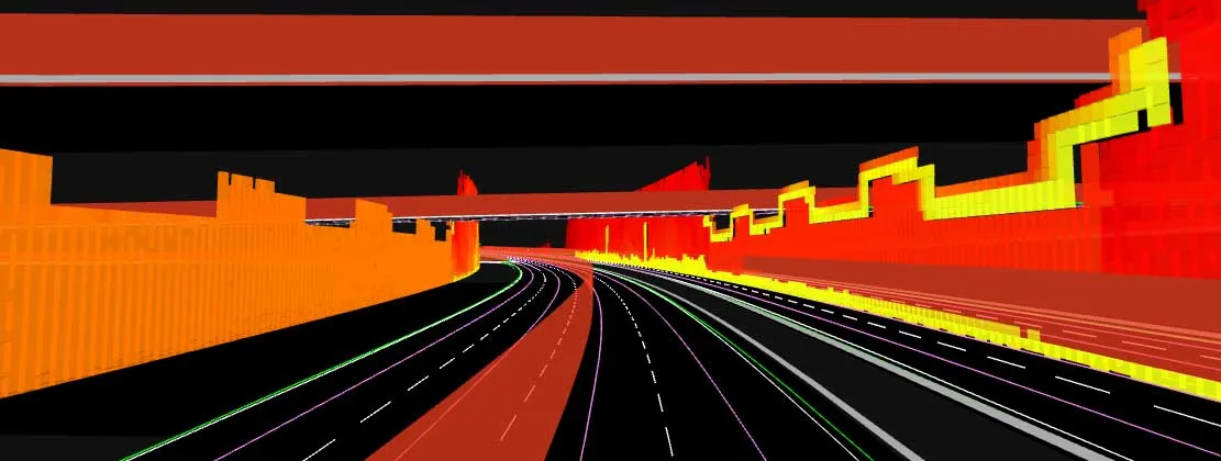
This allows a vehicle to continuously know exactly where it is located on the road. It offers highly accurate vehicle localisation content in an efficient and cost-effective way. By matching RoadDNA data with vehicle sensor data in real-time, a vehicle knows its location on the road and even while travelling at high speeds or when changes occur to the roadside. But by converting a 3D point cloud of roadside patterns into a compressed, 2D view of the roadway, RoadDNA delivers a solution that needs little storage space and requires conventional processing requirements, without losing detail.

TomTom RoadDNA, combined with the TomTom HAD Map, delivers real-time information about a vehicle’s precise location on a map whilst coping with changes in the environment. The firm is also offering its HAD Map for Germany. This complete map of Germany covers the entire Autobahn network and provides a 3D lane map for 24,000km of roads.

The TomTom HAD Map for Germany provides accurate representation of 3D geometries of lane centrelines, lane dividers, road borders, and guard rails, as well as highlighting lane-dependent speed limits and lane divider marking types. In addition to enabling future self-driving cars to see beyond their sensors, the TomTom HAD map can also be used for advanced driving applications like improved versions of eco-adaptive cruise control (ACC), lane level guidance, and predictive powertrain control.

For more information on companies in this article

Related Content

  • Bridge inspection: destructive versus non-destructive methods
    January 6, 2015
    Tens of thousands of bridges in the United States are in desperate need of repair. But where to begin analysing their deteriorating state? Roger Roberts* investigates tips and techniques for ensuring bridge safety The average age of America’s more than 600,000 crumbling bridges is 42 years – many are 60 to 80 years old. The situation is dire, with many described as functionally obsolete, according to the American Society of Civil Engineers’ latest edition of its Report Card for America’s Infrastructure.
  • Software developments aids construction projects
    March 21, 2012
    Liebherr claims its wide range of Litronic control system featuring CANUS software ensures construction projects are delivered on time and to budget. The system’s PDE data recording unit logs information such as depth, suspension levels, drilling speed and geometry. It then displays it in real-time via a colour touchscreen in the operator's construction machine cab. Due to constant awareness of the working process, the operator is able to adapt the PDE unit to suit changing environmental conditions. PDE rec
  • Versatile concrete mixing from Carmix
    February 28, 2017
    High power output, performance and reliability are claimed by Carmix for its versatile new 3.500 TC model. Improvements include more ergonomic controls, better all-round visibility and an air-conditioned cab.
  • Sophisticated plotting
    February 7, 2012
    Leica Geosystems is offering its improved SpiderWeb v4.0 package as part of the new reference station software update. This improved suite of solutions also includes the GNSS Spider v4.0 and SpiderQC v4.0 packages.