The TIC502 incorporates vehicle speed detection with 3D profiling and counting of fast-lane, free flowing and static traffic to facilitate toll charge assessment. It can also be integrated with additional 2D LiDAR sensors to count axles for complete traffic profiling and assessment in a single system, according to the company that was set up in 1946 by optical engineer Erwin
Typical applications include electronic highway toll collection, traffic management and jam detection including tunnel, bridge and ferry operations, explained Neil Sandhu, Sick’s national product manager for imaging, measurement, ranging and systems.
“The unit can also be easily retrofitted on structures such as overhead gantries, bridges or tunnel entrances to upgrade existing traffic monitoring and control,” he said. “The facility for adding an extra LiDAR sensor to the TIC502 allows accurate axle counting, which is often used for improved toll assessment of very heavy transport vehicles, without needing the use of a full vision system.”
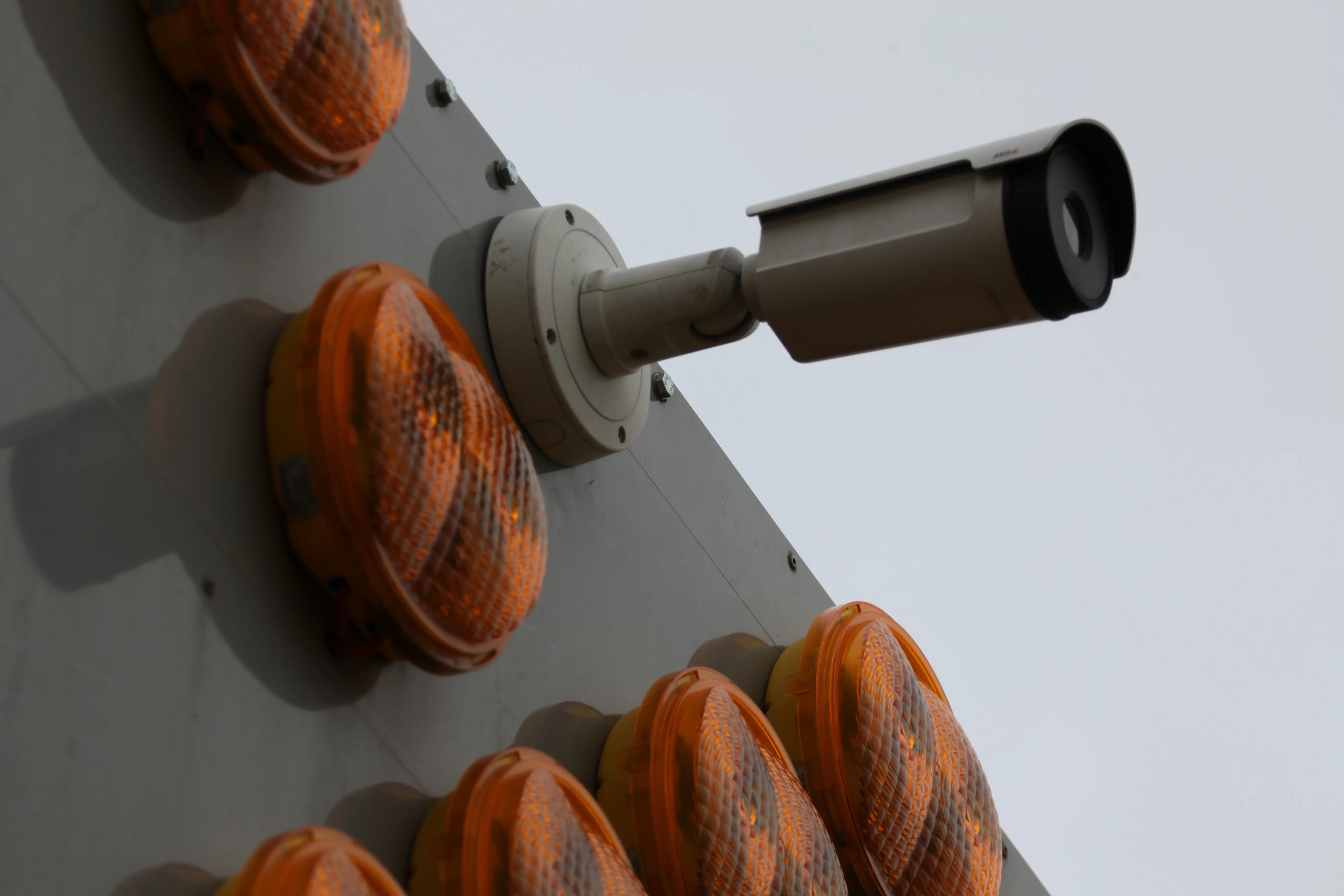
The TIC502 LiDAR system comprises twin LiDAR sensors on an angled baseplate for direct, over lane mounting and a TIC Traffic Controller for installation in the highway control room. The TIC502 Master LiDAR unit can be paired with the TIC502 Slave 2D LiDAR unit for axle counting duties using the same traffic controller. Up to four lanes can be monitored by one controller.
Based on infra-red Class 1 (eye-safe) LiDAR sensors, the TIC502 scans vehicles at up to 100 times a second to generate a 3D profile of each vehicle and assesses vehicle class according to TLS8+1, TLS5+1, TLS2+1 or Swiss10, into up to 30 different classes. The live 3D view of traffic is integrated into one, easy-to-use display, and is auto-calibrated with moving traffic.
The Sick TIC502 has a range of up to 40m and a minimum mounting height of 1.5m above the tallest vehicle. Vehicle counting accuracy is better than 99%, including vehicles with trailers, vehicle class assignment better than 98% and speed assessment accuracy is +/- 3kph up to 100kph and +/- 3% above 100kph.
With modular software and a web-based configuration and user interface, the TIC502 is easy to set up and operate, with the custom-designed installation wizard. No additional software is required for visualisation of vehicle data and the traffic controller automatically stores a data history of the last 50 vehicles detected. Data is sent directly to storage in the customer’s system via FTP or UNC transmission.
SICK launches 3D TIC502 LiDAR sensor system for traffic management
Sick says that its latest TIC502 twin LiDAR sensor system has
high all-weather capability between -40OC and +60OC.
The TIC502 incorporates vehicle speed detection with 3D profiling and counting of fast-lane, free flowing and static traffic to facilitate toll charge assessment. It can also be integrated with additional 2D LiDAR sensors to count axles for complete traffic profiling and assessment in a single system, according to the company that was set up in 1946 by optical engineer Erwin Sick in Waldkir
Sick says that its latest TIC502 twin LiDAR sensor system has high all-weather capability between -40OC and +60OC.