After a long period of consultation and assessment the Federal Highway Administration recently announced the standards for pavement markings on all roads open to public travel in the US.
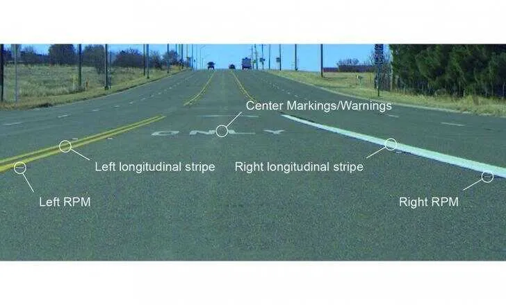
Key changes include a minimum retroreflectivity of longitudinal pavement markings to 50 mcd/m2/lux on roads with speed limits of 55km/h or greater, where average annual daily traffic is 6,000 vehicles per day. The minimum retroreflectivity of longitudinal pavement markings is 100 mcd/m2/lux on roads with speed limits of around 110km/h or greater.
However, the FHWA has decided that this standard does not apply to other pavement markings such as centre symbols, arrows, chevrons or words. Crosshatch markings, transverse markings and crosswalks are also excluded from the minimum standard.
Nonetheless, the US division of Irish firm RetroTek (Reflective Measurement Systems) welcomes the FHWA’s update to the Manual on Uniform Traffic Control Devices. These updates should play a key role in reducing transportation-related fatalities and serious injuries, according to the company.
The ruling will also help to support the operation of Autonomous Driver Assisted Systems (ADAS) that are increasingly dependent on high-quality longitudinal pavement markings to operate correctly.
The methods for maintaining pavement markings are detailed in FHWA-SA-14-017. The methods include visual inspections, measured retroreflectivity, expected service life replacement and blanket replacement.
The changes came into effect on September 6 and US road authorities and departments of transport have four years to comply with the new rulings.
RetroTek said it would “highly recommend” that US road agencies start the planning process now to address how they will monitor and maintain pavement markings to the new standards for minimum retroreflectivity levels. “We believe the most efficient solution which maximises data collection and minimises disruption to road users is the RetroTek-D mobile retroreflectometer system. This will enable road authorities to get accurate retroreflectivity measurements across the full lane width in one pass, day or night, minimising survey time and fuel costs.
“The ability to compare survey results over different years within our survey software helps authorities to plan and predict pavement marking maintenance requirements and budgets,” the company said.
The RetroTek-D records data in real time and automatically stores it on the PC. The data includes route travelled, retroreflective values (RL), GPS co-ordinates, temperature, humidity, distance, speed, time and presence/absence of reflective pavement markings (RPMs) / road studs. The system surveys road traffic markings at legal traffic speeds, eliminating the need for traffic management or road closures, and can assess up to six reflective road assets in one pass.
Since January 2013, Reflective Measurement, based in Dublin, Ireland, has researched and developed machine vision technologies which address the maintenance and safety needs of road infrastructure agencies and airport airside stakeholders.


