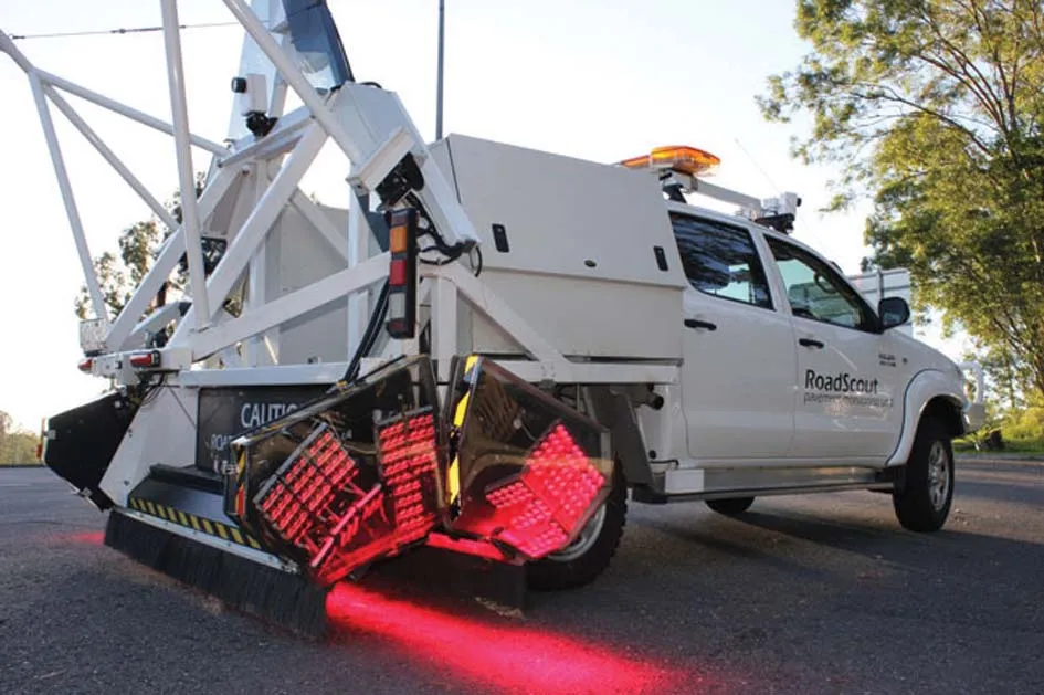
The Iowa Department of Transportation in the US has selected Peek's AxleLight non-intrusive laser axle sensors installed in a permanent site along Interstate 35/80 in Des Moines. This is the first time that the AxleLight sensors, normally designed as a temporary study tool, have been installed in permanent roadside cabinets. AxleLight sensors shoot a beam of non-visible laser light across the roadway, just a few centimetres above the pavement. Using these sensors, and the ADR family of Automatic Data Record

The 1229 Iowa Department of Transportation in the US has selected Peek's AxleLight non-intrusive laser axle sensors installed in a permanent site along Interstate 35/80 in Des Moines.
This is the first time that the AxleLight sensors, normally designed as a temporary study tool, have been installed in permanent roadside cabinets.
AxleLight sensors shoot a beam of non-visible laser light across the roadway, just a few centimetres above the pavement. Using these sensors, and the ADR family of Automatic Data Recorders from Peek Traffic, state and municipal governments can count, classify, and analyse traffic flow.
Peek worked with the Iowa DOT to certify that the AxleLight units would satisfy the state's high accuracy requirements in the permanent installation environment. The department is using the AxleLight, along with the solar panels and wind turbines that are powering the units, as both a solid and safe source of valuable traffic flow data, and also as an example of 'green' technology at work.