
Jenoptik’s Vector SR gets UK HOTA approval

Vector SR, a new Spot Speed camera from Jenoptik, has achieved Home Office Type Approval – HOTA - a UK certification.
October 1, 2019 Read time: 2 mins
Spot the speeders: Jenoptik’s Vector SR is a practical solution

Achieving HOTA means the system passed rigorous evaluation and testing required to allow it to be operated as an unattended enforcement device for the measurement of vehicle speeds.


3987 Jenoptik are best known in the UK for the Specs average speed enforcement cameras that are used at more than 150 sites. The Vector SR solution was developed as a complementary enforcement device for the measurement of spot speeds. Where vehicle speeds need to be managed over a short section of road, Vector SR provides a practical and cost-effective solution, says the manufacturer. This allows those responsible for road safety to address collision hotspots while also providing a practical alternative for obsolete wet-film camera sites.

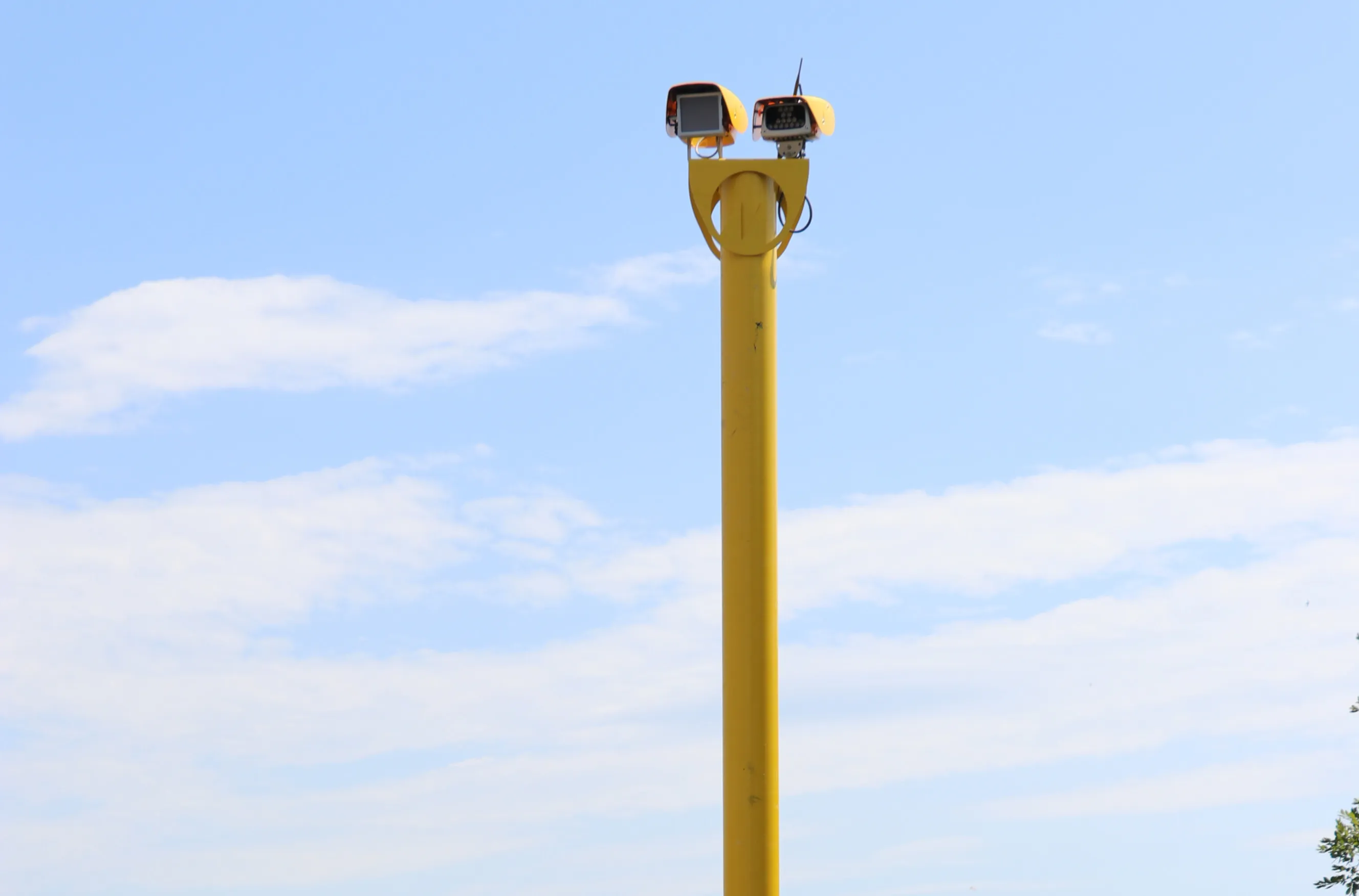
Vector SR uses the highly capable Vector2 integrated ANPR (automatic number plate recognition) camera platform, working alongside Jenoptik’s own 3D tracking radar device. Both modules are lightweight and low power, allowing Vector SR to be mounted on a passively safe pole – something that has not been possible before with older enforcement technologies, said the company.

The system can operate alongside the patented Vector IR Infra-Red illumination module, allowing image capture on a fully dark road without any distracting flashes or dazzling puddles of light.

Vector SR is supported by Infra-Red illumination, is lightweight enough to mount on a passively safe pole or existing street furniture and has no need for in-road sensors, explained Geoff Collins, Jenoptik’s marketing director.

Jenoptik’s expertise extends to measuring average speed over a defined section of road – called section speed control - and automated number plate recognition. Thanks to the digital combination of several sensor technologies with software and data management, Jenoptik is also a new systems supplier for truck toll monitoring on federal highways in Germany.


For more information on companies in this article

Related Content

  • Rapid adoption of GPS machine control
    February 10, 2012
    The high sophistication of GPS machine control systems has resulted in a fast pace of technological advancement. The three major players in the machine control sector, Leica Geosystems, Topcon and Trimble have all made major gains in recent years. The sophistication of the latest systems can combine satellite position data from the GPS and GLONASS networks with information from total stations to provide precise, high speed machine operation. Further more the firms have also prepared themselves for the intro
  • Videalert adds clean air capability to digital video platform
    May 14, 2018
    Videalert has added a facility to their hosted digital video platform to identify vehicles by their noxious emissions ratings to help enforce low-emission zone management. Videalert, a UK supplier of traffic enforcement and management solutions, said the addition comes as more UK cities are looking at better enforcement of what is called a Clean Air Zone (CAZ) and Low Emission Zone (LEZ). “While London, Birmingham, Derby, Leeds, Nottingham and Southampton now have the powers to begin tackling this issue
  • Highway 407 Revisited – smart tollroad extension
    June 7, 2016
    In the late 1990s, World Highways published a supplement on construction of Canada’s Highway 407, the world’s first all-electronic toll road. But how successful has it been? David Arminas reports from Toronto The head office for 407 ETR Concession Company is a low-rise building next to exit 59, just north of Toronto, Canada’s economic powerhouse. The building may be non-descript but inside is the advanced technical heart of Highway 407 ETR – Express Toll Route. It houses the latest toll monitoring techno
  • Nira and Univrses in Swedish road data project
    April 6, 2023
    NIRA Dynamics and Univrses are working on road surface conditions analysis using data from connected vehicles, RWIS, radar/satellite images and weather prognoses to provide a real-time picture of the road status.