
GuidSIGN version 5.0 offers faster sign design

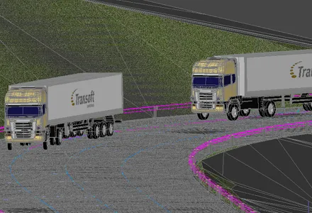
Software specialist Transoft Solutions says that the latest version of the efficient sign design software, GuidSIGN version 5.0. A is both easy to use and versatile. The package can deliver cutter-ready signs designed to standard in minutes according to the firm. The product comes with new features, functions, and added libraries that give traffic engineers efficient, time-saving, productivity-enhancing sign-designing capabilities says Transoft. A key feature is the new QuicDesign template system that suppl
July 24, 2012 Read time: 2 mins
Software specialist 349 Transoft Solutions says that the latest version of the efficient sign design software, GuidSIGN version 5.0. A is both easy to use and versatile. The package can deliver cutter-ready signs designed to standard in minutes according to the firm. The product comes with new features, functions, and added libraries that give traffic engineers efficient, time-saving, productivity-enhancing sign-designing capabilities says Transoft. A key feature is the new QuicDesign template system that supplies national standard templates to help users create signs quickly and with greater consistency. It offers traffic engineers and consultants standardised templates and helps ensure repeatable time-savings. Designers can browse by road classification or sign designation to select the appropriate template. QuicDesign also gives users the ability to replace the content of the template by keying in changes or through the new Name Lookup feature, which can select destinations based on the included American Association of State Highway Transportation Officials (AASHTO) Control Cities or United States Geological Survey (USGS) Place Name Lists. Users can also create templates from previously created guide signs and build a custom library for use in traffic signing plans and structural detail drawings. Sign and content libraries within GuidSIGN have also been augmented to make them more extensive than previous versions. Included are more MUTCD standard highway signs, panels, symbols, and arrows from US, Canada, and Australia.

For more information on companies in this article

Related Content

  • Savoy swept-path
    February 21, 2012
    Savoy Computing in the UK has been quick to launch a new version of its AutoTrack swept-path analysis software to take advantage of the latest AutoCAD 2012 platform.
  • Road construction software innovations
    February 13, 2012
    A range of key software innovations are now available for road construction applications from various suppliers - Adrian Greeman writes. Two significant and highly economic alternatives are now available to the major CAD providers both from Belgium and both offering interesting features. First is Pythagoras, which describes itself as a modern CAD program specially designed for topographical applications which include land surveying, road design and city planning.
  • Sophisticated software solutions offering surveying innovation and construction efficiency
    August 28, 2014
    An array of new software tools will deliver greater efficiencies to construction companies – Mike Woof writes. Sophisticated software systems are delivering advanced solutions to traditional construction tasks. Key developments have been made by major players in the sector, such as Bentley Systems, Fugro Roadware, Leica Geosystems and Topcon Sokkia. From Bentley comes a new package that will help road construction activities in urban areas featuring a heavy concentration of underground utilities. This n
  • Yotta upgrades asset management package
    May 19, 2015
    Yotta is now offering the latest version of its Horizons visualised asset management platform. Version 2.6 of the package is said to provide a better user experience with improved visualisation. The latest version of the cloud-based solution also offers improved transparency with upgraded reporting providing clear and auditable work trails. Users of Horizons 2.6 can now directly link documents and images in Horizons, improving access to detailed information about a specific asset through the use of phot